Annapurna Circuit: Part 2
Continued from Annapurna Circuit: Part 1
Vlog #4 - Tilicho Lake
Vlog #5 - Over Thorang-La Pass
[Here’s an article I wrote for TheTrek.co about my hike: How to Hike Nepal’s Incredible 150-Mile Annapurna Circuit]
April 22: Manang to Tilicho Lake Base Camp - 4150m/13,615ft (elevation at base camp)
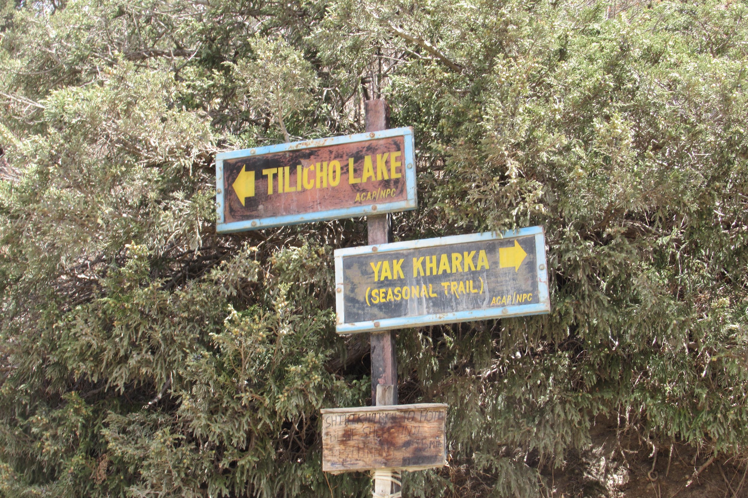
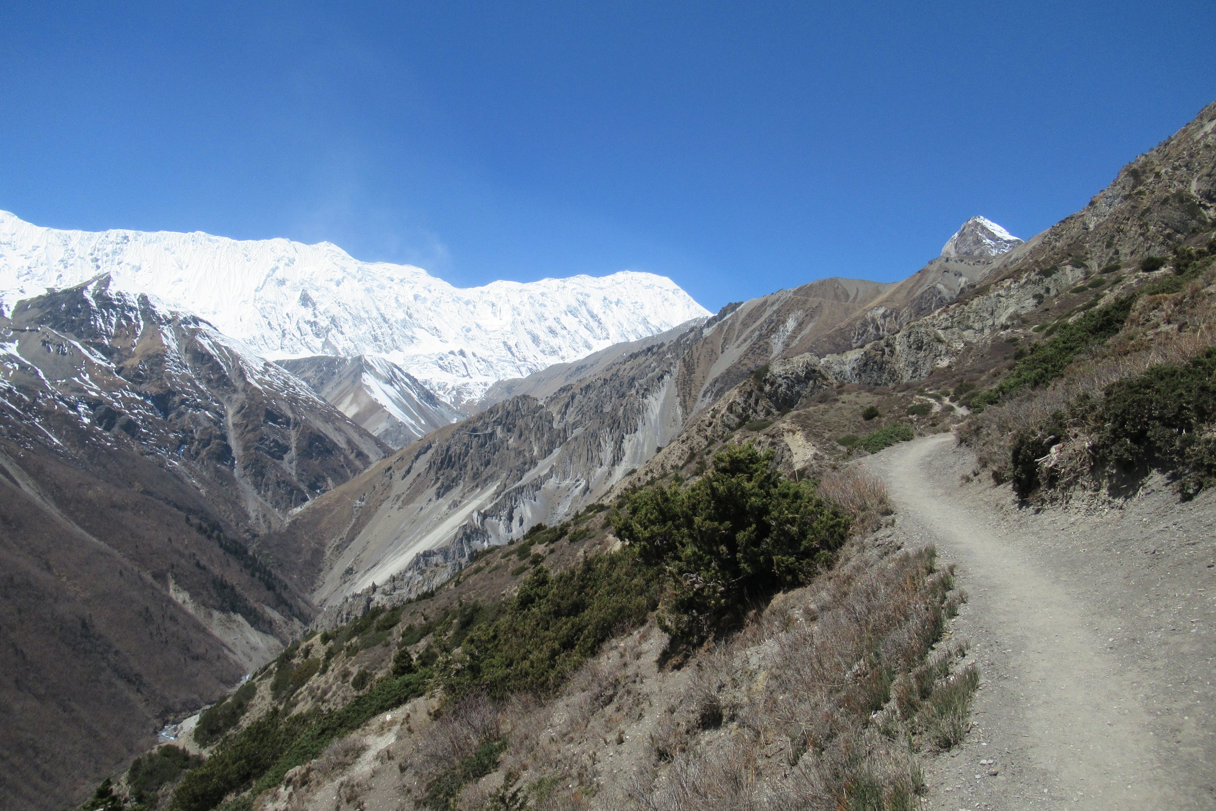
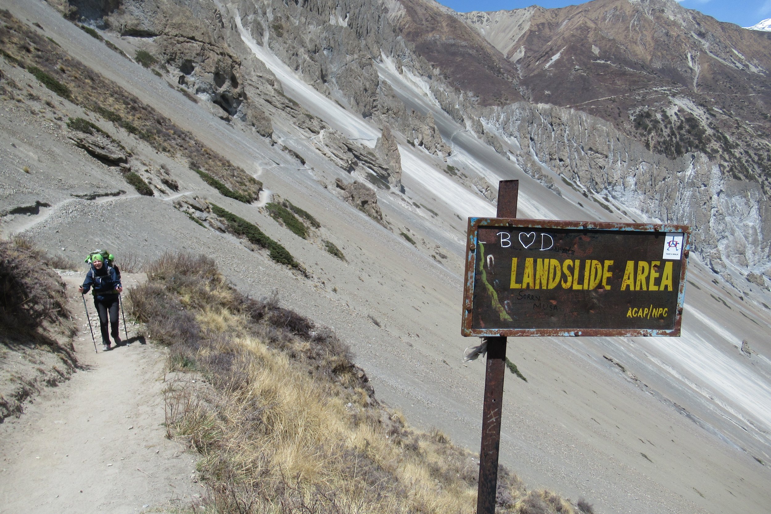
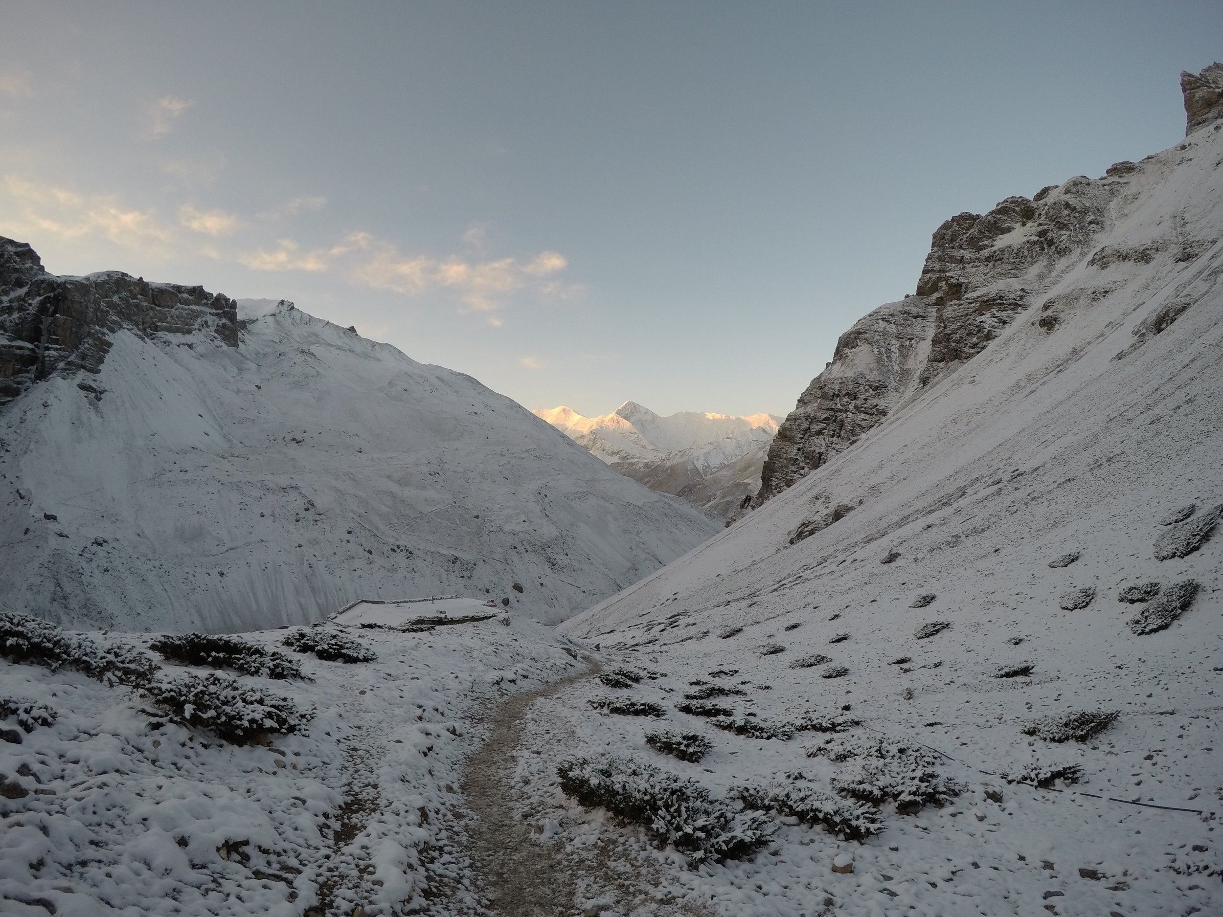
I left Manang on the side trail marked with a white/blue painted blaze to Tilicho Lake Base Camp. I decided I wanted to take the side trip to Tilicho Lake, which would add 2 more days to my trek, because the lake is the highest largest lake in the world. And I guess I'm compelled whenever I hear world's --anything. After leaving the village of Khangsar I came upon a fellow solo woman hiker headed the same direction. I immediately knew that I was going to hike with her; I was headed to a more difficult area and wanted company. So I struck up a conversation with her and thus a friendship was born with Kate from Russia. We hiked a little ways together before I went faster uphill. We met up off and on until right before the dangerous landslide area and then we stayed closer through that.
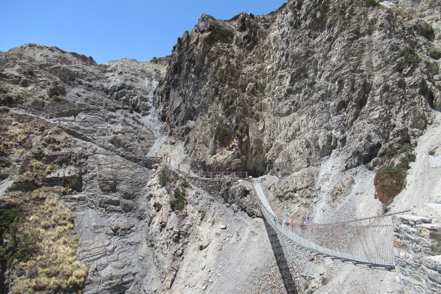
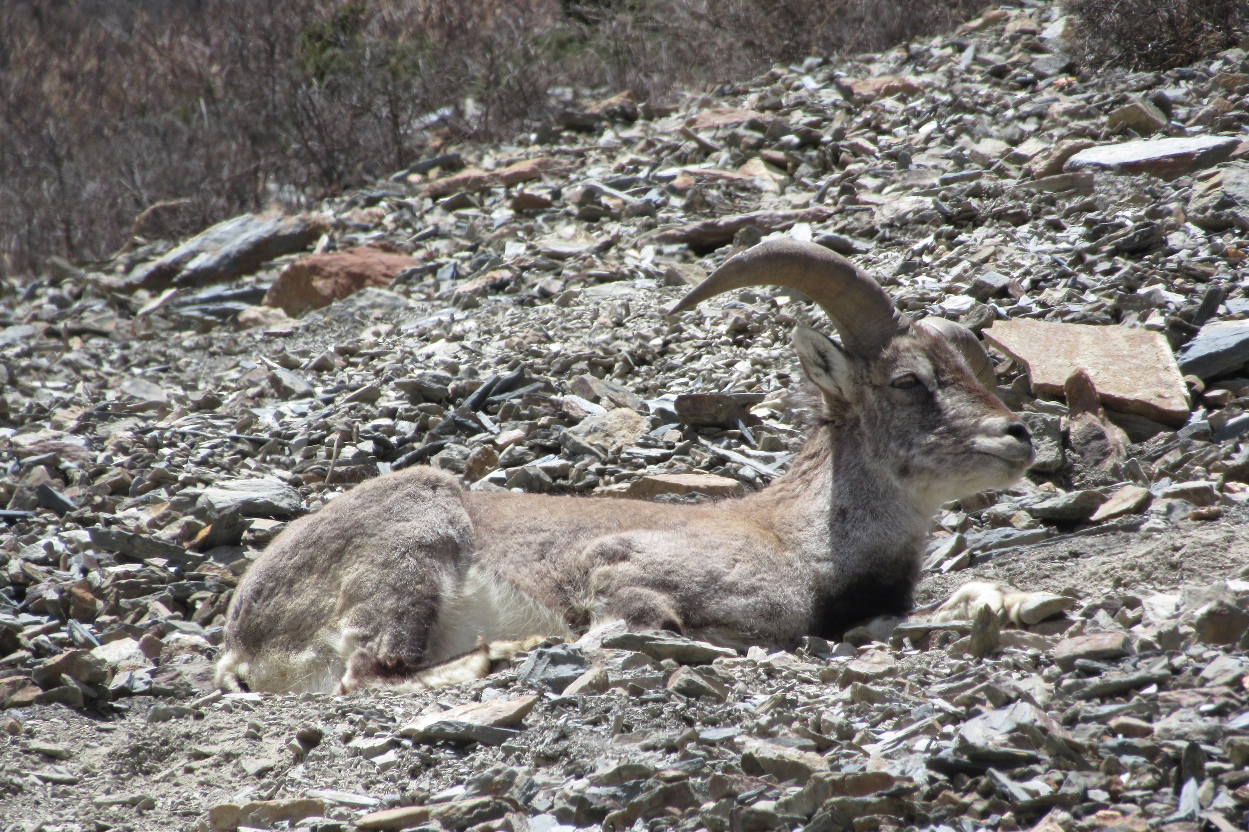
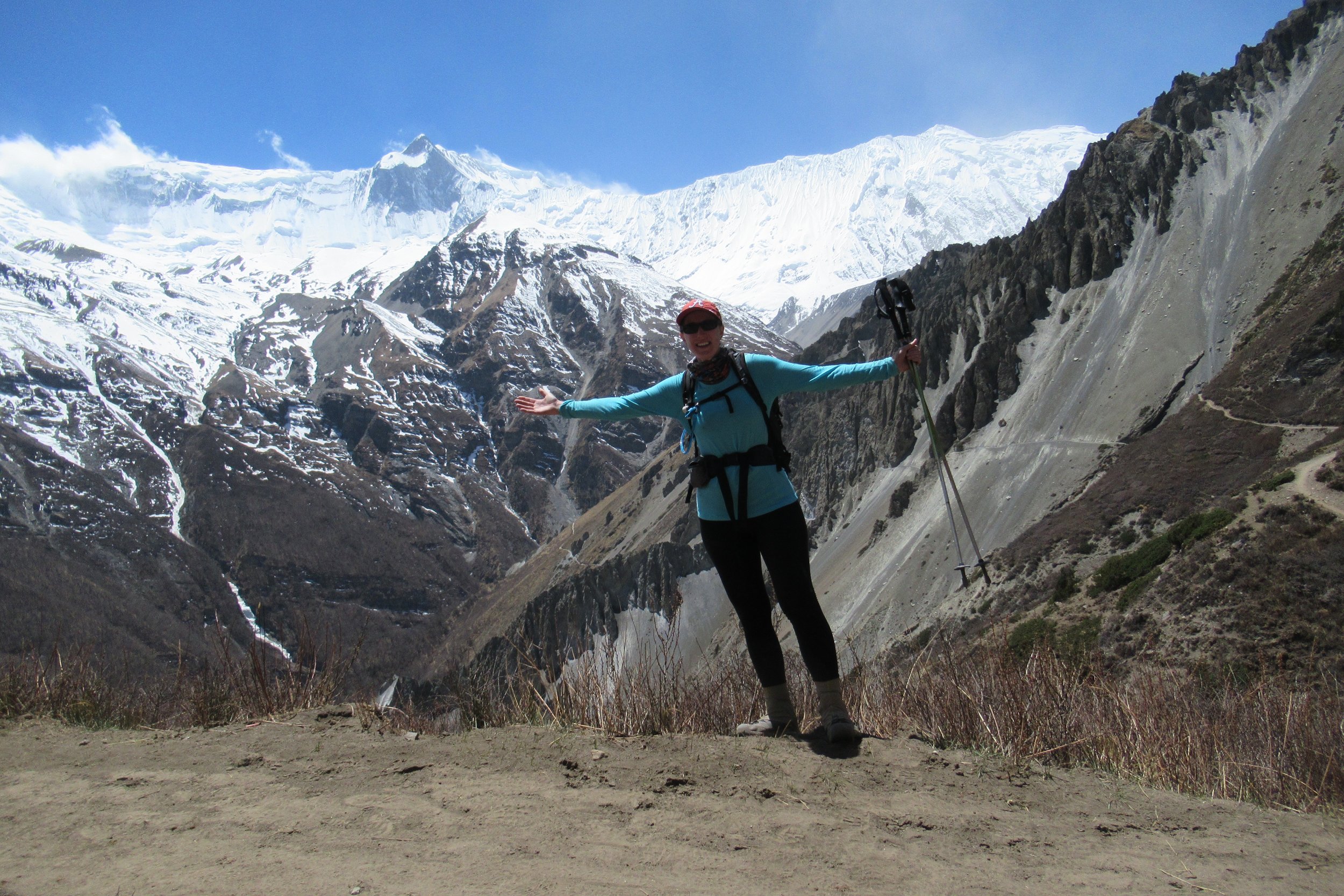
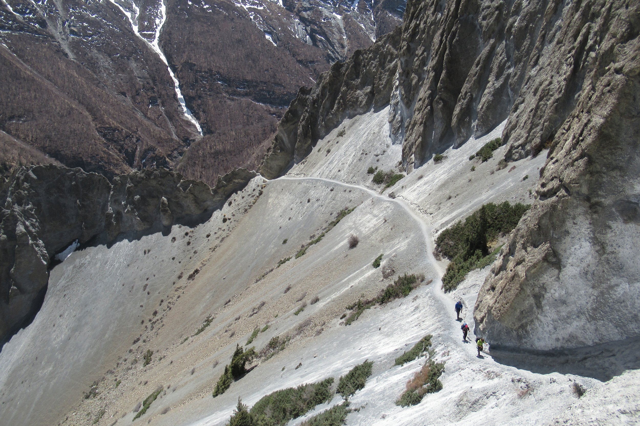
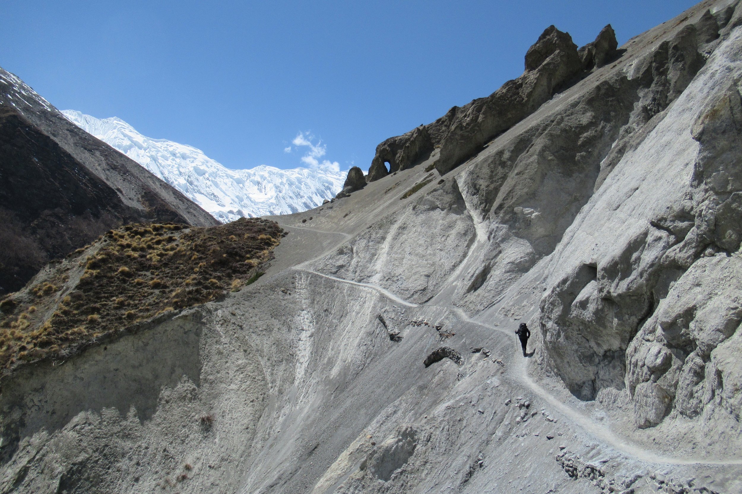
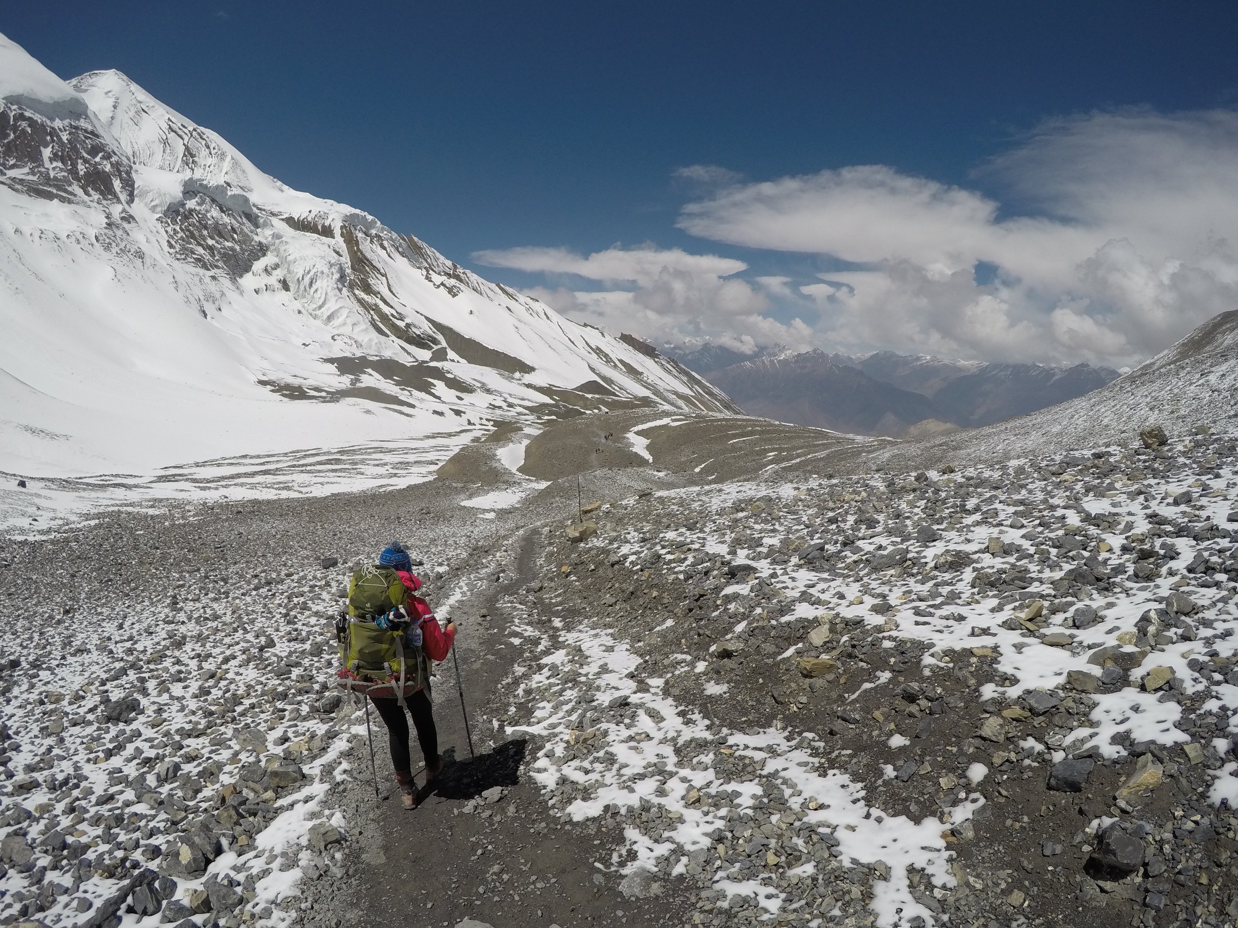
I had read that they recommend crossing the landslide area earlier or later in the day when the winds aren't strong and the heat doesn't warm up the rocks and cause them to shift. Well, we crossed around midday and saw many people doing the same. The path was extremely narrow on the loose rock, at times only as wide as your foot. I tried to move quickly but carefully through the open sections with loose rock above and below to make it to safety where the large boulders blocked the view of any rocks that may fall. The key is to constantly look above to watch for any falling rocks. Sometimes you can hear the small rocks knocking on the others as they fall, but not until they get too close. You want to make sure you can see what's coming in time to dodge if necessary. The area was slightly stressful and continued the majority of the way to the lodges at base camp. A bonus surprise was when I spotted a group of Bharal (Himalayan Blue Sheep) sitting up above on the small rocks. I was moved to tears today while hiking in literal mouth-opened awe at my spectacular surroundings. I have to constantly remind myself that I'm in Nepal, I.AM.IN.NEPAL.
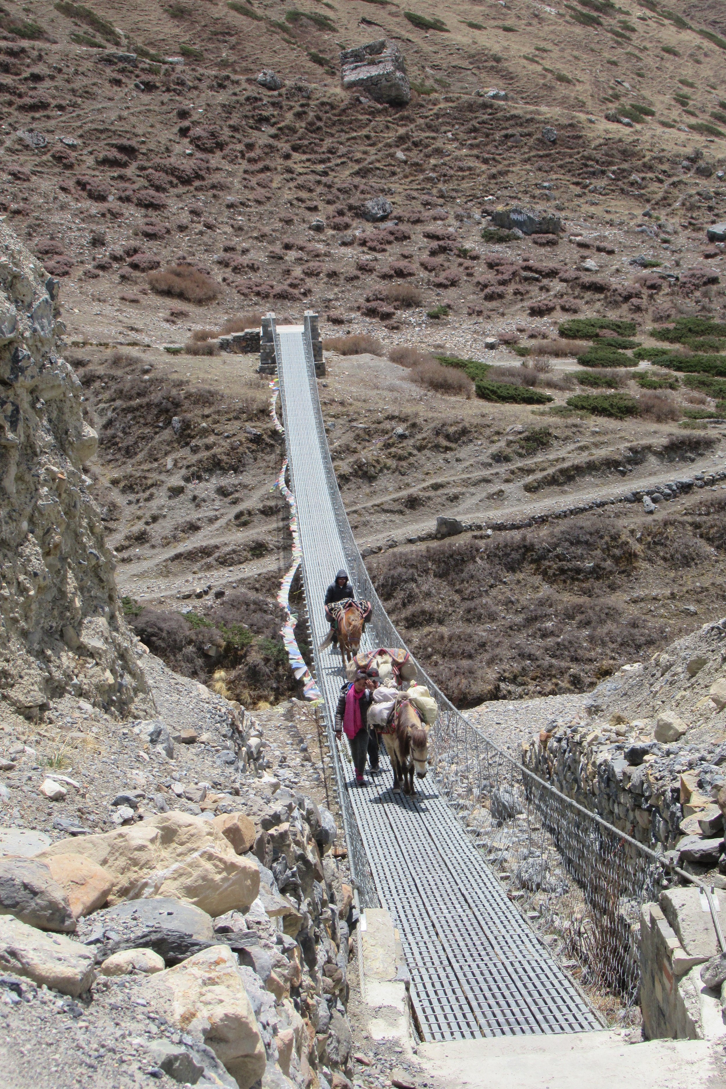
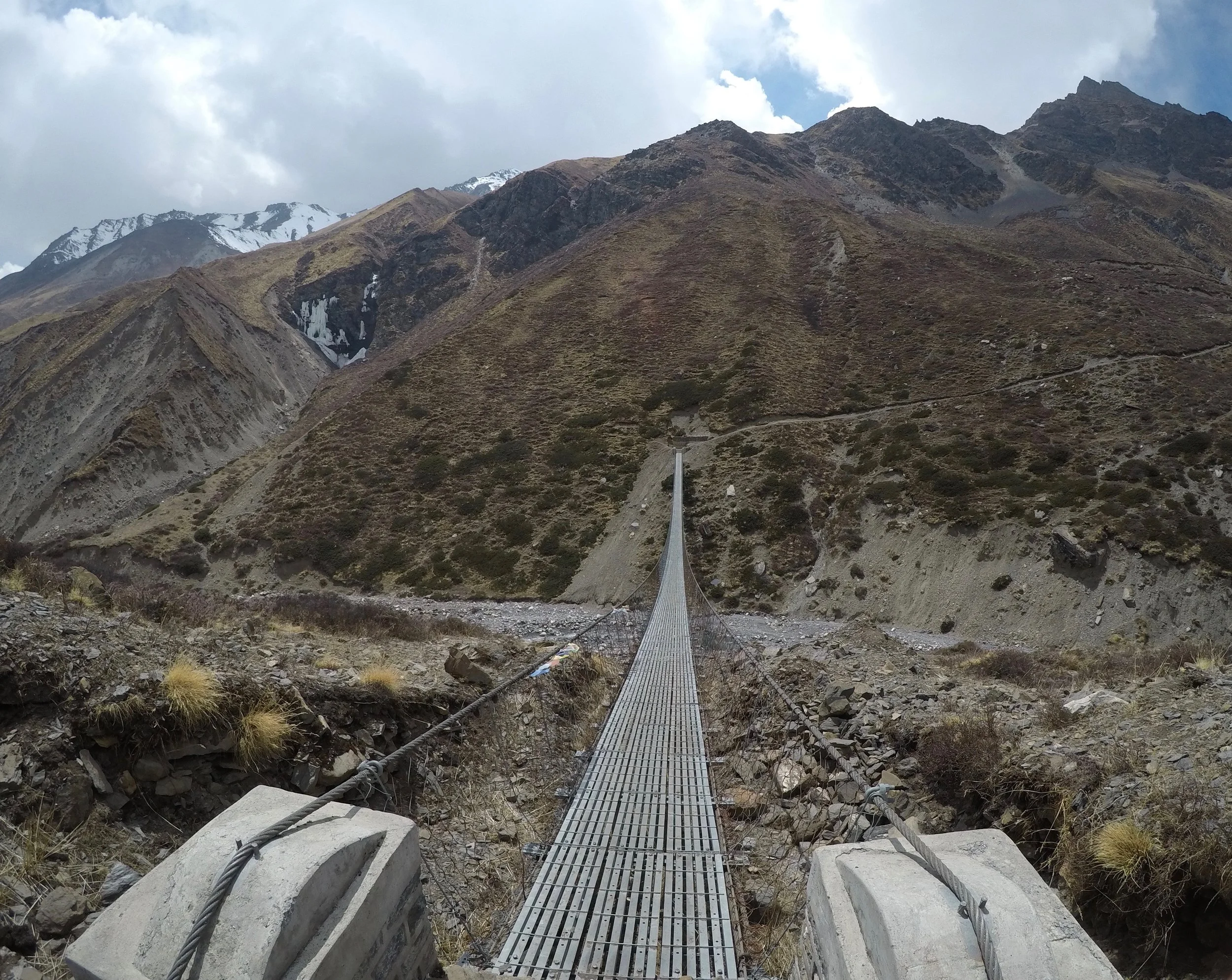
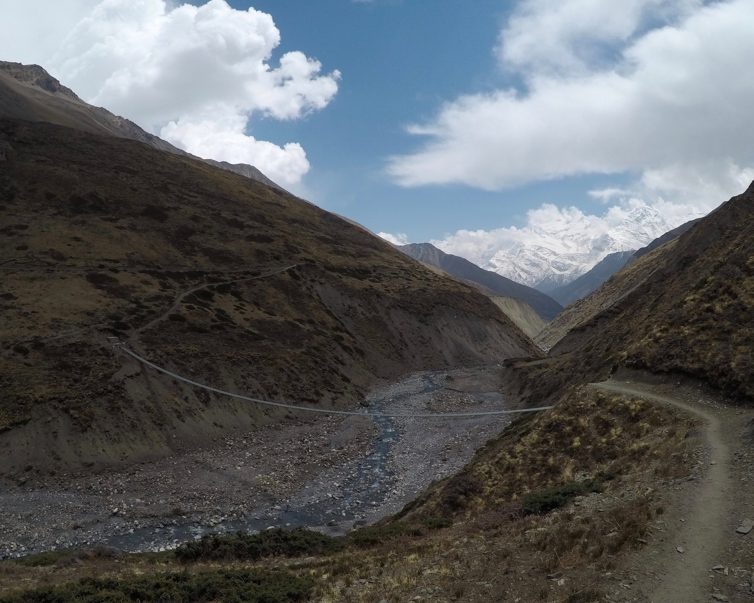
Photos Below: 1) Suspension bridge 2) Directions 3) Yak band record cover 4) Trail ahead 5) Blue Sheep 6) Relishing in the grandeur 7) Navigating the dangerous landslide area 8) More landslide area 9) Kate in the landslide area 10) Glacial valley
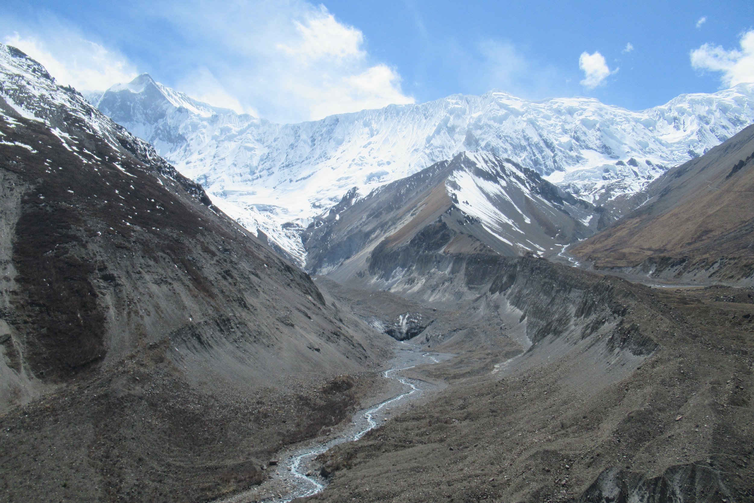
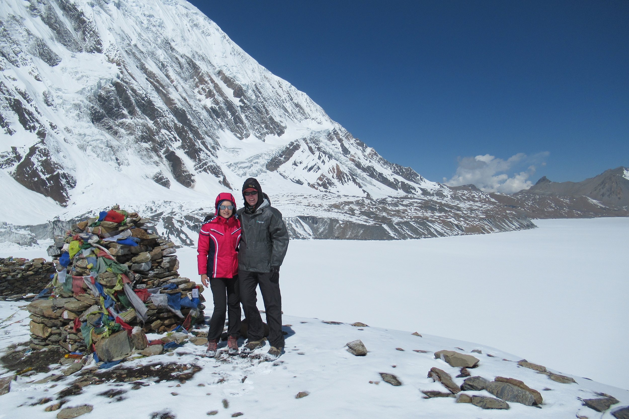
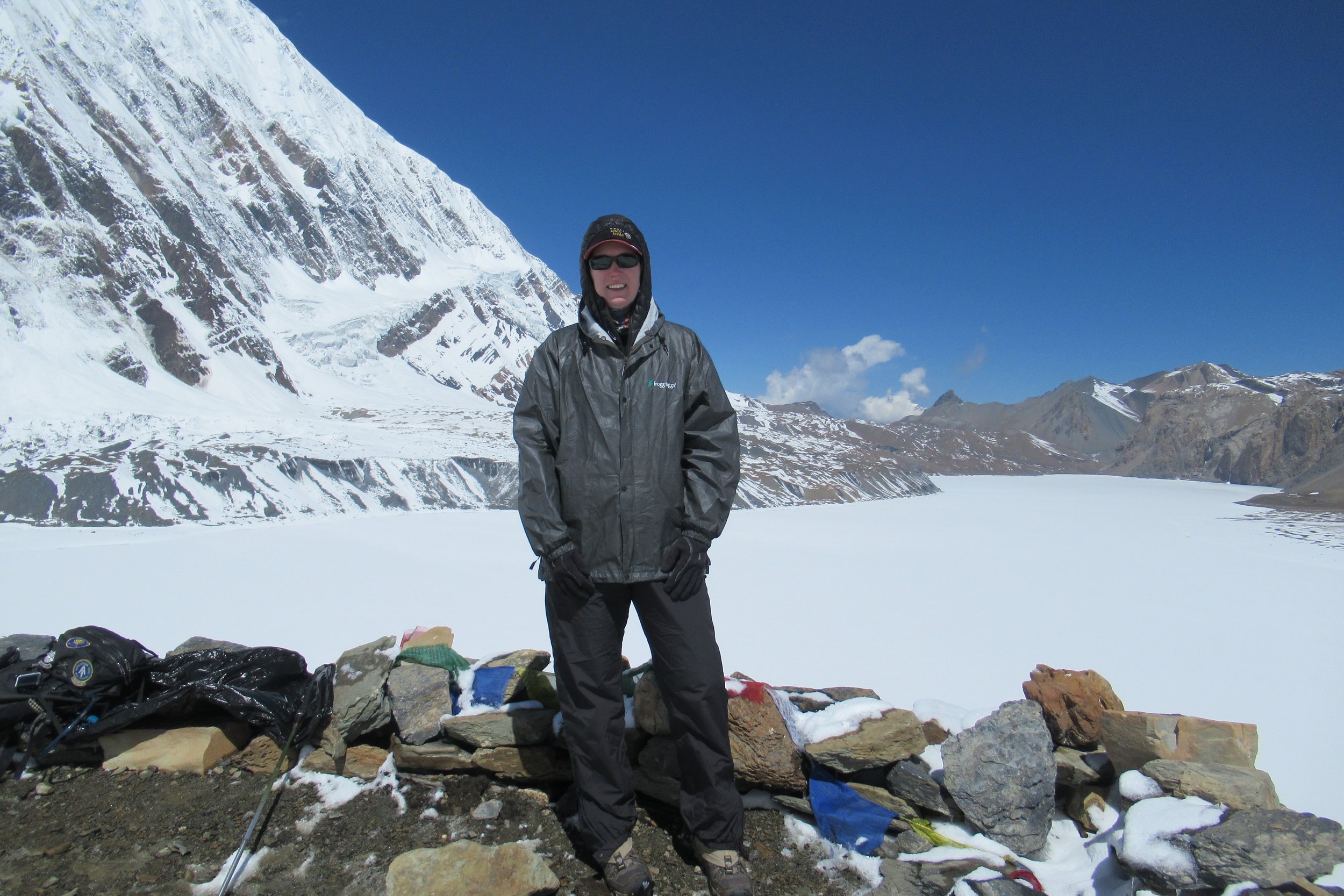
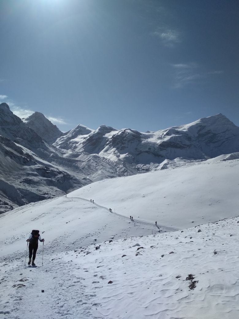
April 23: Tilicho Lake Base Camp to Tilicho Lake (4919m/16,138ft) then to Shree Kharka - 4075m/13,369ft
I woke after having an extremely disturbing and graphic dream of friends dying that I'm going to blame on the high elevation and my subconscious being worried about the forthcoming hike up to the lake and altitude sickness. It took awhile to adjust after that dream as I thought it might be a sign not to hike up. I had a headache since the night before and hoped it wasn't the first symptoms of altitude sickness. Anyways, we woke up early since we had a big day ahead and I started hiking at 6:18. I took it slow and steady, stopping every so often to slow my breathing down. For the majority of the hike at high elevations I walked very slowly but continuously making sure to keep my heart rate and breathing low. I crossed another large landslide area and made my way to the zig zags, the switchbacks that I could see all the way in the distance from the trail yesterday. I would pause and bend down to rest on my hiking poles at every turn but I made it up in 30 mins. After the switchbacks I arrived at the snow and a sign that said 35 minutes to the lake. The snow wasn't deep and I was able to go faster due to the area being flat. I kept getting to points where I thought I'd be able to see the lake but it was a false hope. Once I saw people standing around in the distance and prayer flags flying in the wind I knew the lake must be right there. The build-up to the reveal resulted in a bit of an anticlimactic moment when I just saw a large expanse of white which was the frozen lake out in front of me. I'm sure the lake is really nice when it's not frozen. I took a break enjoying the area surrounded by glaciers and realizing that this was the highest I had ever hiked, just over 16,000ft. It took me 3 hours and 15 minutes to hike up the 2,523ft to get there (not sure how many kilometers), close to the 3 hours stated in the guide.
The hike down was much faster since I didn't have to walk slowly or take breaks. However, I was moving quicker than I should and by the time I reached the bottom the outside of my right knee felt tweaked. I also had a little excitement on the return trip when a soccer ball-sized rock hurled down about 10 seconds after I passed during the landslide area. I had turned around and saw it come down and immediately thanked my lucky stars that I wasn't standing in that spot. I arrived back down to base camp in an hour and a half. We took a snack break and started hiking back the way we came the day before. It was windier in the landslide area and I was fairly stressed constantly scanning above me for any signs of falling rocks and then would try to book it across to safety points. Finally out of the danger zone I was able to relax a bit and we walked quickly to Shree Kharka where we stayed the night.
Photos Below: 1) Hiking up the switchbacks to the lake 2) Kate & I at the lake 3) All the layers at the frozen lake 4) Snow hiking 5) Wonderful day to hike in the snow 6) Those black specks below are people hiking up

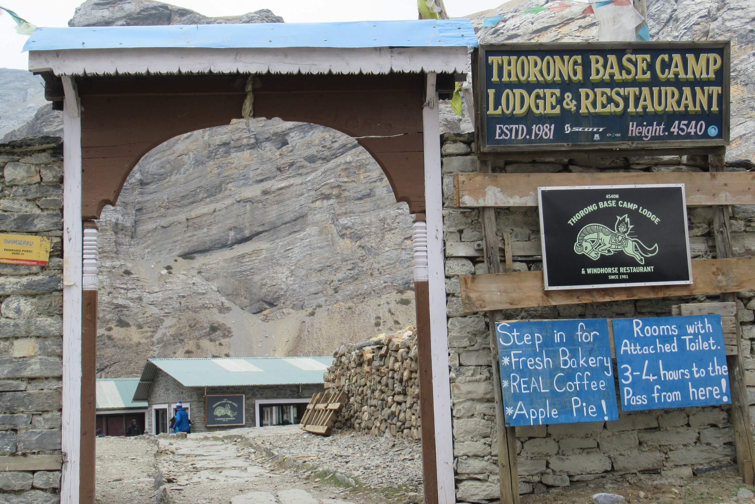
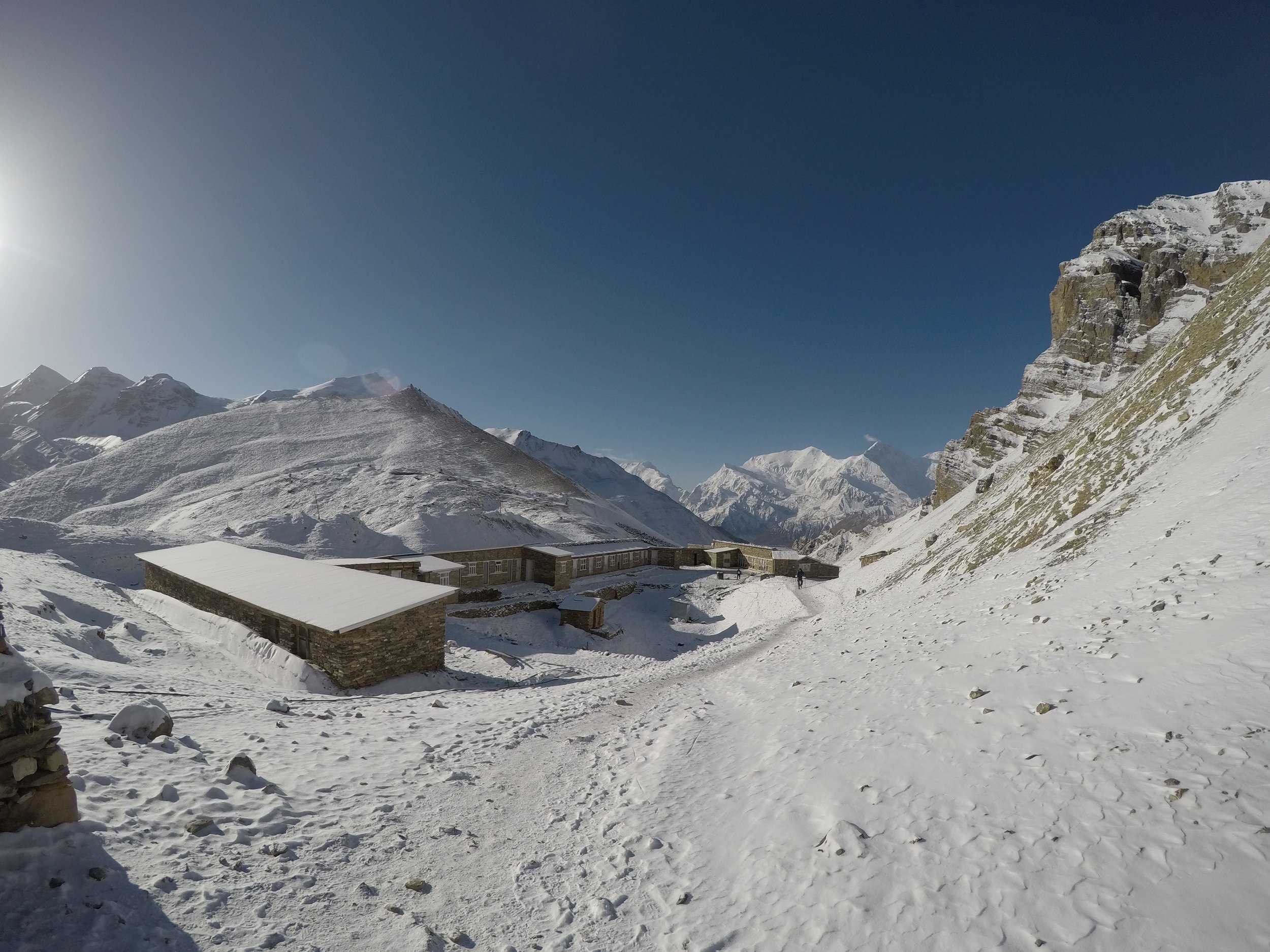
April 24: Shree Kharka to Thorong Phedi - 4550m/14,927ft
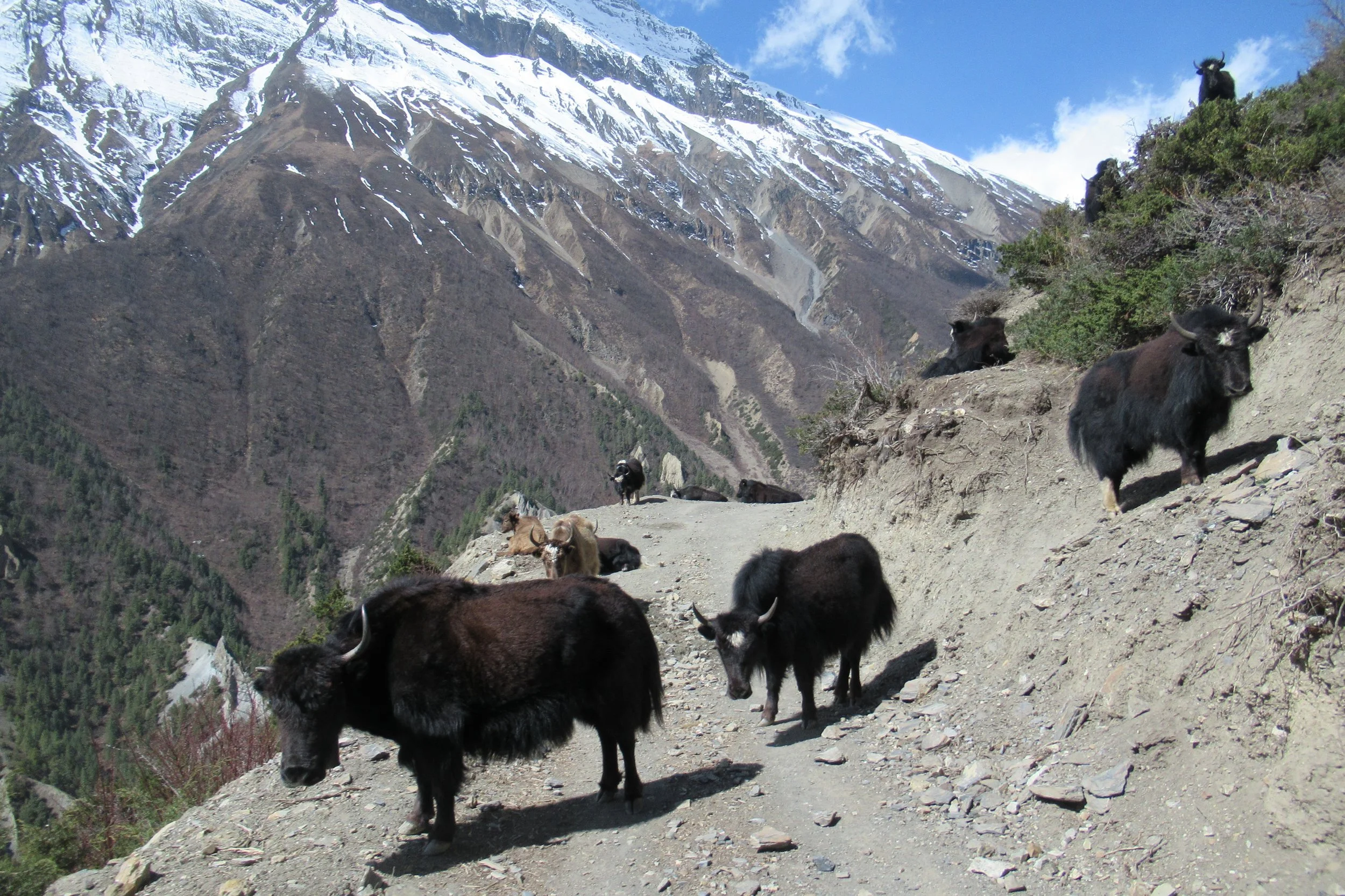
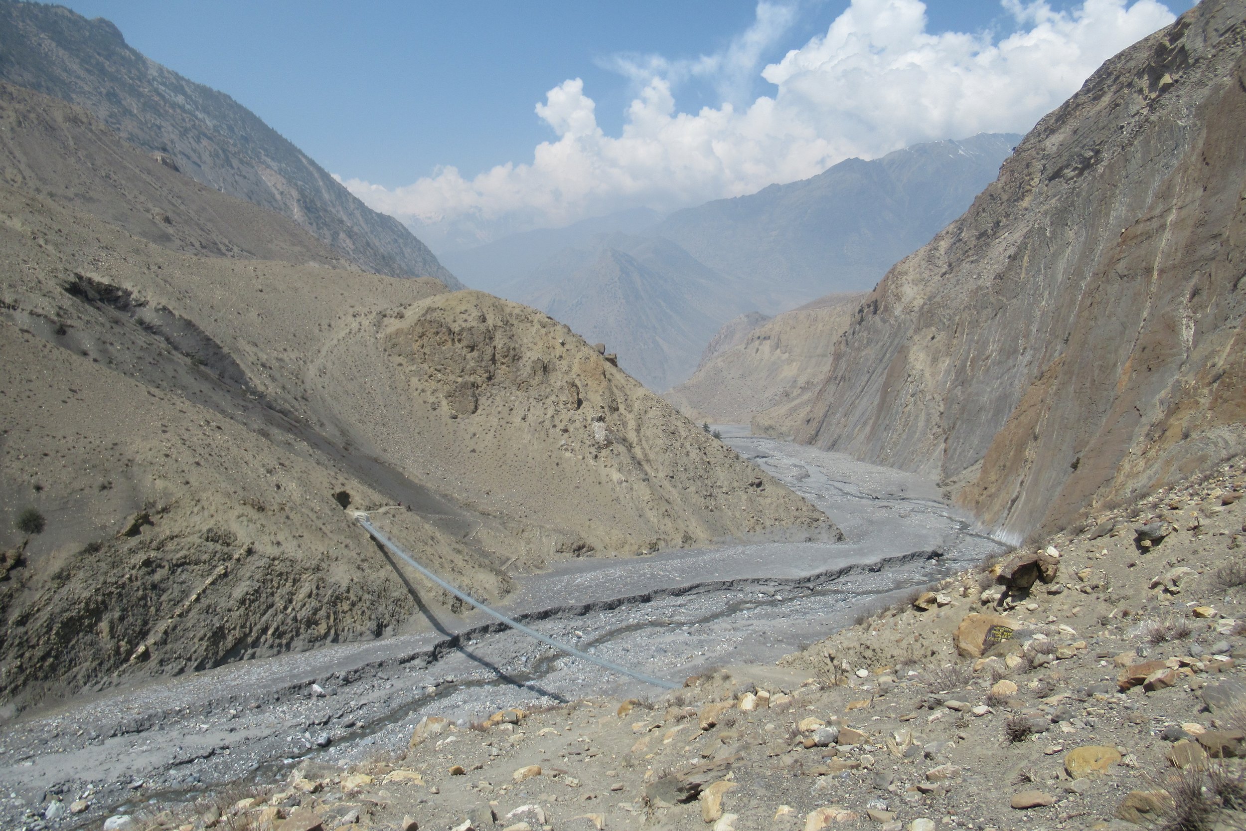
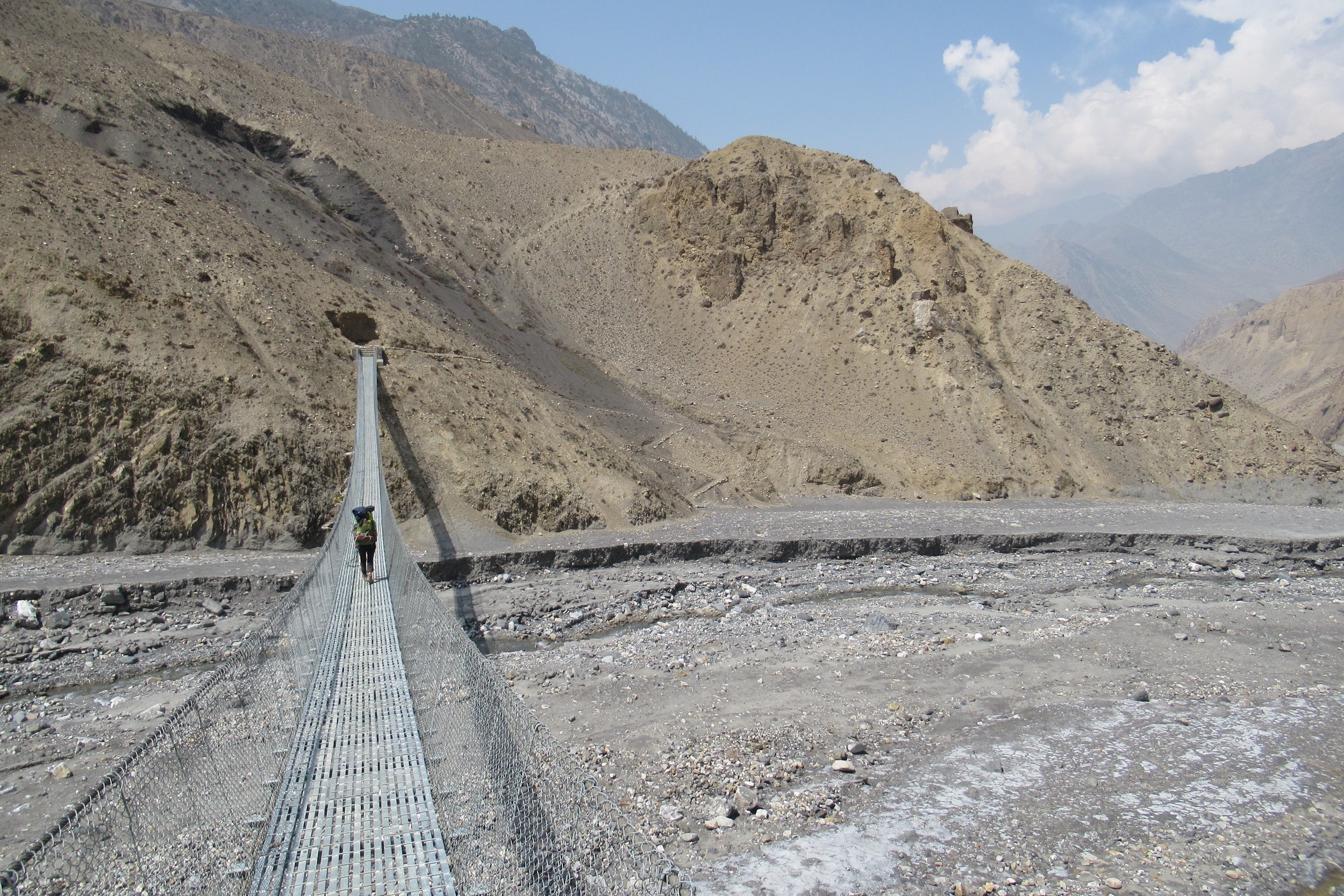
Rather than backtracking all the way to Manang where we split off the trail, we followed a seasonal route that rejoined the main trail before the village of Yak Kharka. We passed the Old village of Khangsar, now consisting of empty stone buildings and followed a stone wall before rounding the edge of the mountain and hiking down to the river. I had to take the downhill slow as my knee still felt tweaked, but I was able to move just fine when hiking up. We rejoined the main trail and soon after arrived in Yak Kharka where we took a short break. Back on the trail and past the village of Churi Ledder we crossed the longest suspension bridge yet. The bridge wasn't that high up nor the river very large down below but it was the length of the bridge that made it nerve wracking. I filmed the crossing and by the end I felt slightly queasy. Not long after the bridge we crossed another landslide area and marveled at the mule train passing us by on the loose rock (we had to stop at wider areas to let them pass by). Clouds were moving in and by the time we arrived in Thorong Phedi it was starting to spit snow.
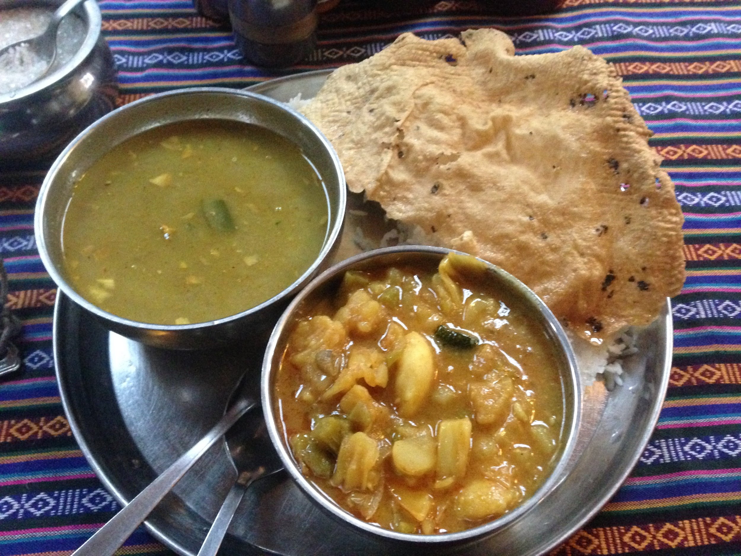
We spent the rest of the day inside the lounge/eating area of the compound as it's too cold to stay in the simple guestroom (none of the lodges along the trail have heat that's why people take sleeping bags or use the blankets). We socialized with fellow hikers from Switzerland, UK, Cyprus, and Spain. For dinner I finally had the national dish of dal bhat (dal-lentil soup, bhat-rice). I figured I would power up for the big climb the next day as they serve dal bhat with endless refills, although I couldn't finish what I got. I retreated to our shared room after warming up by the wood stove in the common area and went to bed around 8 (most nights were early nights due to being tired from the day of hiking and there not being much else to do after dinner).
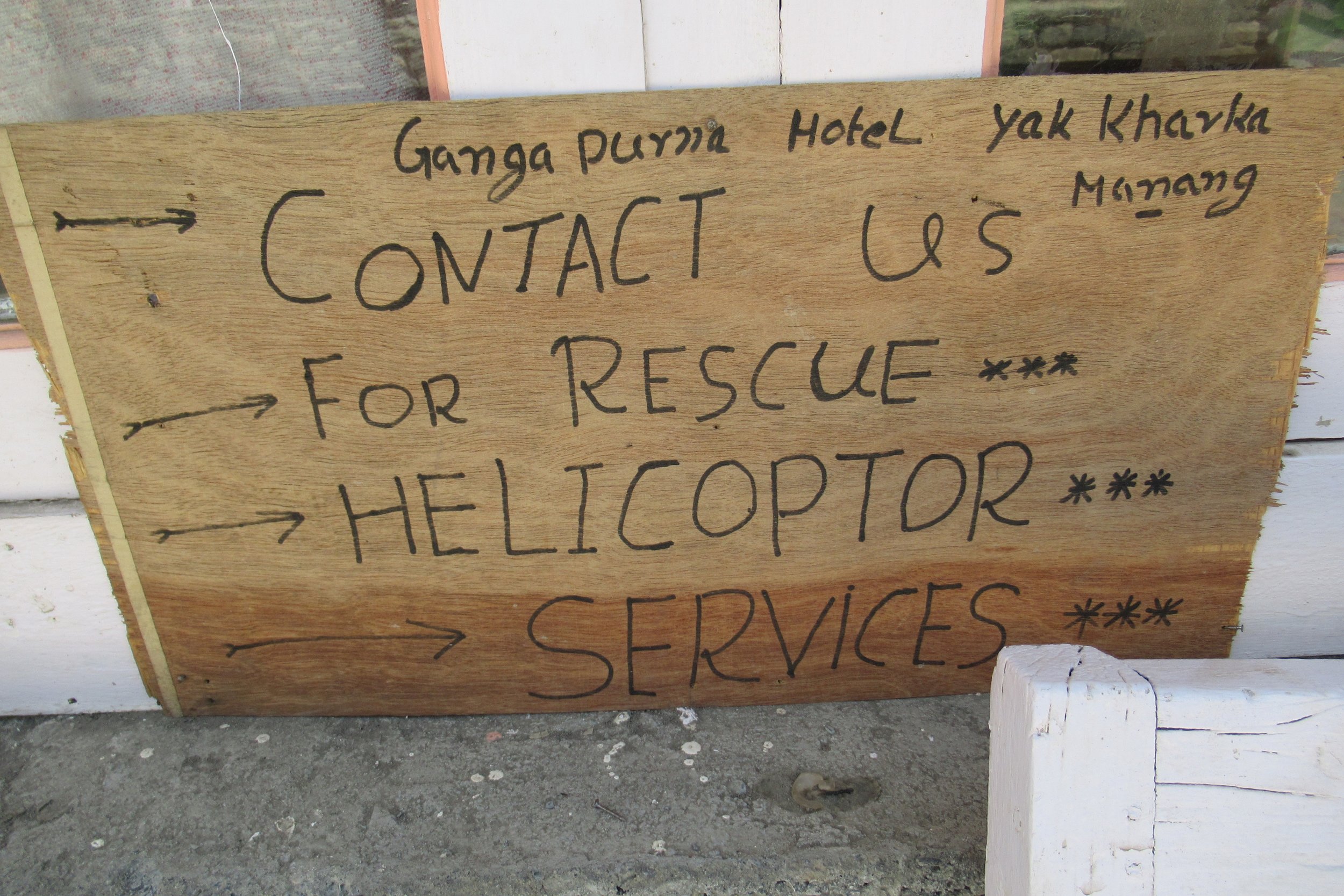
Photos Below: 1) Old Khangsar 2) Looking back towards Manang 3) Pack horses crossing suspension bridge 4) Helicopter Rescue Services 5) One of the longest suspension bridges I crossed 6) Gopro shot of the long bridge 7) Thorong Phedi- gateway to Thorong-La 8) Dal bhat

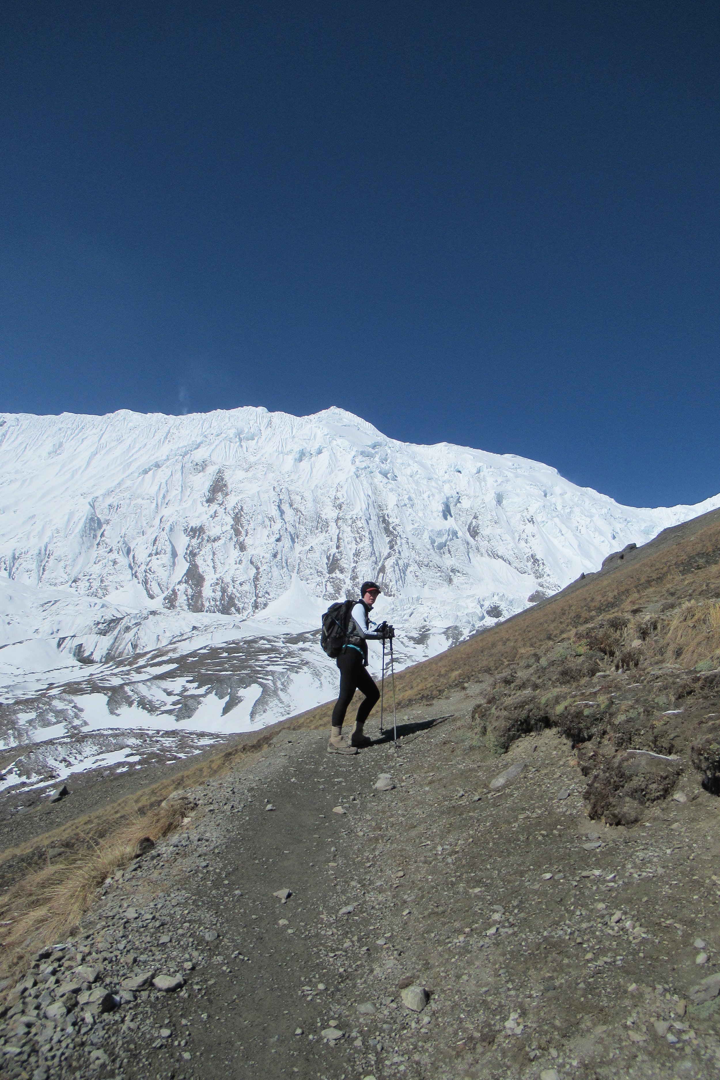
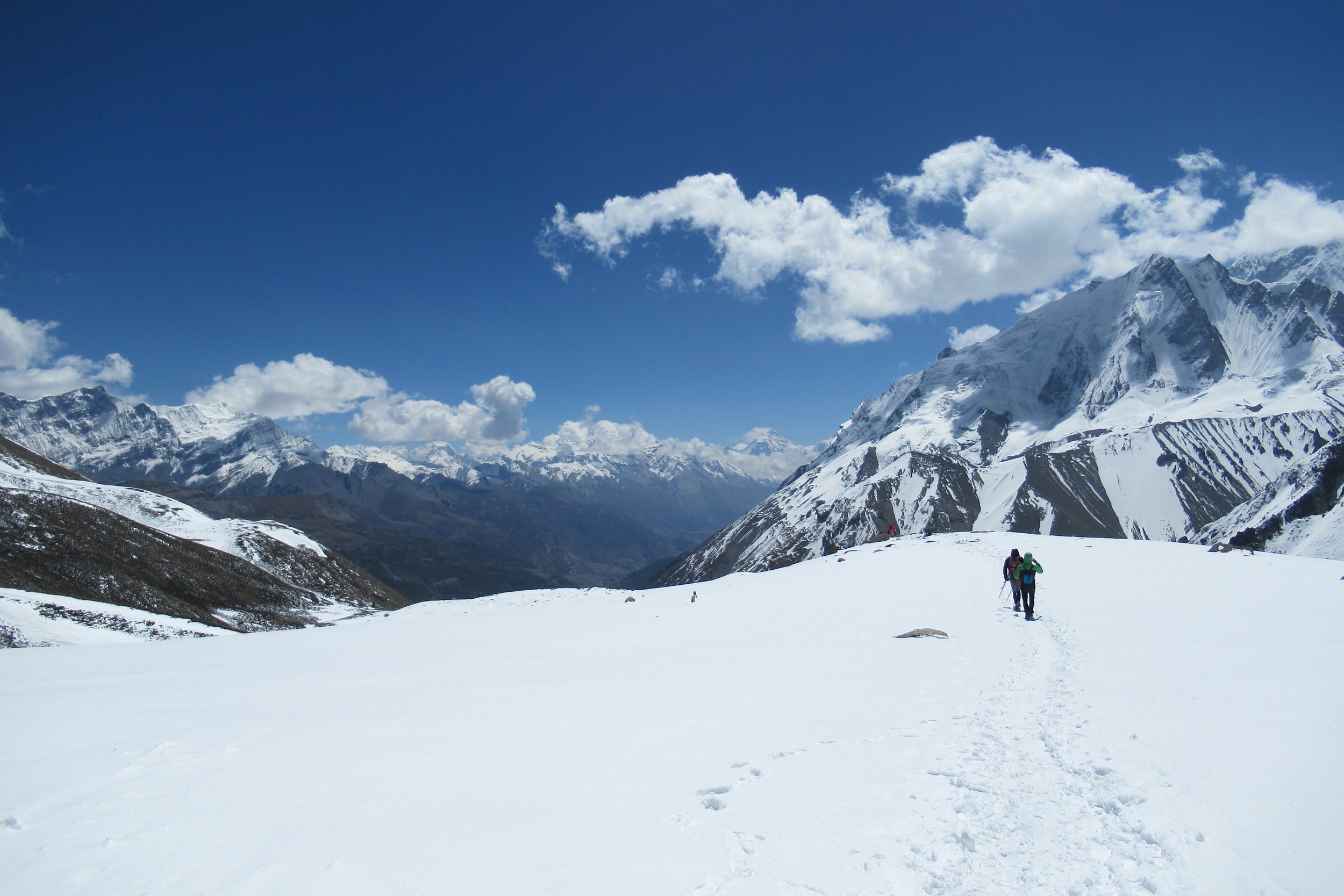
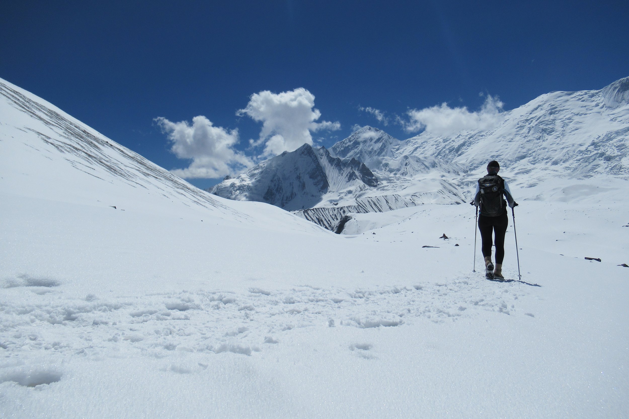
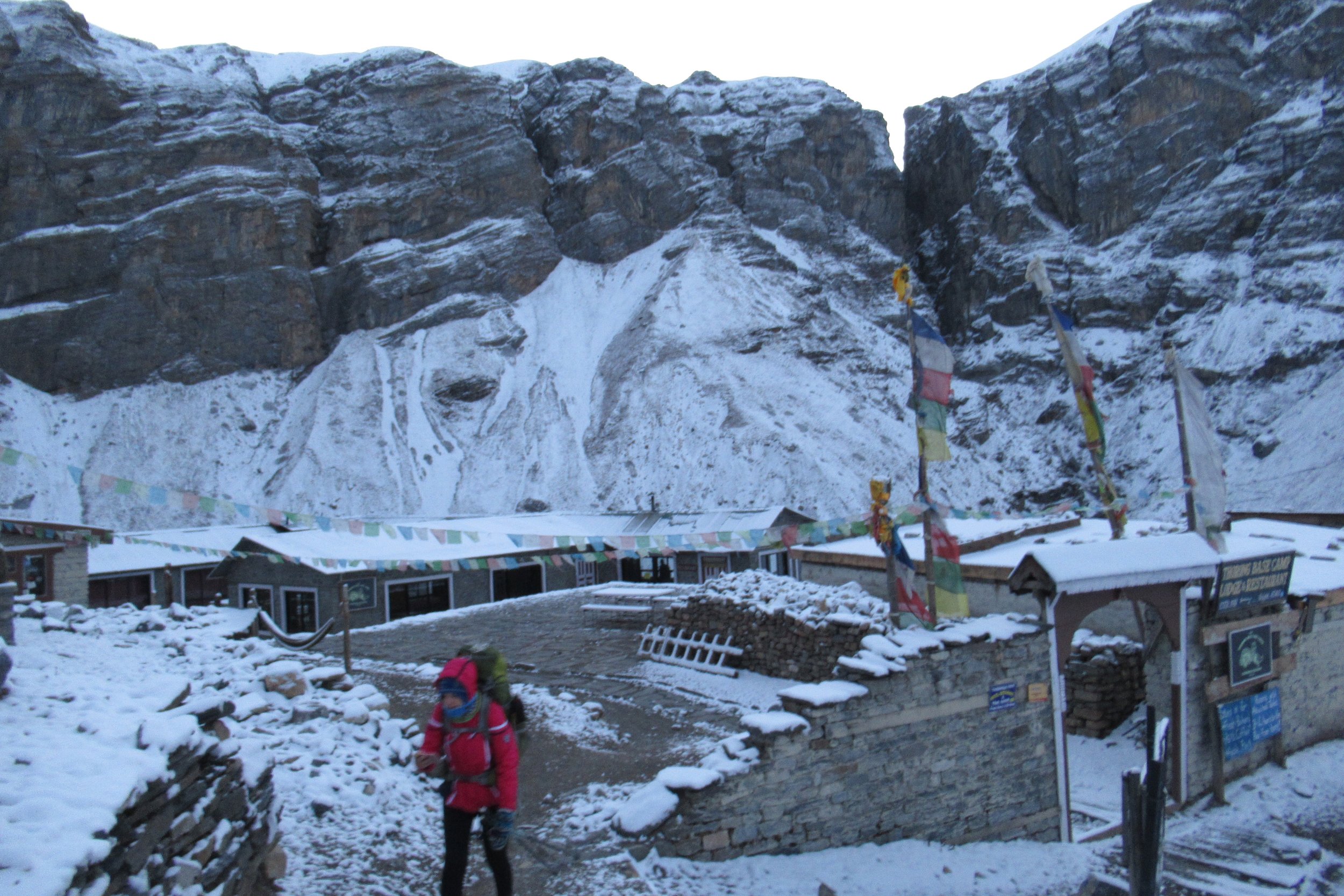
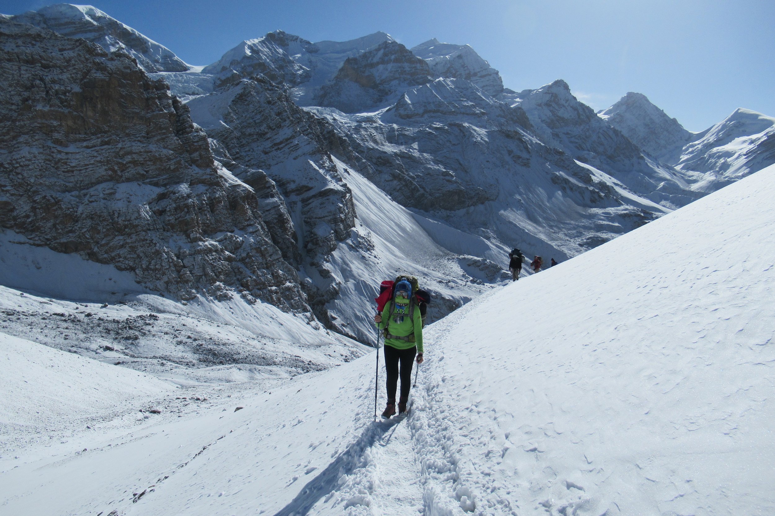
April 25: Thorong Phedi over Thorong-La (5416m/17,769ft) to Muktinath - 3800m/12,467ft
We got up at 4:30 after a sleepless night filled with tossing and turning. I think I might have slept for an hour total. I had a sandwich for breakfast at 5 and started the long climb at 5:30 as the sun was rising. It had snowed all night and the surrounding mountains and trail were covered in an inch or two. The 1km/.62mile, 300m/984ft climb up to high camp was hella steep and super slow. I made it in an hour. I went inside the eating area to warm up and wait for Kate. Even though I wore two pairs of gloves as soon as I got inside my right fingers were so cold and hurt so bad that I started getting nauseous and thought I would throw up. After a 30 minute break and hot tea we continued on from high camp. Soon thereafter we saw a woman being helped down who I imagine was suffering from altitude sickness as her body was limp and was barely able to walk.
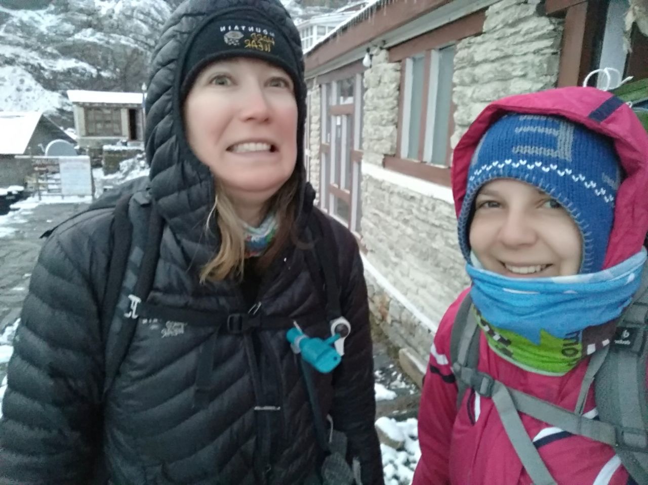
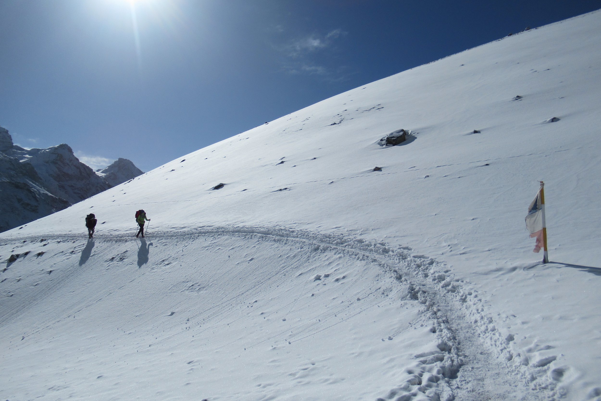
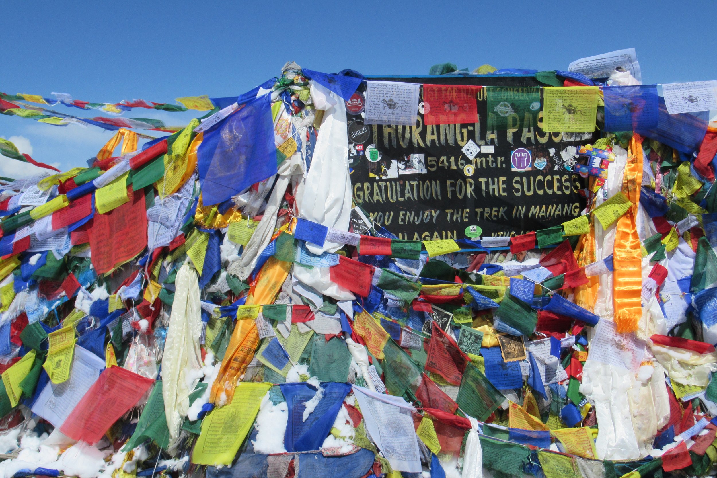
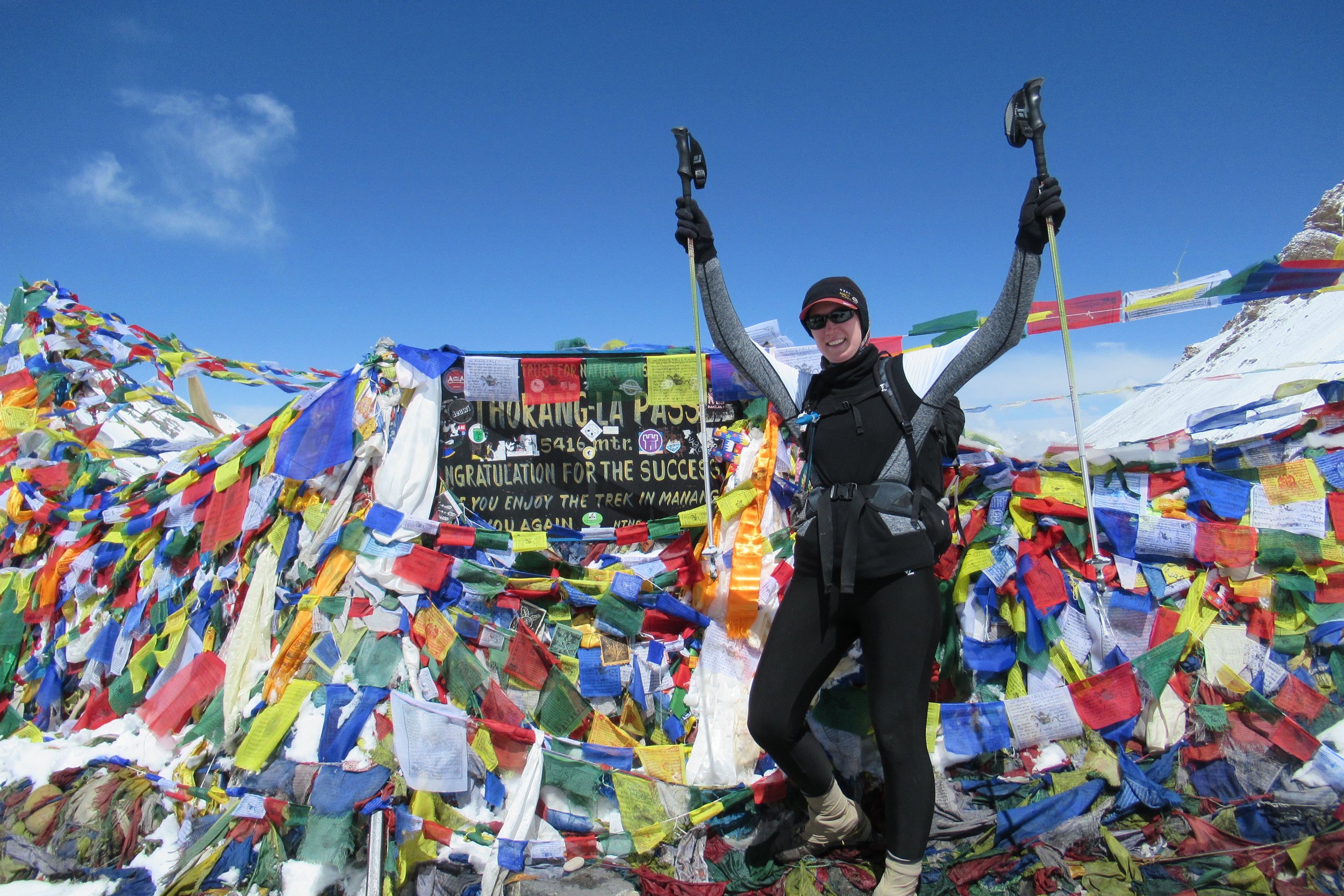
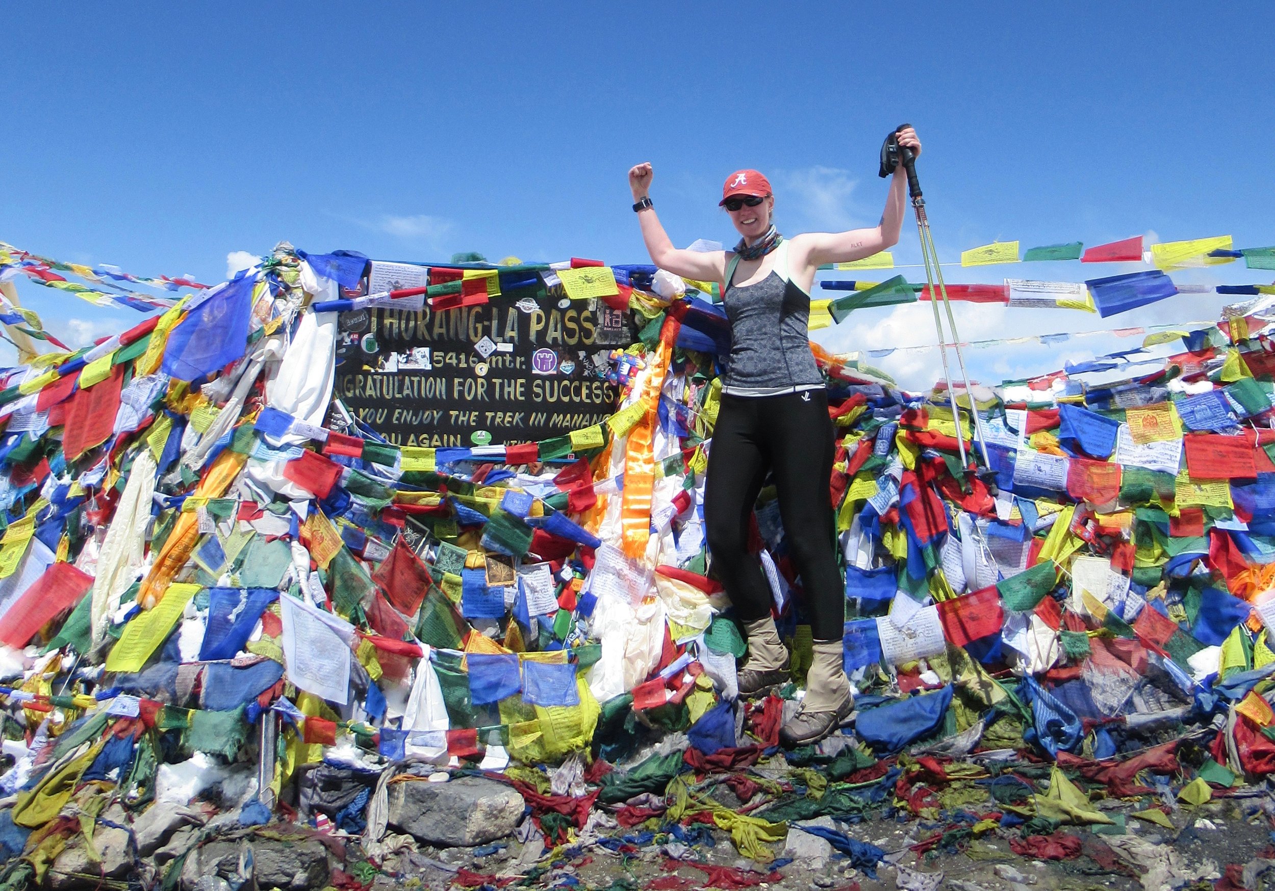
A little later on my heart started racing which I've noticed before happening in Colorado but hadn't since being in Nepal. I stopped to get it under control but I couldn't so I continued walking very slowly till the next stone building operating as a small teahouse. I sat down and tried to do some yoga breathing, inhaling and exhaling through the nose for several seconds a piece. While closing my eyes and focusing on slowing my heart, after a few breaths I could feel my heart return to a normal rhythm. Whew! Back to hiking and soon after Kate fell behind and I continued on. With every turn I thought I would see the pass but there were many false points. Finally I saw people and prayer flags so I started filming and was welcomed and congratulated as I approached the Thorong La pass sign. I made it there just before 10. Thorong La is the highest mountain pass in the world at 5416m/17,769ft. The highest I've ever hiked!
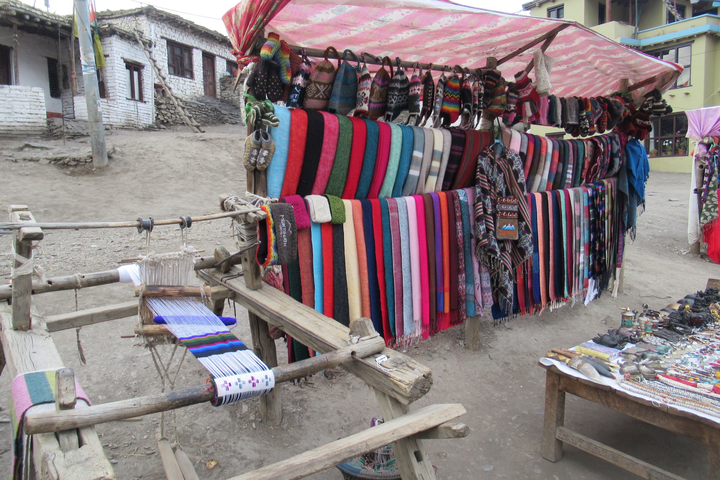
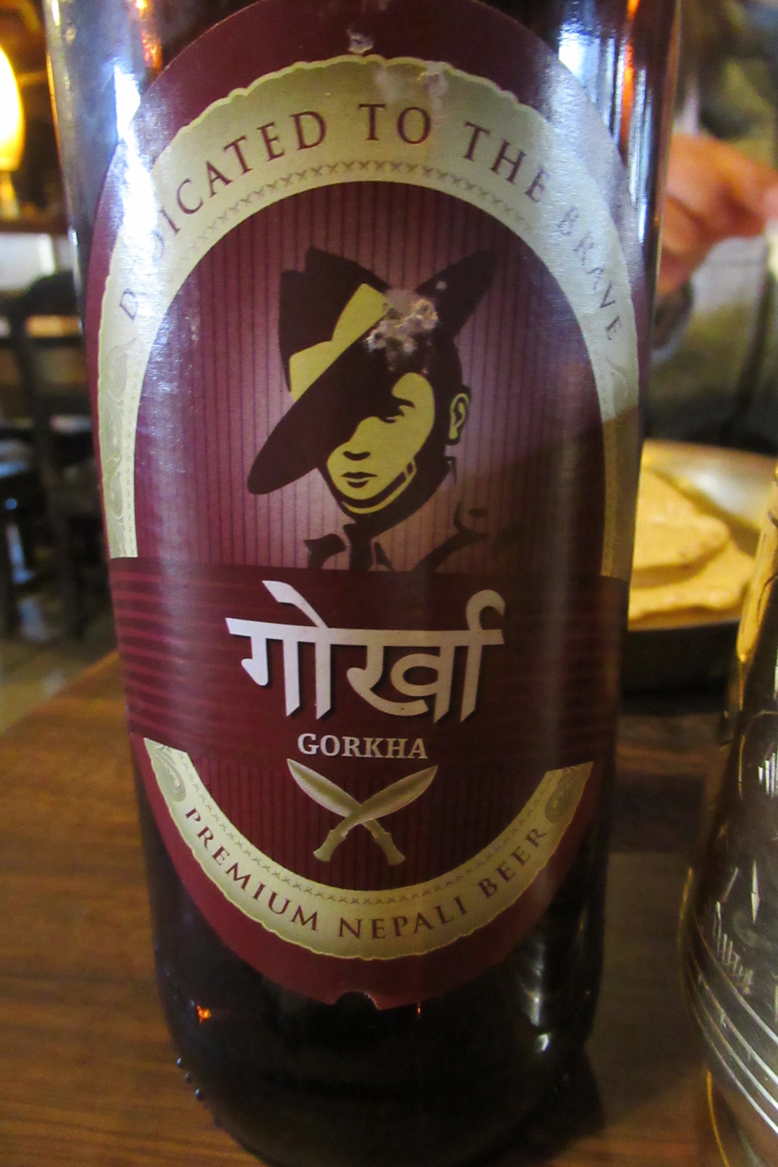
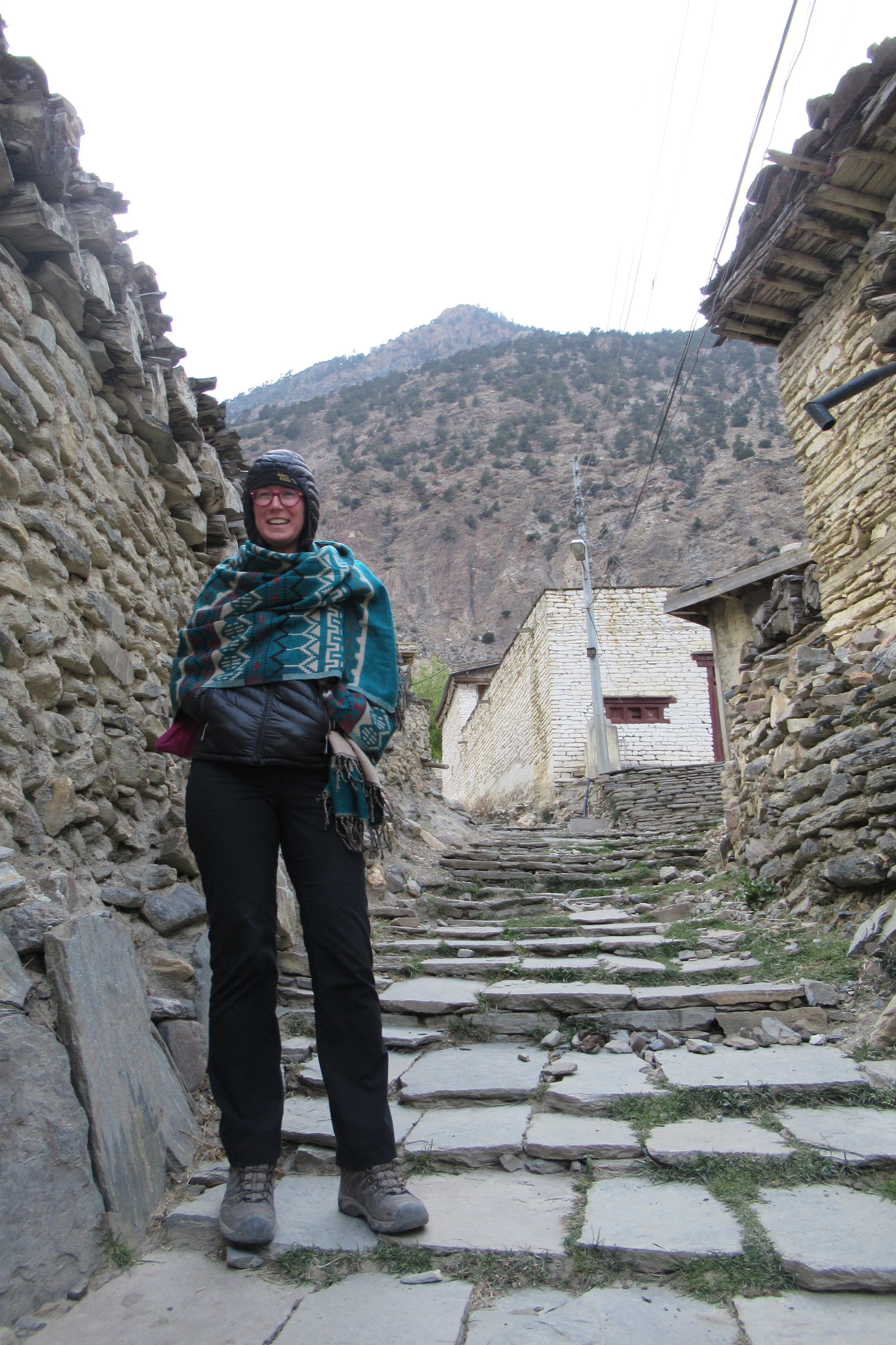
After pictures and a celebratory snickers I waited for Kate. She made it and we put up prayer flags that she had been carrying. We heard weather was moving in so we started hiking down around 11. Over the next several miles to Muktinath we descended 5,302ft. Luckily the trail wasn't covered in snow which would have made the descent much more difficult. The trail was still fairly difficult going down and I wasn't able to go too fast. One more stop to enjoy a local sea buckthorn juice before continuing on to Muktinath. Muktinath is the largest town since probably Kathmandu and was quite a bit of a culture shock to be around cars and lots of people again. Plus the brownness of the high desert sharply contrasted from the winter wonderland of the snow covered mountains we were just in. We stayed at a nicer hotel but shared a room with 2 other woman so I had to sleep on a mattress on the floor. Kate and I walked around town admiring the handwoven yak shawls made on looms right on the street, and I bought one even though I would have to carry it the rest of the way. That night I had a Gorkha beer to celebrate making it over the pass.
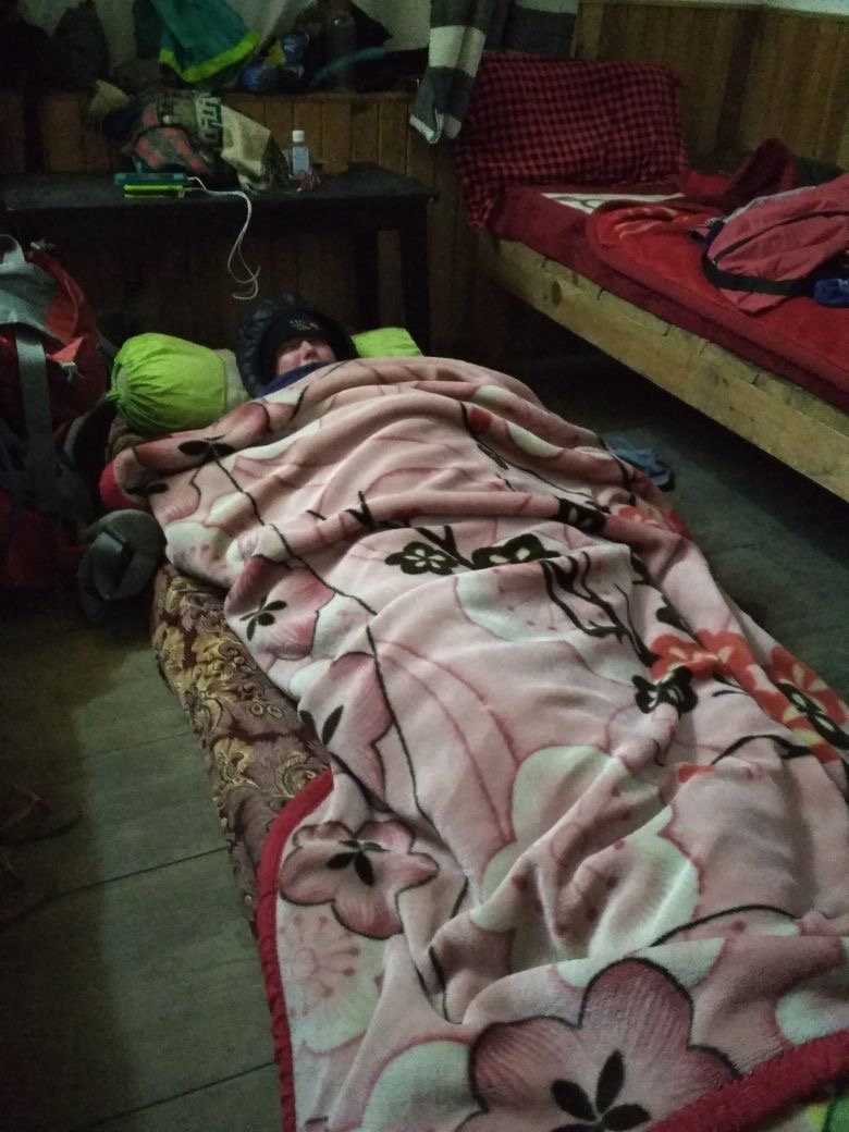
Photos Below: 1) Leaving snowy Thorong Phedi @ 5:30AM 2) Kate's photo of us at the start of the day 3) Looking up toward High Camp 4) Looking back down at High Camp 5) Kate hiking to the pass 6) Hiking to the pass 7) Kate's photo of me hiking in the snow 8) Thorong La Pass sign 9) I made it to the pass! 10) It wasn't that cold at the top 11) The descent 12) Hand woven Yak wool scarves 13) Gorkha beer 14) Kate's photo of me sleeping on the floor at the guesthouse
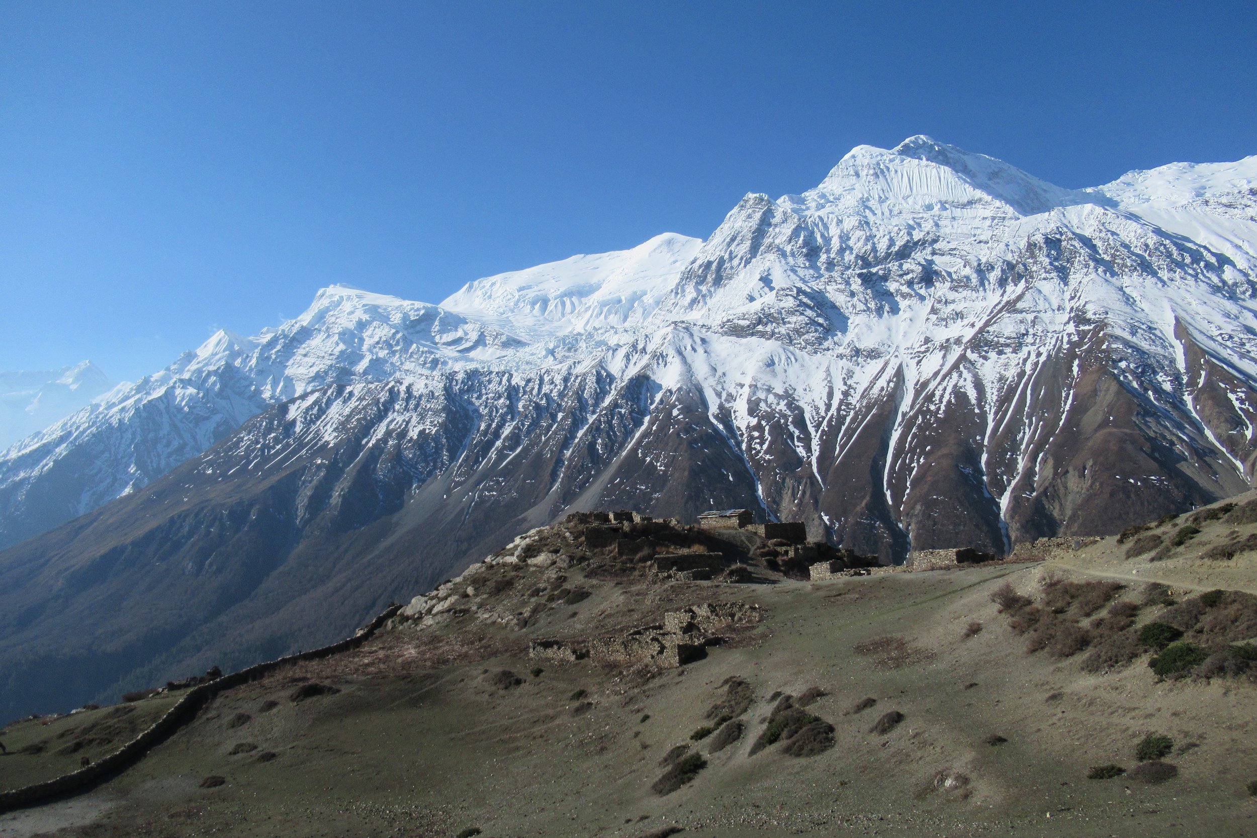
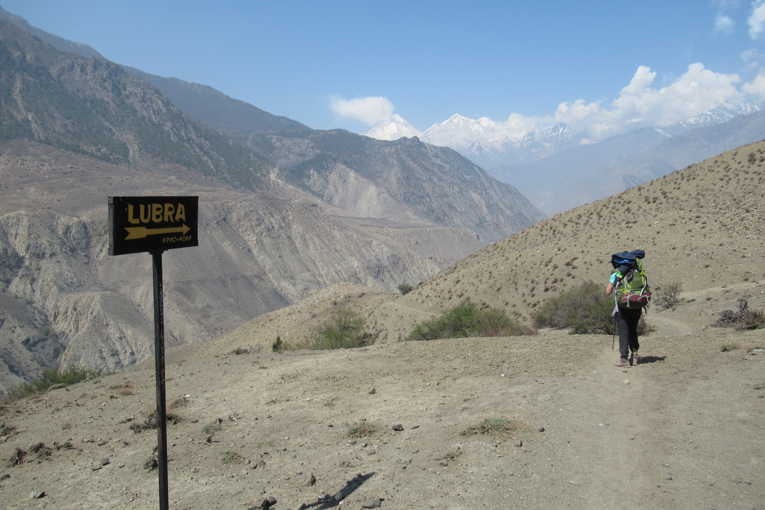
April 26: Muktinath to Marpha - 2670m/8,759ft
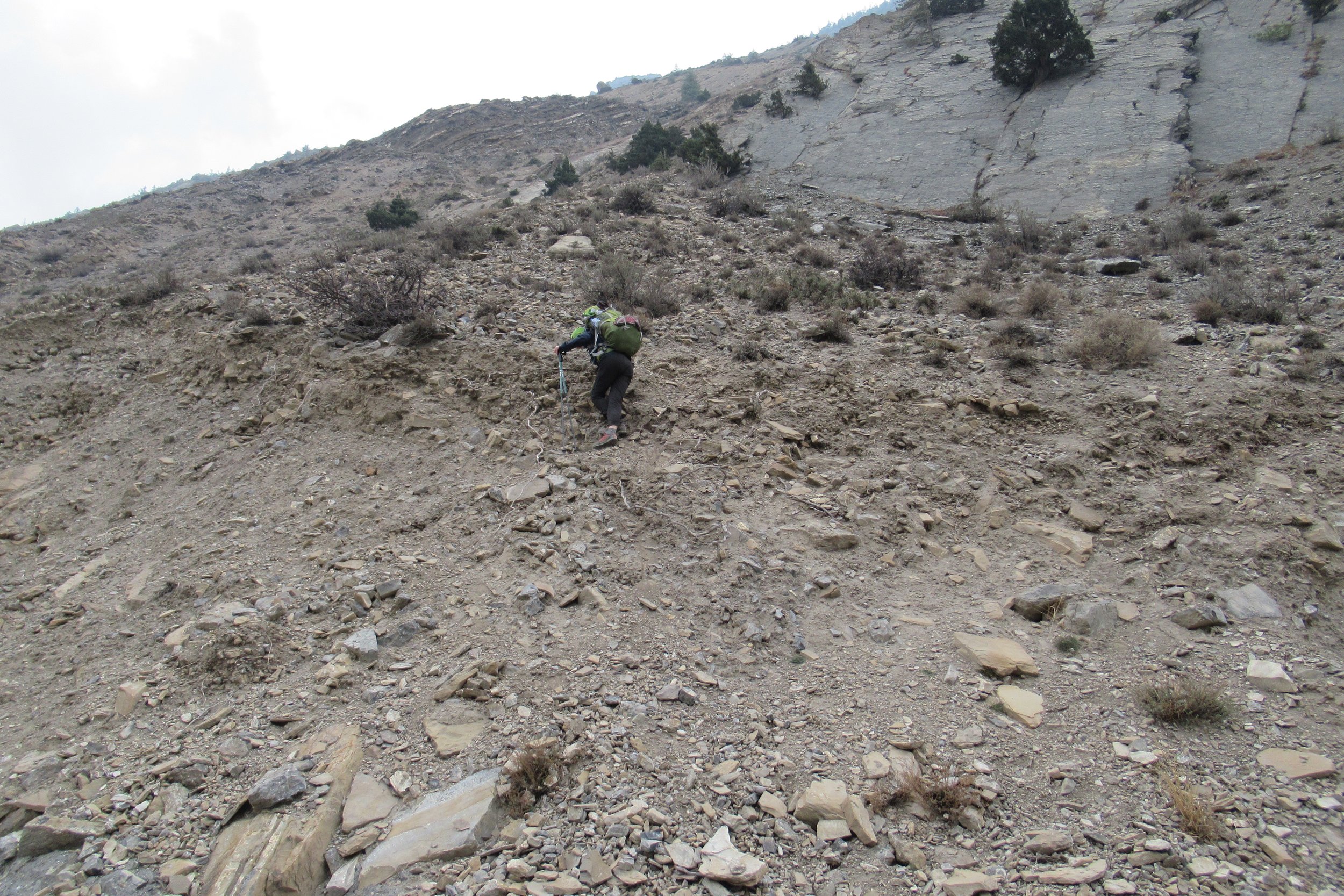
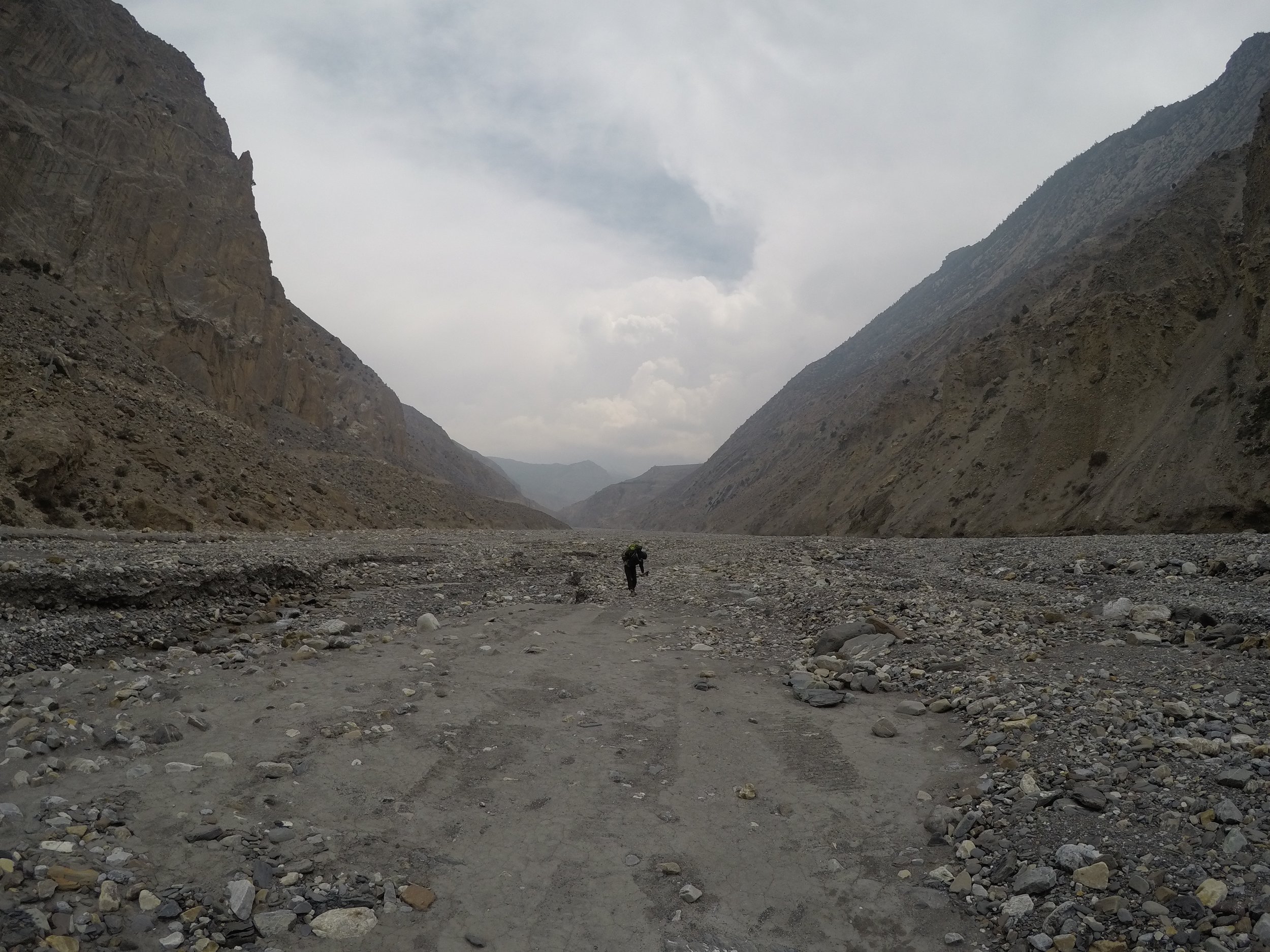
After the pass a lot of people stop their hike and take a bus to Pokhara or take a bus to skip sections and then start hiking again around Poon Hill. That's why my research was unclear and I wasn't totally sure what my plans were after the pass. Kate was following a fellow Russian's blog who had hiked the circuit last year and knew she wanted to go to Marpha, just past Jomsom so that's what I decided to do as well. She would stop her hike there and take a bus to Pokhara. I figured I would keep going, but more on that later. We left Muktinath and immediately had difficulty finding the trail. There were several different routes you could take and we decided to go by Lubra then to Jomsom. I saw people in the distance on a path so we blazed our own way and made it to the path. Once we got up and over a pass we descended down to a dry riverbed and through Lubra. After the town we were high up on the side of a mountain but we saw hikers down on the riverbed. The trail was loose rock and it was windy in the canyon and we didn't feel safe. So at a low point we decided to climb down to the riverbed instead of staying on the trail that was going up.
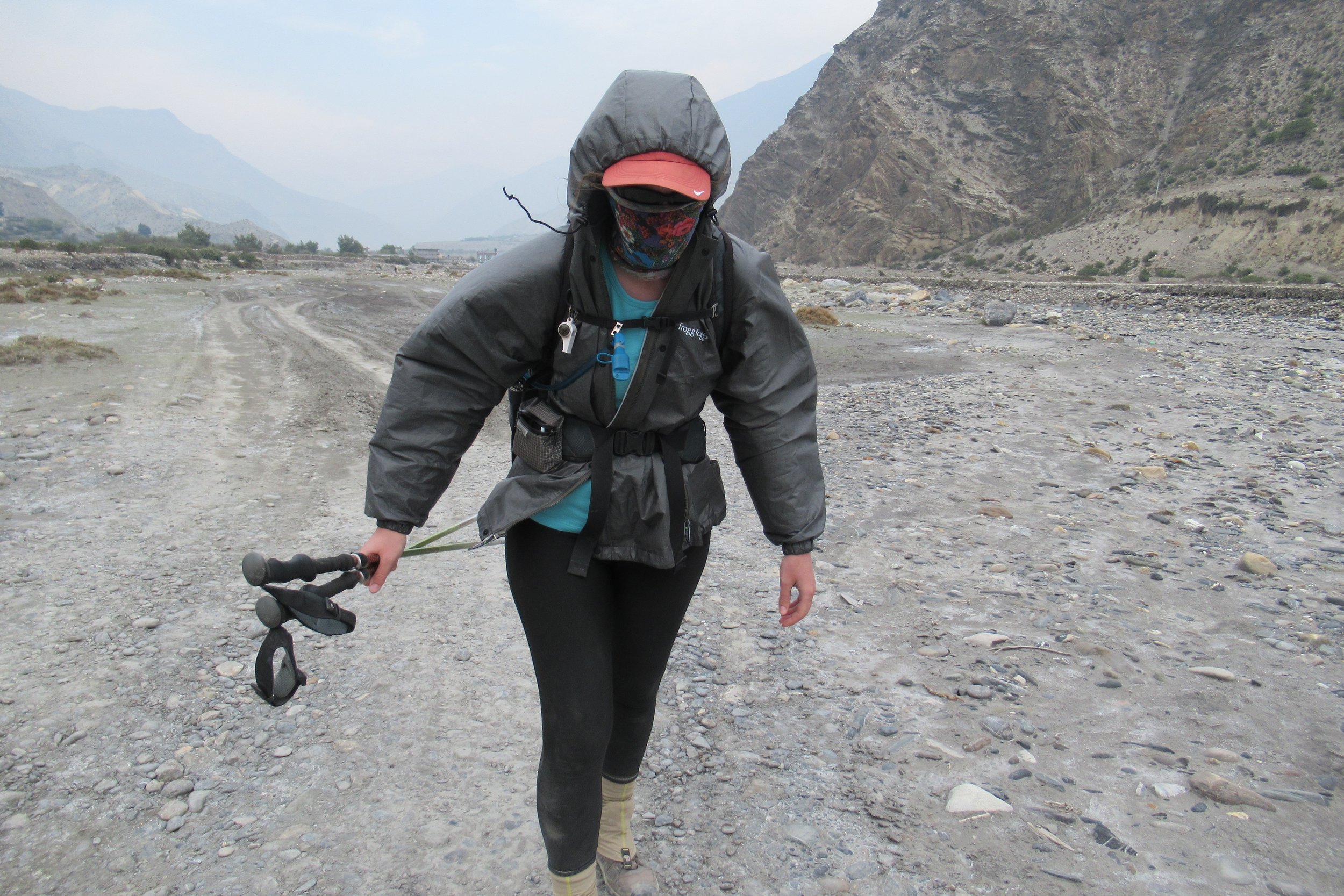
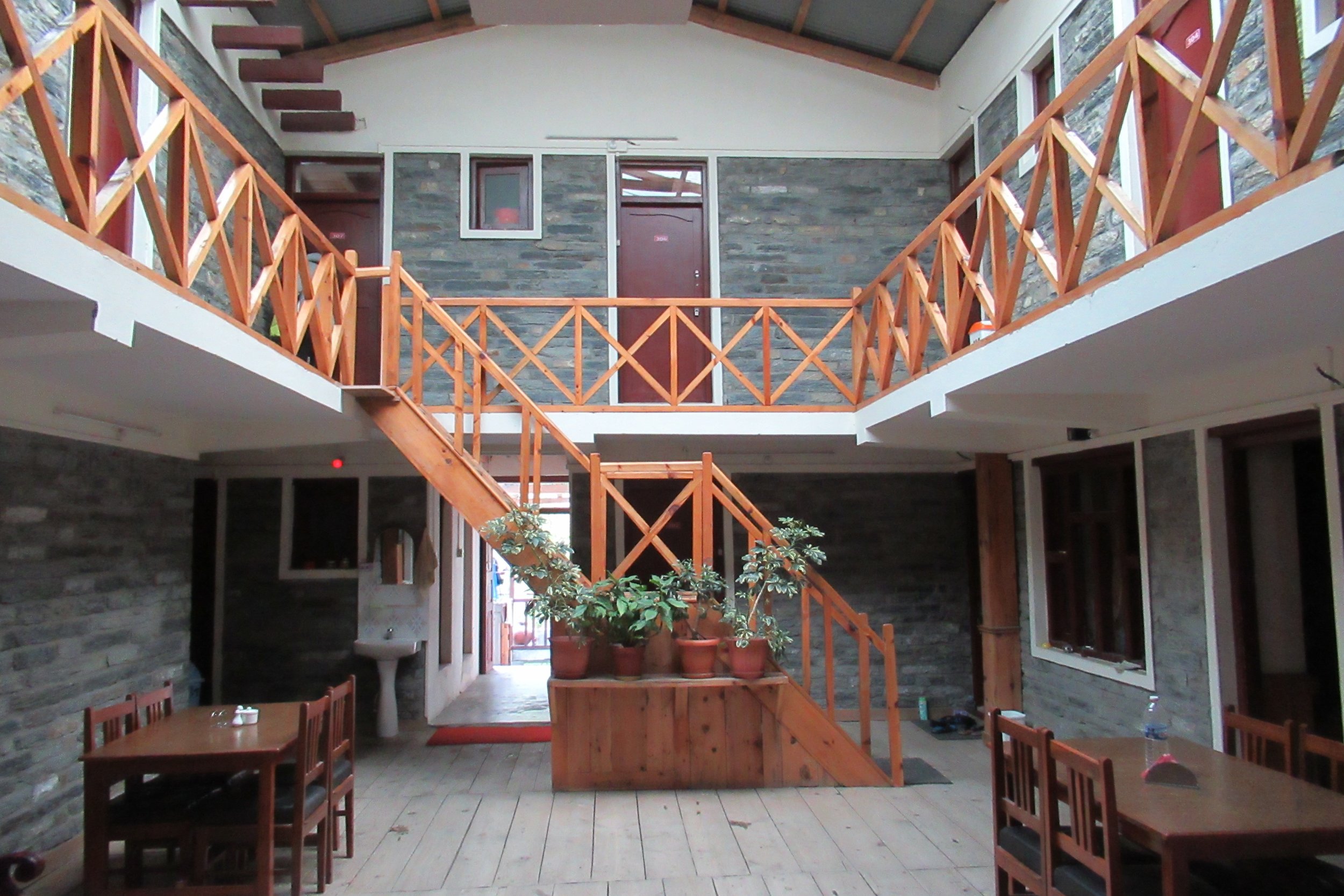
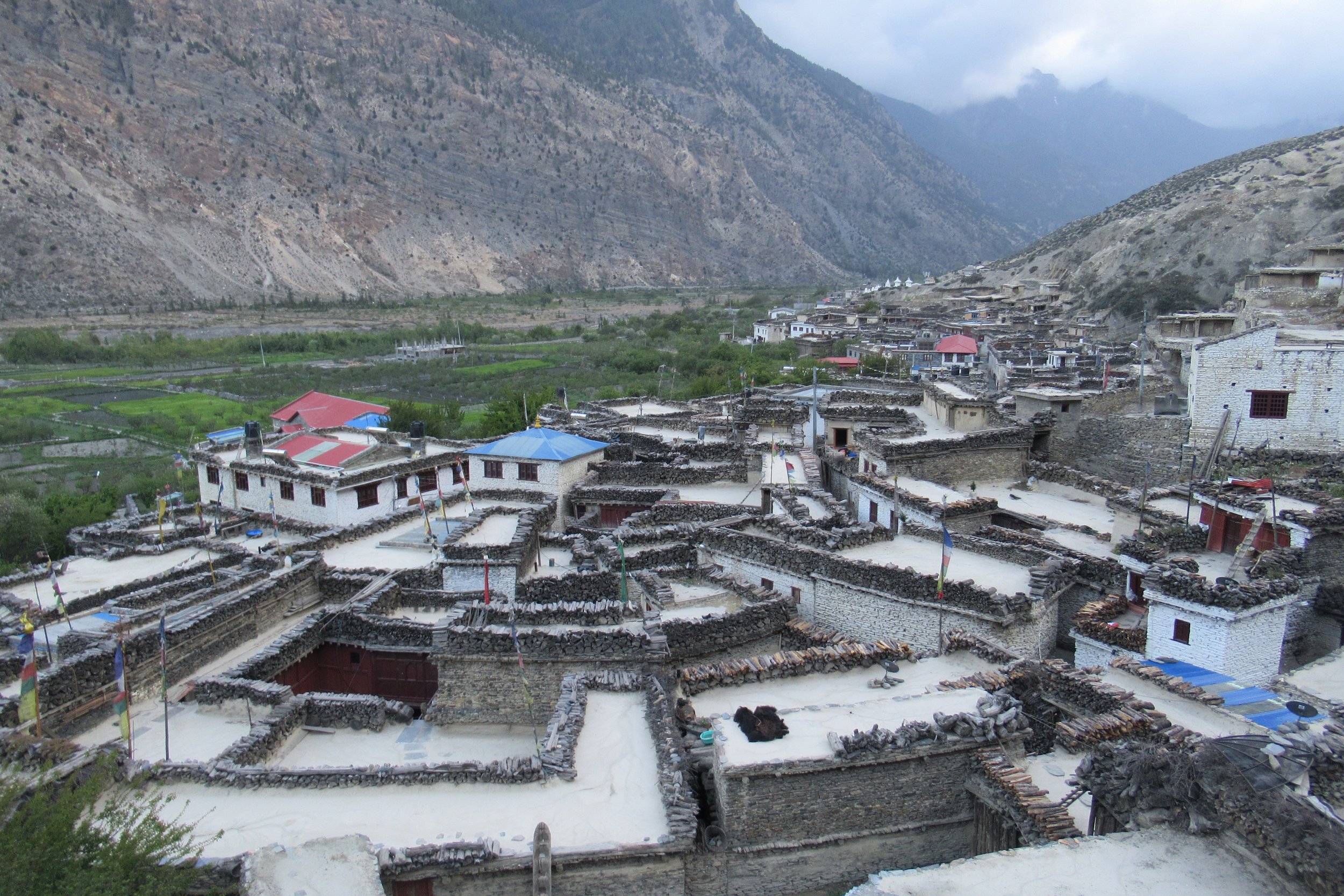
Once on the riverbed we navigated over rocks and I had to hold on to my hat because the wind kept blowing it off. We made it to the gravel road the buses take to Pokhara and started following that to Jomsom. We ended up walking the dusty road and could barely hear anything other than the strong winds. It was miserable and I hated it. Finally we reached Jomsom, stopped at a bakery to recharge and continued the 2 hours to the apple region of Marpha. The wind was still strong and I ended up putting my rain jacket on, cinching the hood down to keep my hat from flying off, and pulling my buff over my nose because the wind was kicking up all the dust in our faces. We were so relieved to finally get to Marpha and after rejecting the first guesthouse we stopped at we found a nicer one, probably the nicest one I stayed at on the trek. We leisurely walked around town taking in the sights and looked for any apple-related products to consume. The narrow streets and the stone buildings at different levels made the town a bit of a maze and reminded me of the streets of Venice. We tried some local apple cider and had a nice last night together.
Photos Below: 1) On the way to Lubra 2) Another long suspension bridge 3) I loved the bridges 4) Climbing down to the dry riverbed 5) Riverbed walking 6) Wind walker 7) Inside our guesthouse 8) Modeling my new yak shawl 9) Marpha from above
Next--> Annapurna Circuit: Part 3
Vlog #4 - Tilicho Lake
Vlog #5 - Over Thorang-La Pass
