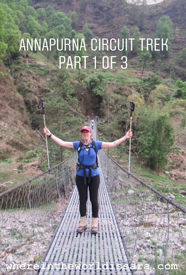
Annapurna Circuit: Part 1
[Here’s an article I wrote for TheTrek.co about my hike: How to Hike Nepal’s Incredible 150-Mile Annapurna Circuit]
Check out my Video Blogs/Vlogs on my Youtube Channel
Vlog #1 - Kathmandu to Danaqyu
Vlog #2 - Danaqyu to Manang
Vlog #3 - A Walk through Manang
I'm not sure when I first heard about the Annapurna Circuit hike but about 3 years ago I started to feel the pull of Nepal on my heart. Of course, I want to travel everywhere and go to every country and see all the things, but I'm not rich and can't take the time to go everywhere (yet) so I have to pick and choose. My decision process seems to operate by what stays with me the longest, time frame, and cost. Nepal has been on my mind for awhile, I read the best times for this hike are mid-March to mid-April and October, and the dollar goes a long way in Nepal so the costs would be less.
Written Gear List found on my gear lists & review page
As I plan my year out I have ideas of things I want to do but they are never set-in-stone because I've learned to be flexible and open to opportunities that arise in my nomadic, seasonal life. That's all to say that I wanted and said for months that I would do this hike in April but didn't really start planning it until March because I wasn't sure of my present plans. Then when planning I thought I would try and travel afterwards perhaps to nearby India and then to Europe to visit a friend. So I bought a one-way ticket to Kathmandu a month before I departed. I was also waiting around because I was trying to find someone to accompany me. From the initial research I did I got the impression that the permits require you to have at least one partner and people don't hike it solo. That was my biggest hang-up, but I joined a helpful facebook group and found that my impression was wrong and that I could hike solo and would most likely meet people on the trail to hike with. So that fixed my apprehension and I continued planning. [I also want to note that a lot of people hire local guides and porters to carry their pack. I think as the years go by less and less people do this refraining to carry their pack themselves, but it is definitely an option and helps the local economy as well as helps the hiker acclimate to the high elevation without having to haul a 20+lb pack.]
Once the ticket was bought I tried to decide how long the hike would take. The research I found was unclear and everyone's trek was a little different. Therefore, I wasn't sure on the total mileage, how long it would take to hike, or where I would start or stop the hike. This planning process proved very different than any of my other hikes and taught me to be more flexible and patient. I decided to get a 30-day visa-on-arrival and have my bases covered so I didn't have to rush and keep open the possibility for side hikes or additional hikes afterwards. I also wanted to attend a meditation retreat while I was there, but those plans fell apart because I couldn't request a spot in a date-specific course due to not knowing when I would finish the trail. The most helpful and entertaining part of my research was watching a vlog series on youtube titled The Annapurnas about two bros hiking the trail. Over 20+ episodes my excitement grew from the epic drone shots of the hike and I got a little familiar with the towns along the trail and what to expect. [There is no official guidebook for this trek. I heard about a pdf guide from 2011 and that's what I used but didn't follow precisely. It was more for secondary reference. You can find the guide HERE]
“Himalaya means abode of snow in Sanskrit.”
SO that leads me to my last post titled Kathmandu, Nepal, and starts the story off there.
Fast forward to the beginning of the hike...
April 17: Bus Kathmandu to Besisahar. Hike from Besisahar to Bhulbhule - 840m/2,756ft (elevation of Bhulbhule)
I took a taxi from my Thamel hotel to the Gongabu bus station, bought a new ticket (they wouldn't honor the ticket I previously purchased for an earlier day but didn't make due to getting sick) to Besisahar for under $4, bought some snacks for the ride, met up with a German woman I met at the permit office the day before, and headed off around 6:30AM. I was a little/quite concerned about the bus ride because in my research I saw that the roads are pretty bad, the ride is very bumpy, long (8+hours), and cramped. Being prone to car-sickness I made sure to take motion-sickness pills throughout the ride and I successfully made it without upchucking.
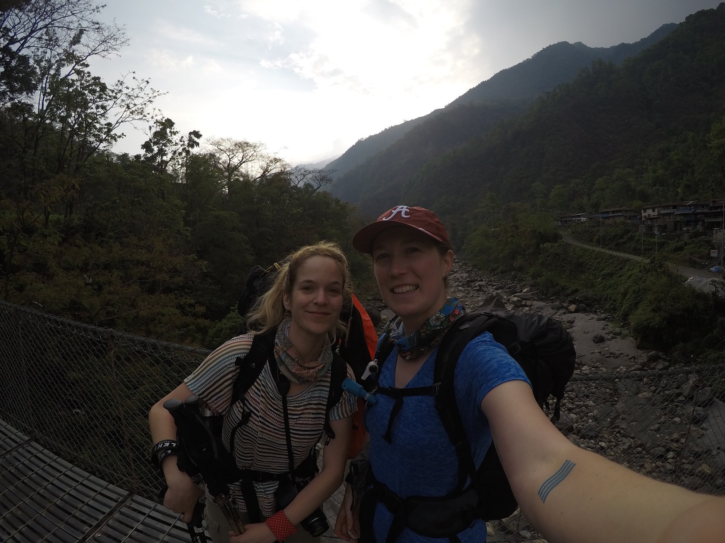
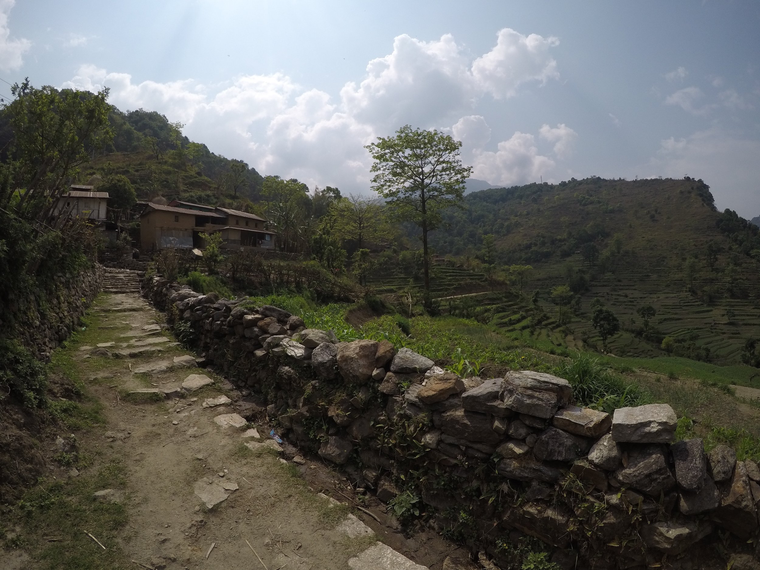
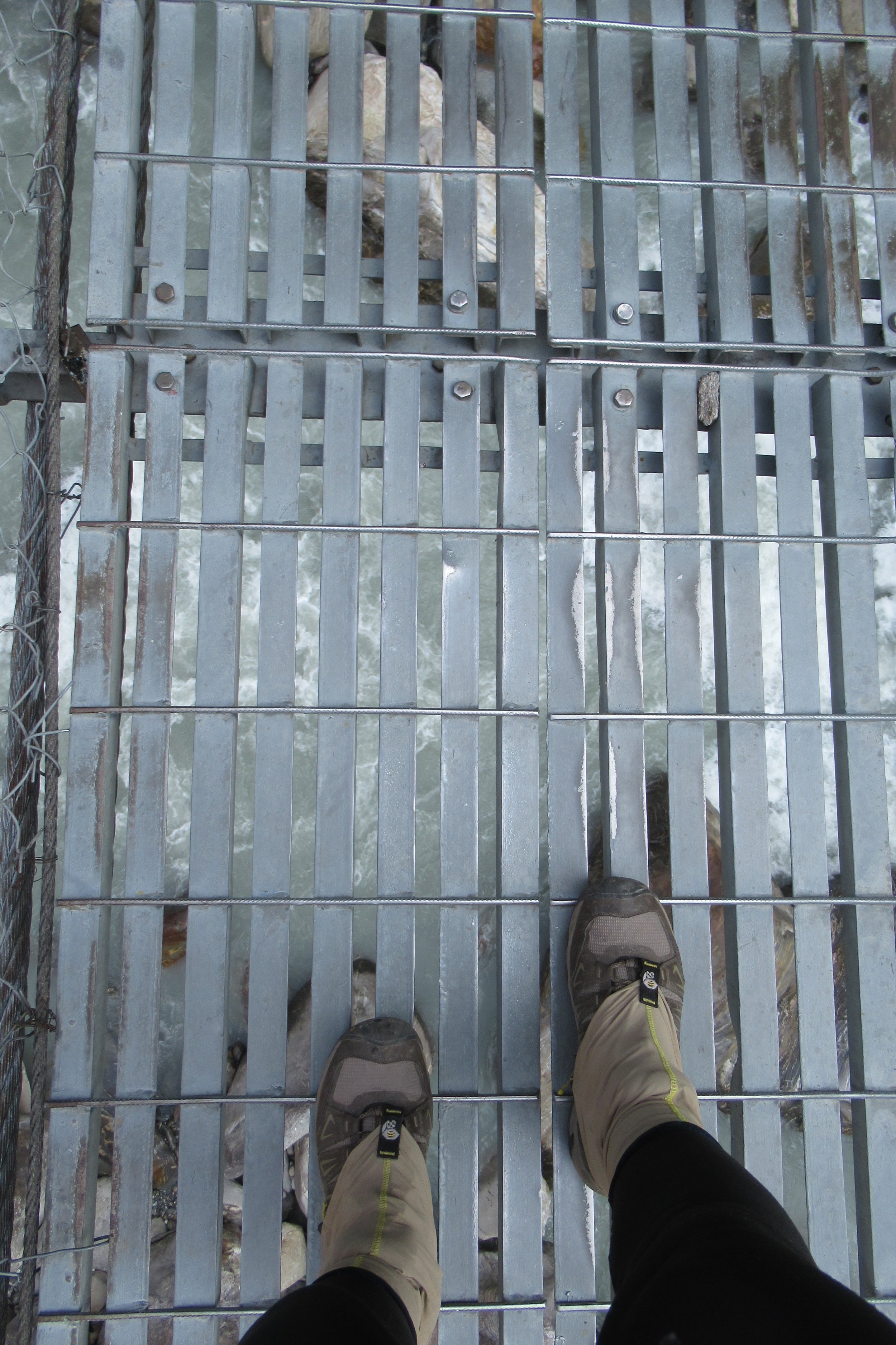
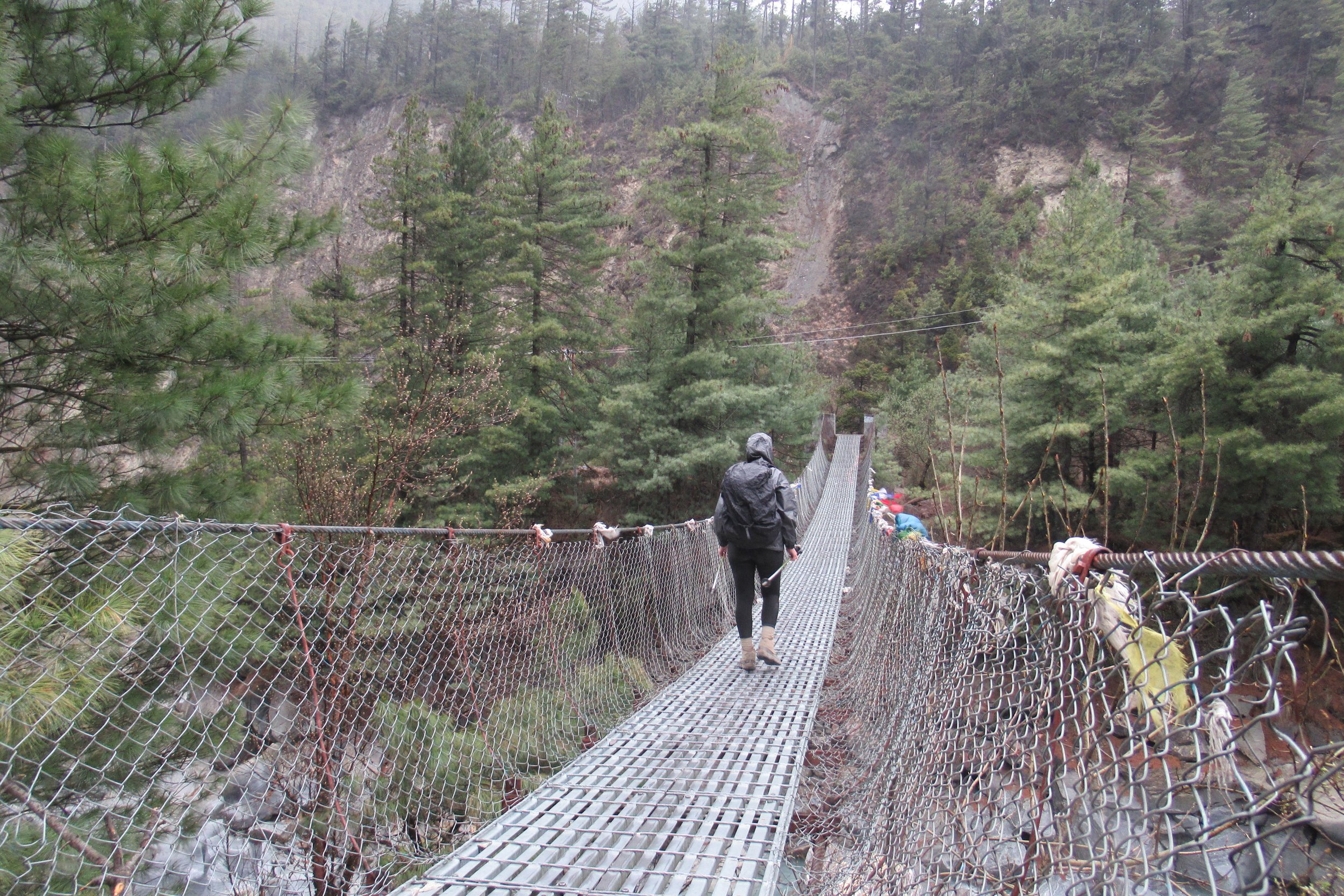
I had the rough idea that after arriving in Besisahar that I would take another bus just down the road to Bhulbhule, but I decided to hike with my new friend Fabianna the two hours to the first village. Once off the bus, I got a lunch of fried potatoes and we hit the trail around 3PM. We crossed our first suspension bridge of the trek and entered the countryside passing by endless terraces. Local kids followed us asking for candy and money which got frustrating with their persistence but once we left the villages we only saw the local water buffalo (which I came to love because of their surprisingly expressive faces compared to cows). 2 hours came and went and only then did we find out that we must have taken the long route and it would end up being 4 hours. I was immediately pissed as I had not prepared to hike that long on the first day off the bus, didn't want to hike till 7PM, and would have been hiking quicker as we heard thunder in the distance and didn't want to get caught in the rain. After that hissy fit, I calmed down and decided to not make it a big deal and enjoy the time. We got caught in the rain, asked the locals for directions, and finally made it to the first lodge in Bhulbhule and got a room. The power was out at the time (probably due to the storm) so I wasn't able to check in with my parents. We were too tired to eat dinner but I did reward myself with an orange Fanta - a craving I always get on the trail for soda that I don't drink in my everyday life. Day 1 down!

The bus I took to Besisahar

Leaving the village
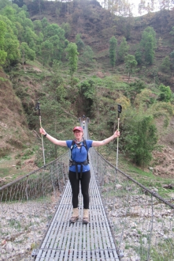
Start of my Annapurna Circuit Trek!

I'm loving this photo-I can only see it as a painting
April 18: Bhulbhule to Jagat - 1300m/4,265ft
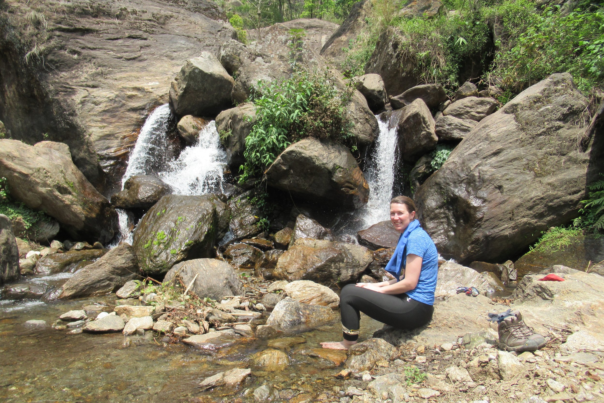
After a small breakfast of chapati bread and jam, we started hiking around 7:30. The hiking was fairly flat and we moved quickly. Everything was new so we stopped constantly to take pictures. As the day went on our hiking speeds separated us and I hiked by myself and stopped every so often in the villages where we would reconnect. We met other hikers, cooled our feet in a cold waterfall, and ate snacks of bananas. I arrived in Jagat around 4:30 and stopped at the first guesthouse. After cleaning up, I went outside to write in my journal so I could see when Fabianna arrived. But she never did. We never really discussed where we were going to try to get to that day, and I wasn't sure we would end up hiking together anyway because she was a bit slower than me. It's too bad because I never got to say good bye and good luck, I never got her contact info, and I never saw her again. I enjoyed a dinner of vegetable momos and went to bed. First full day in the books! [*Note: Greeting in Nepal- "Namaste". Whenever I passed locals or porters I would say namaste and they would say namaste in return.]
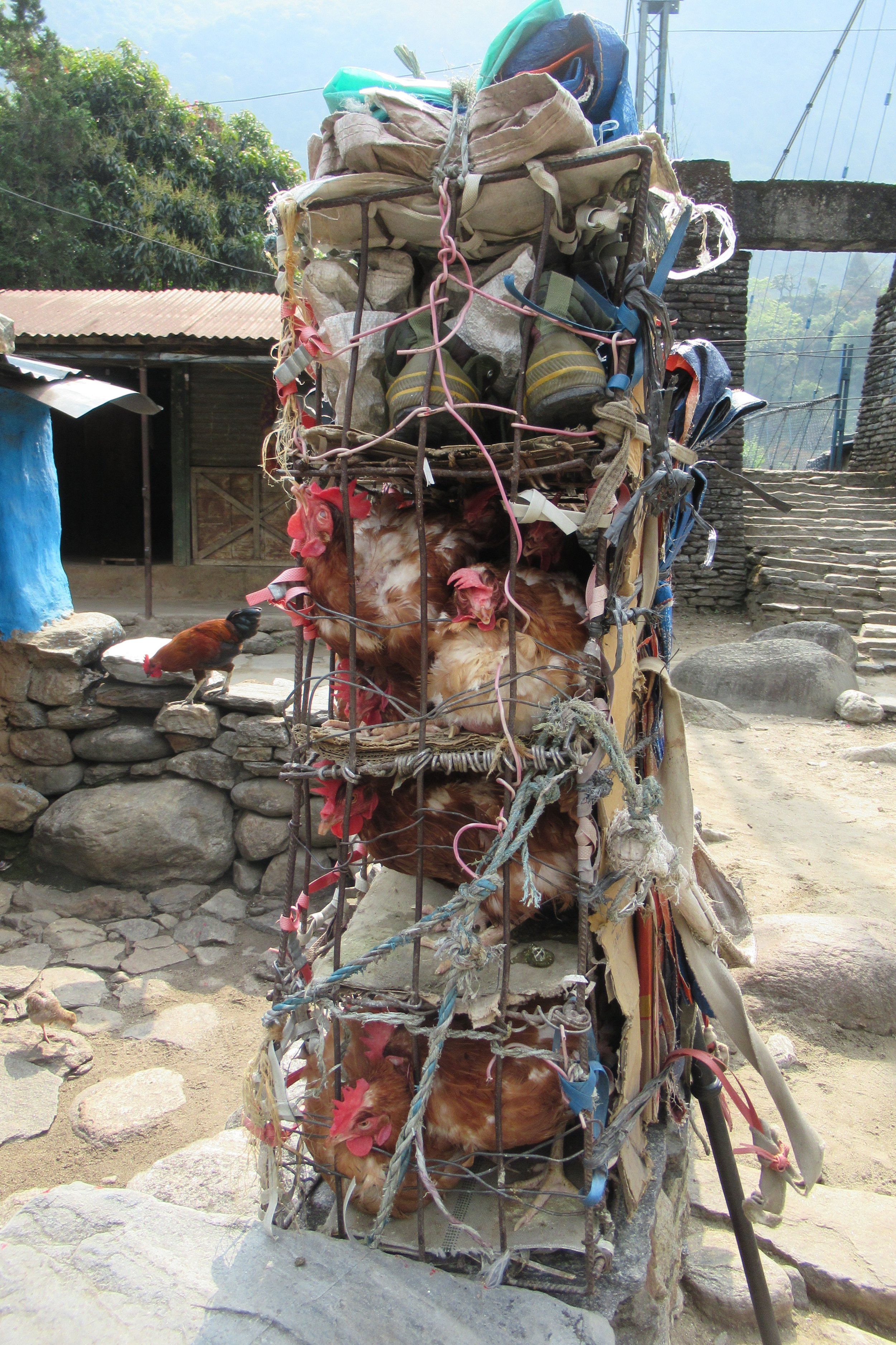
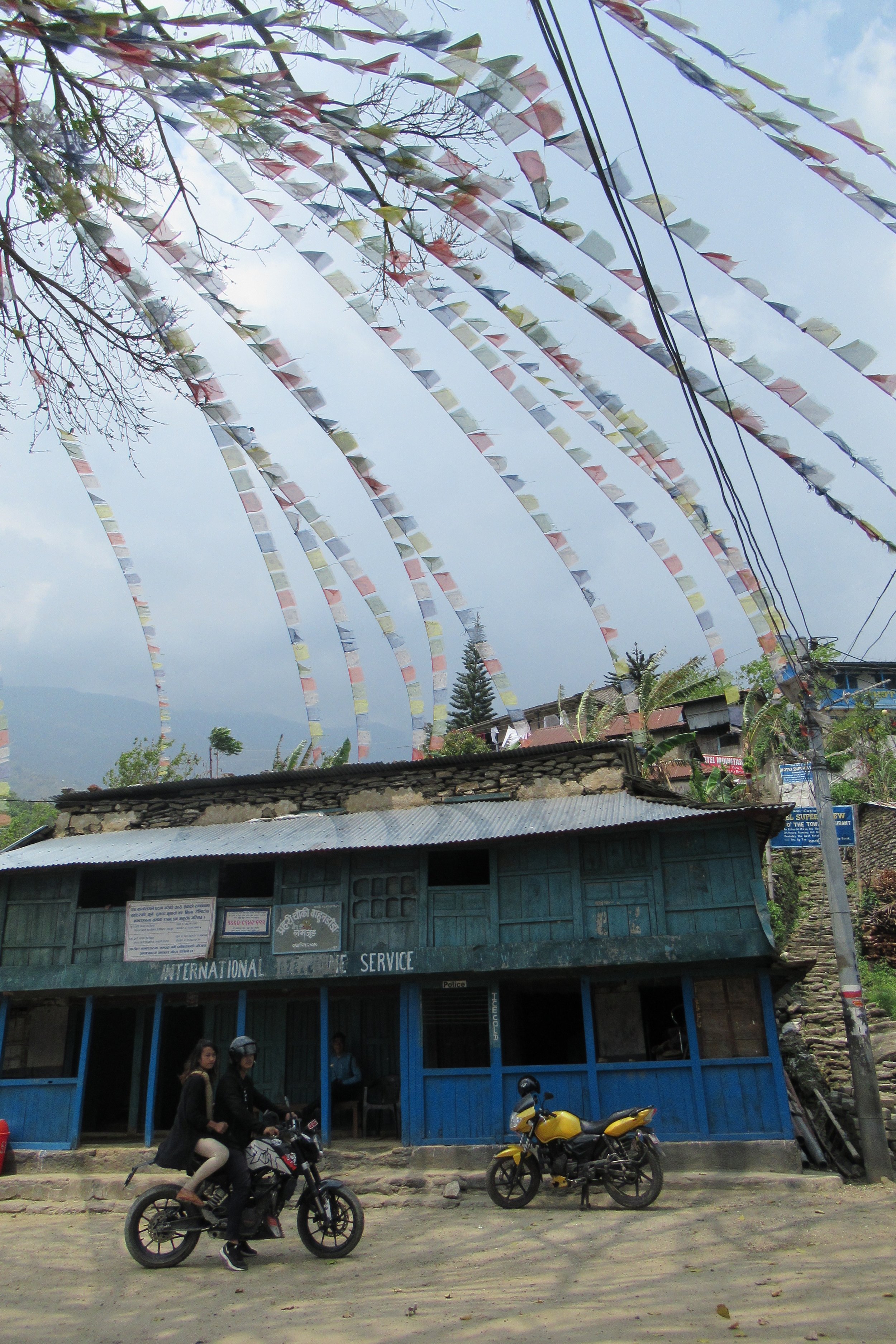
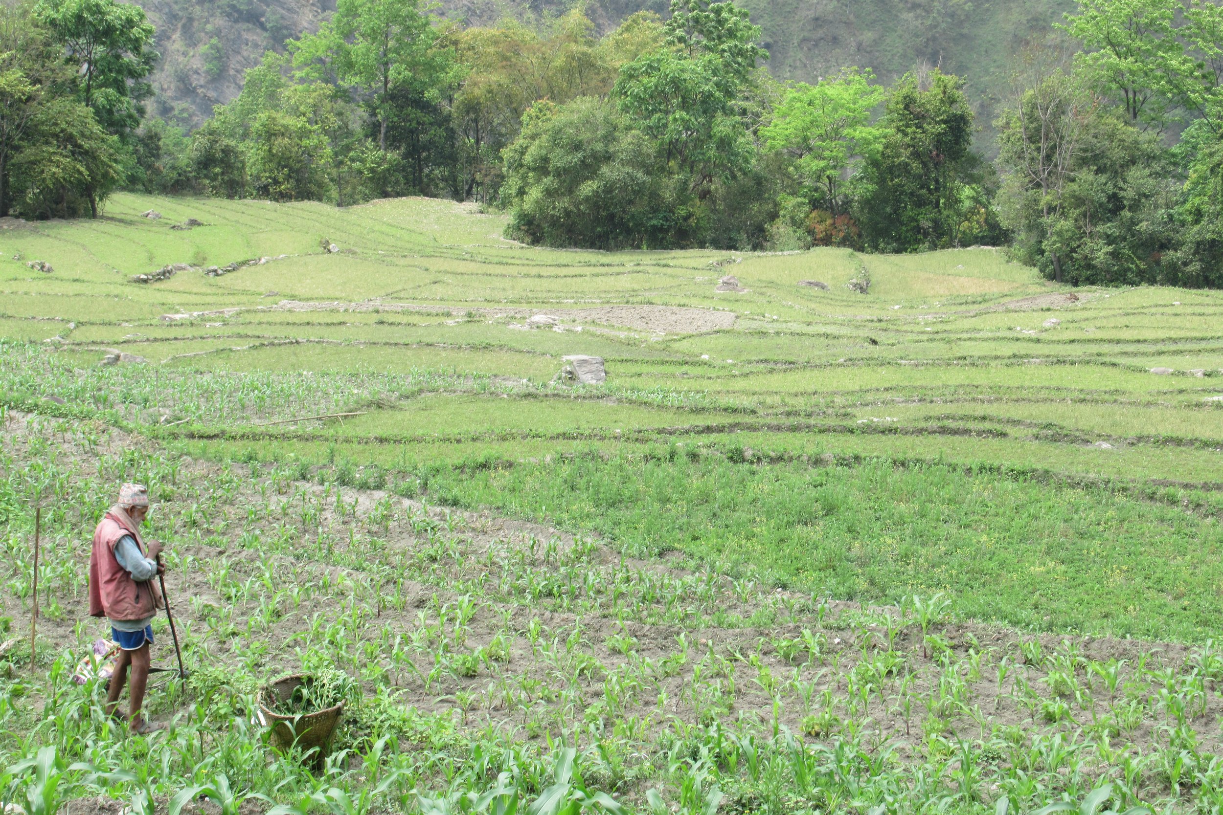
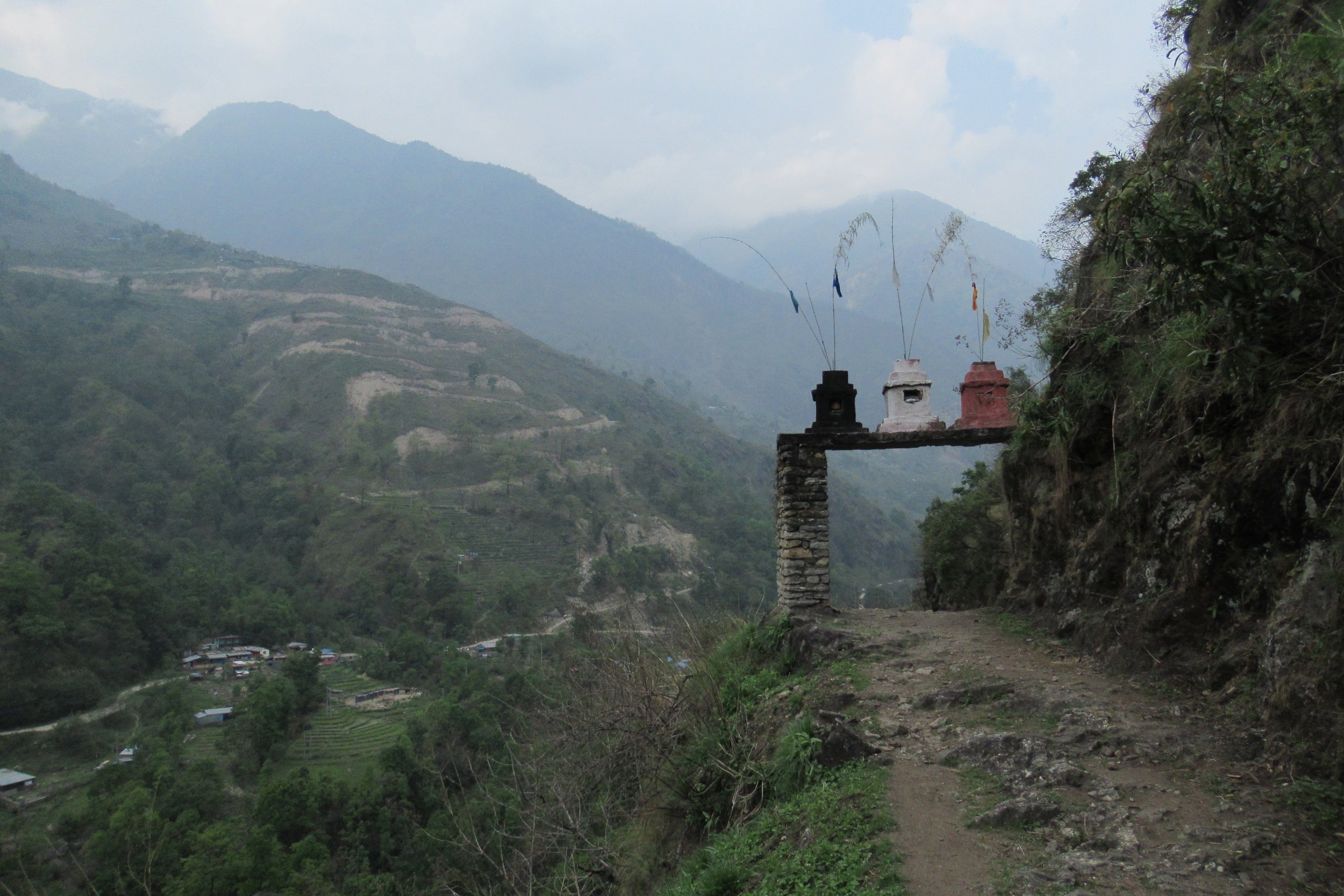
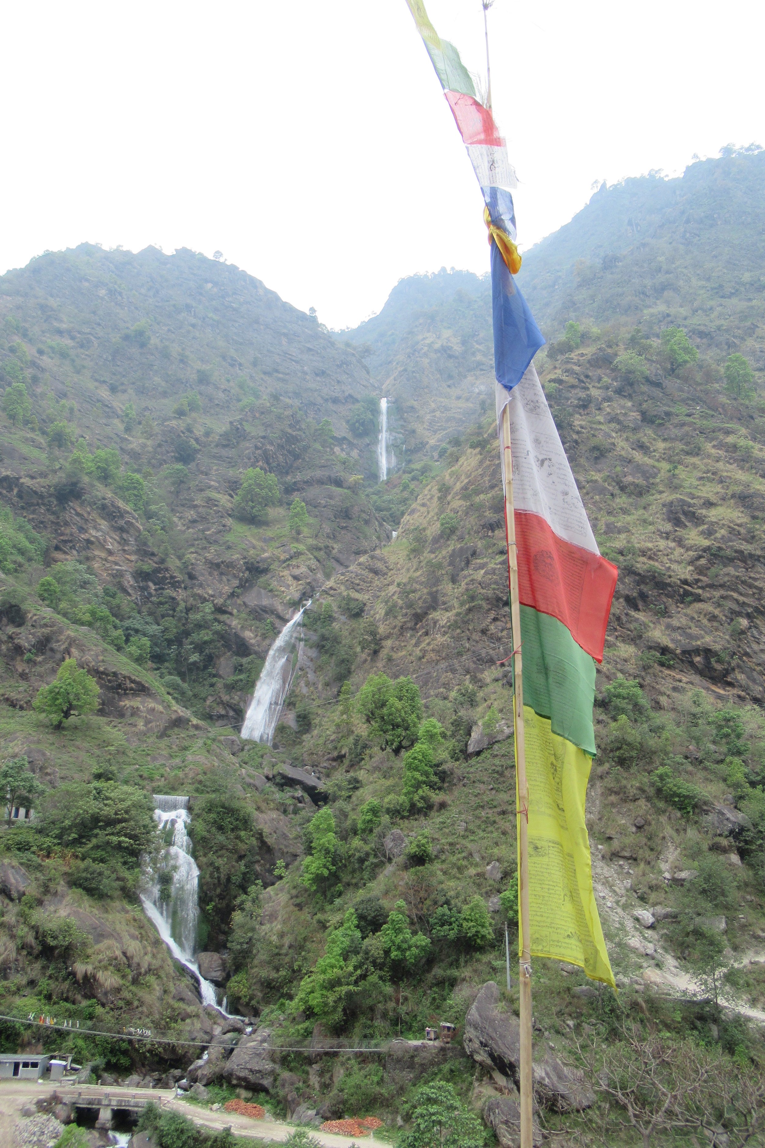
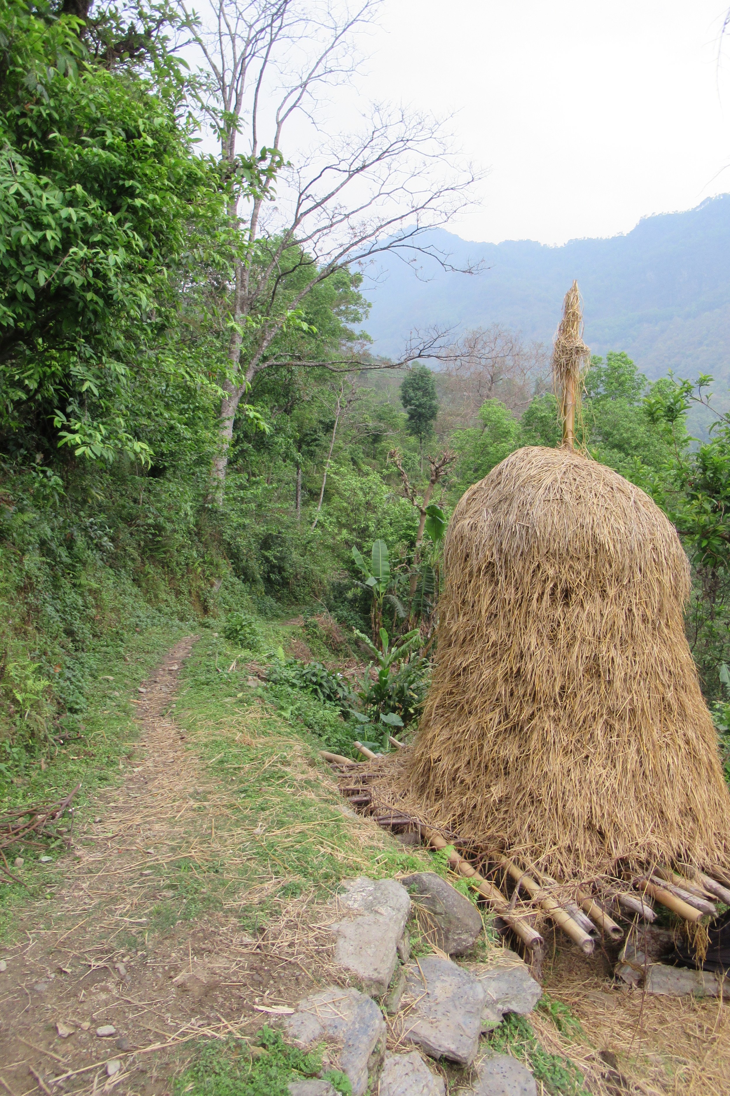
Photos Below: 1) Only picture I got with Fabianna 2) Beautiful country 3) Interesting chicken carrier 4) Prayer flags blowing in the wind 5) I love these terraces 6) Resting at a waterfall 7) Lovely entranceway 8) Prayer Flags and waterfall 9) Straw pile
April 19: Jagat to Danaqyu - 2200m/7,217ft
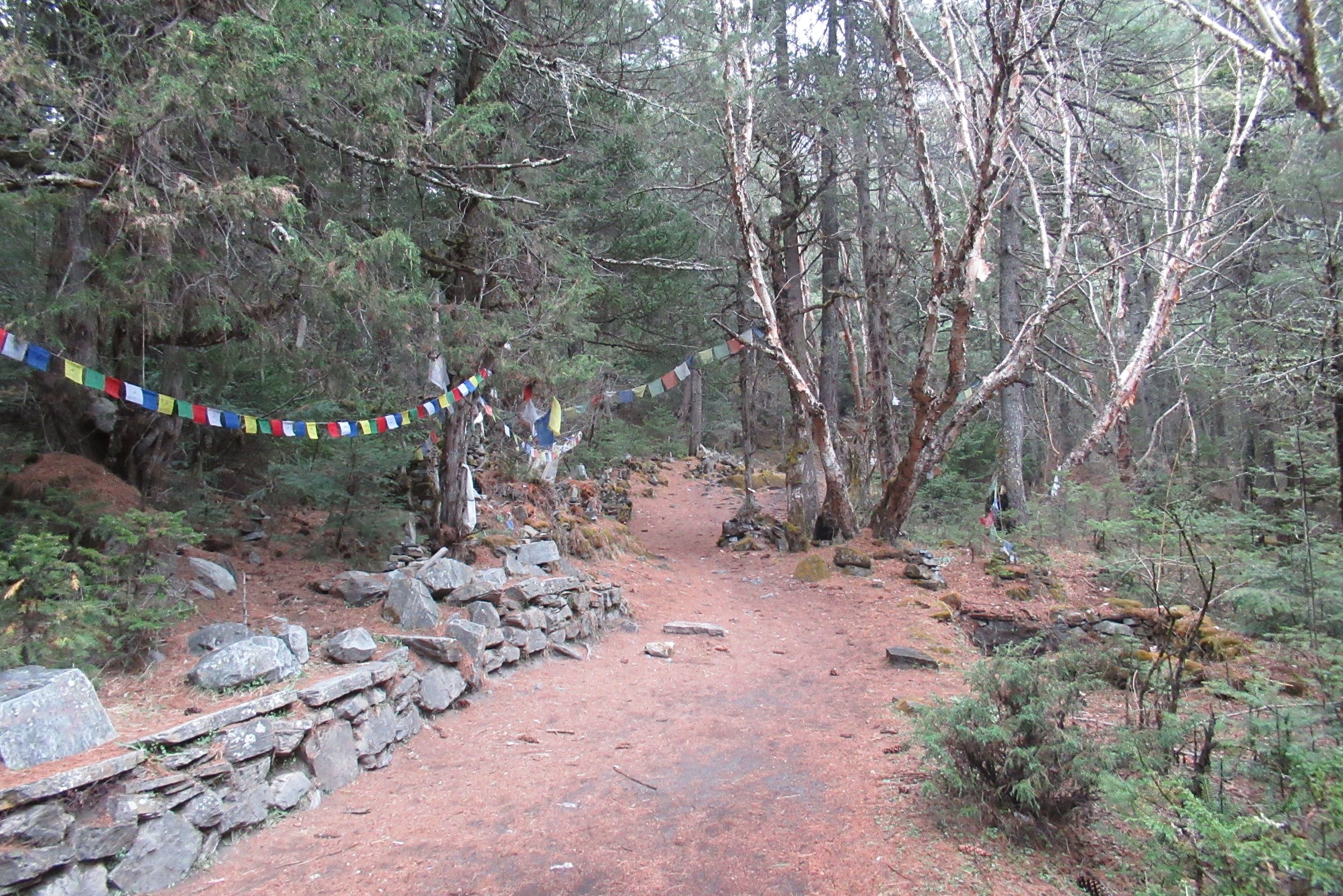
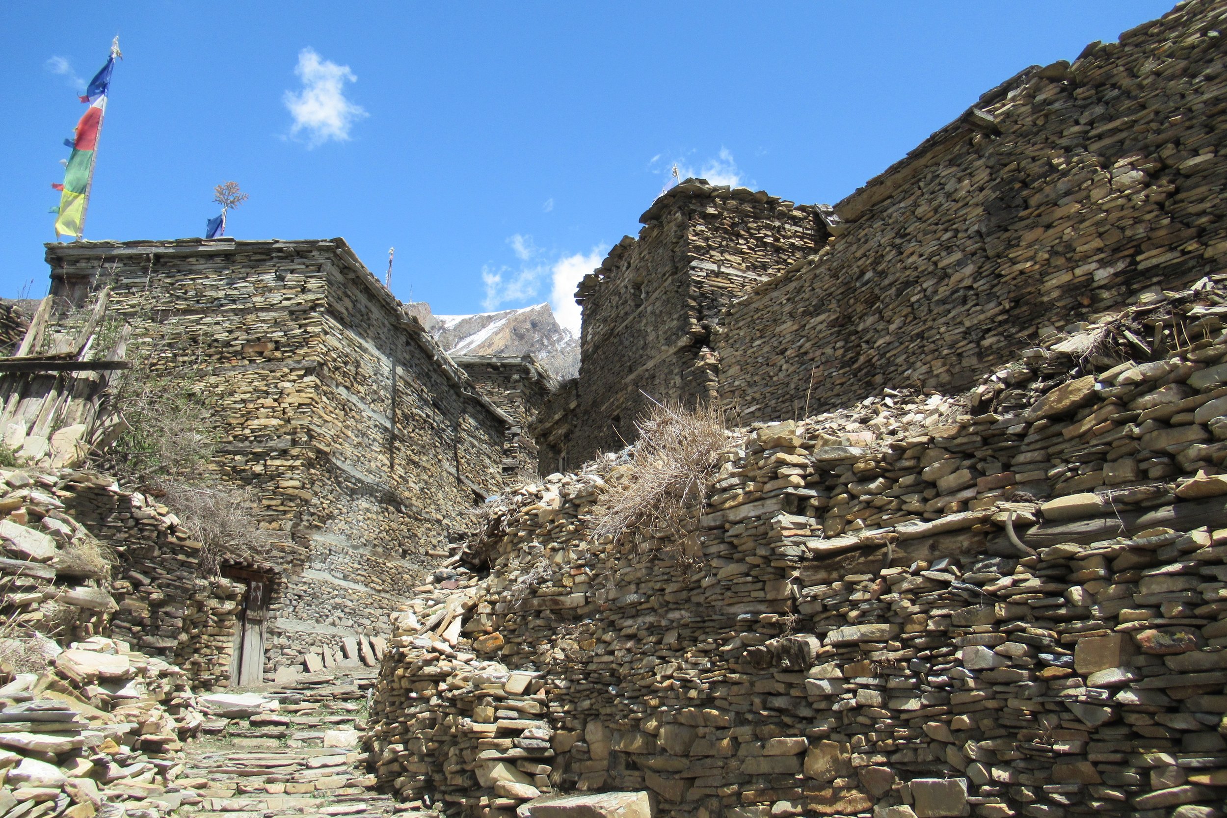
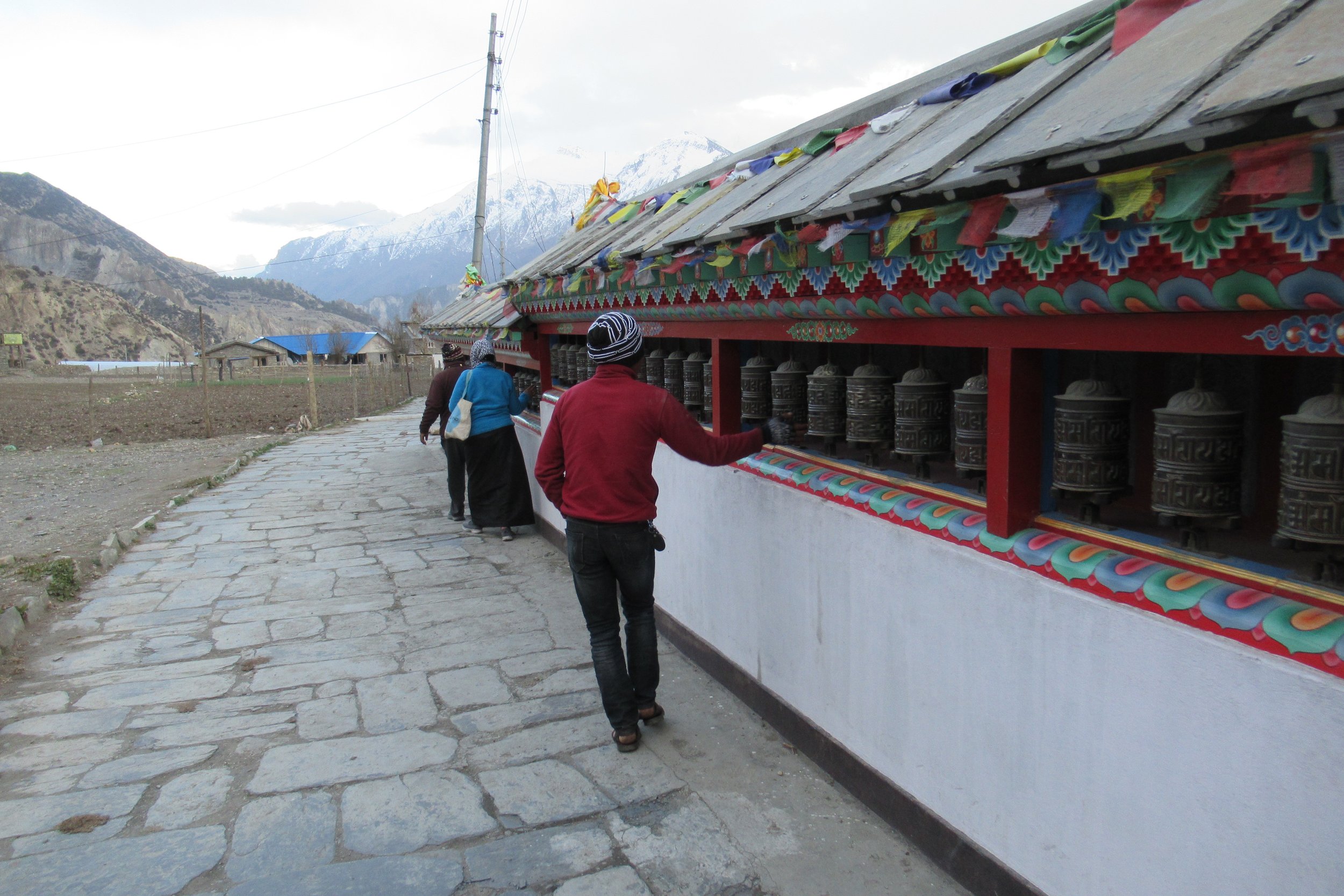
This morning I tried Tibetan bread with jam for breakfast and that's what I ended up having every morning with either honey or cheese. It reminded me of a funnel cake and it was filling. The hiking got tougher with steeper and longer climbs. The trail crossed the river several times and I climbed up the canyon with the river down below. I reached an archway and once through it revealed a widened landscape, calmer bright blue river, and the town of Tal. I passed the first stand of prayer wheels I saw on the trail. Over the course of the hike I saw many prayer wheel stands, a narrow stand with cylinders inscribed with a prayer that once spun symbolizes the spreading of prayers. I loved seeing them in the distance and then arriving to spin each one as I walked passed. Along with prayer wheels on the trail are the abundant prayer flags, multi colored flags with prayers written on them that spread the prayer when the wind blows over the flags.
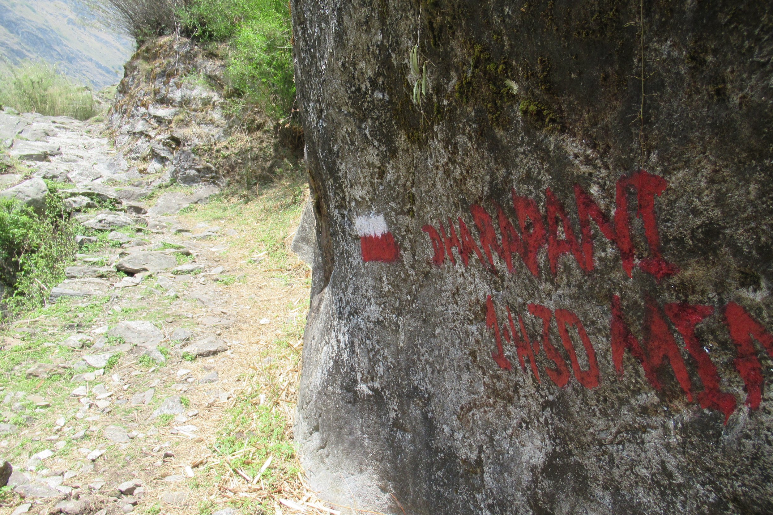
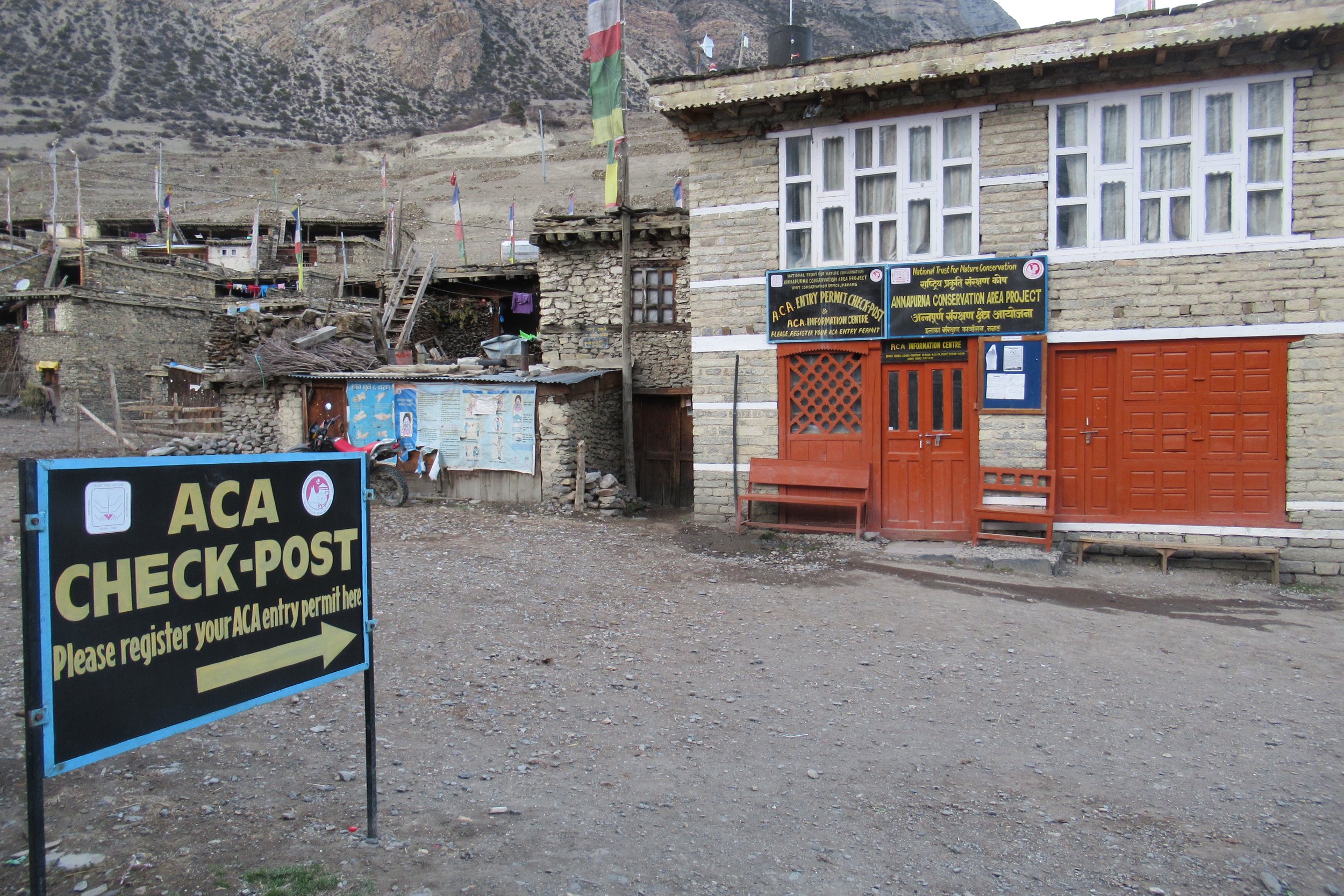
I reached the first checkpoint in Dharapani where I stopped for the person to check my permit and write my information down. The purpose of the check posts is to have the last town that you were checked in at to start looking from in case you go missing. I arrived in Danaqyu around 4, got a room at one of the lodges, cleaned up, ate dinner, and went to bed. This was the first night I needed a blanket with my sleeping bag liner because it was getting colder at night at 7000ft. [I decided not to take a sleeping bag to save weight so I took my thin sleeping bag liner. I read that all the guesthouses have blankets you can use and that would keep you warm enough. So every night I wore my pants, smartwool top, and down jacket inside my liner with a blanket on top and I stayed warm. You can check out my gear list page to see a video and full list of my gear set-up].
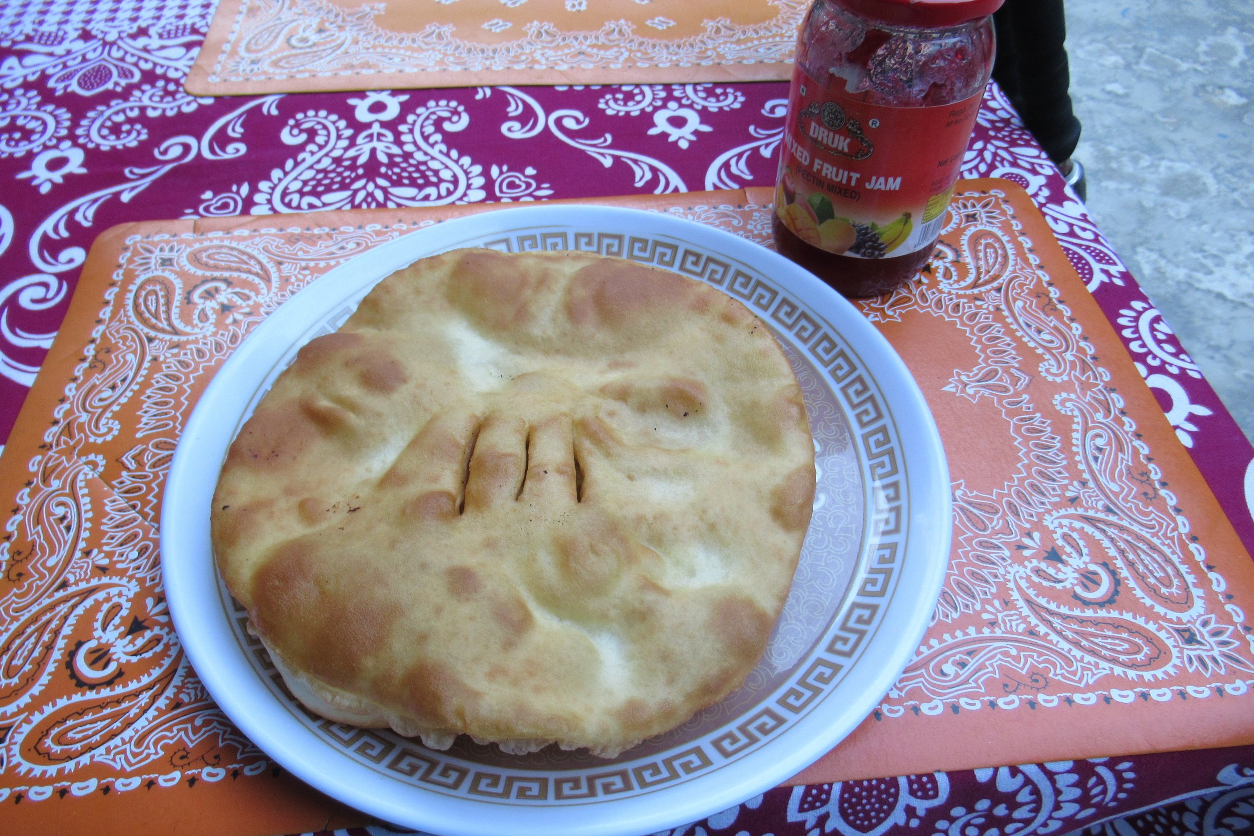
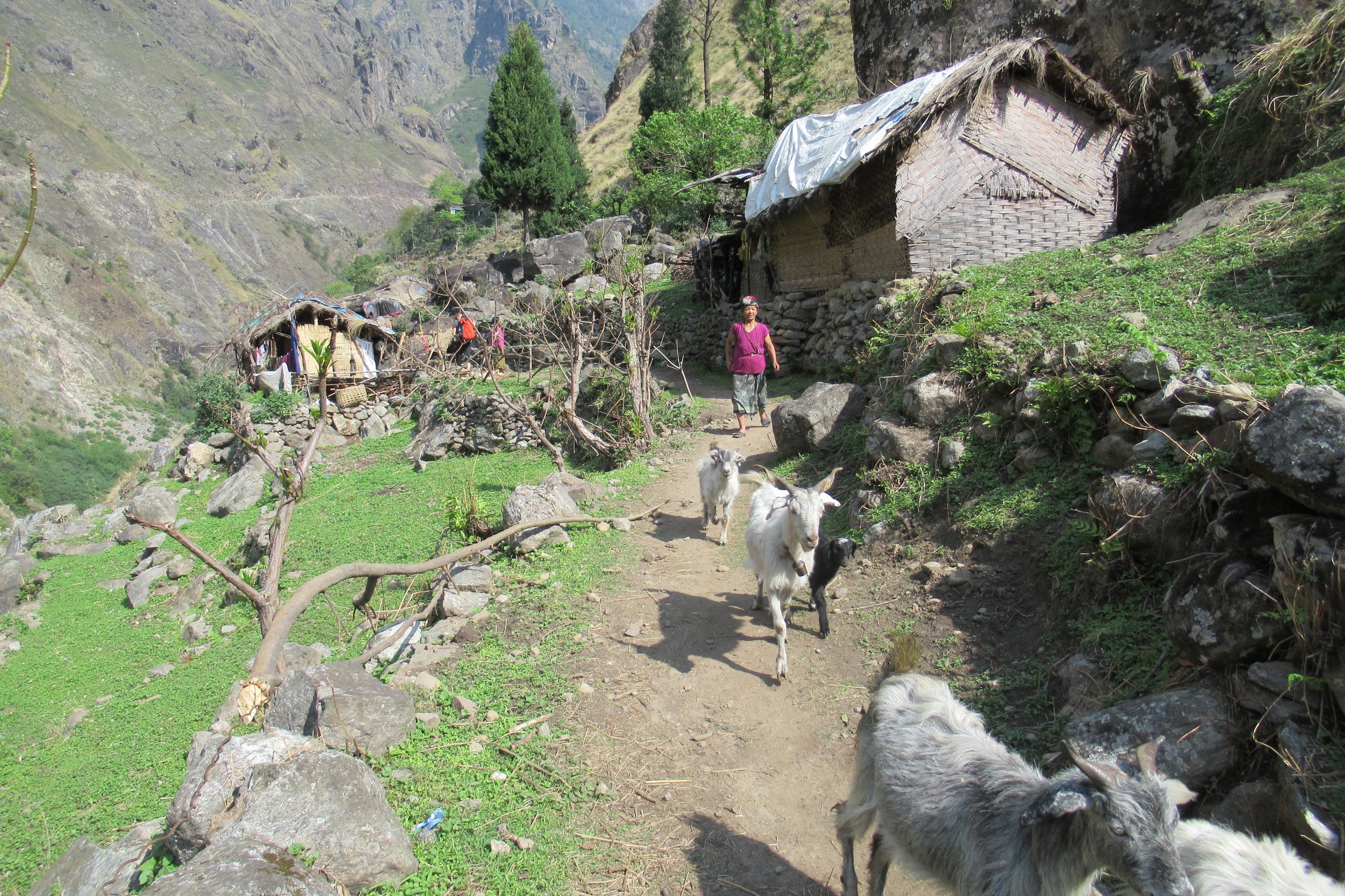
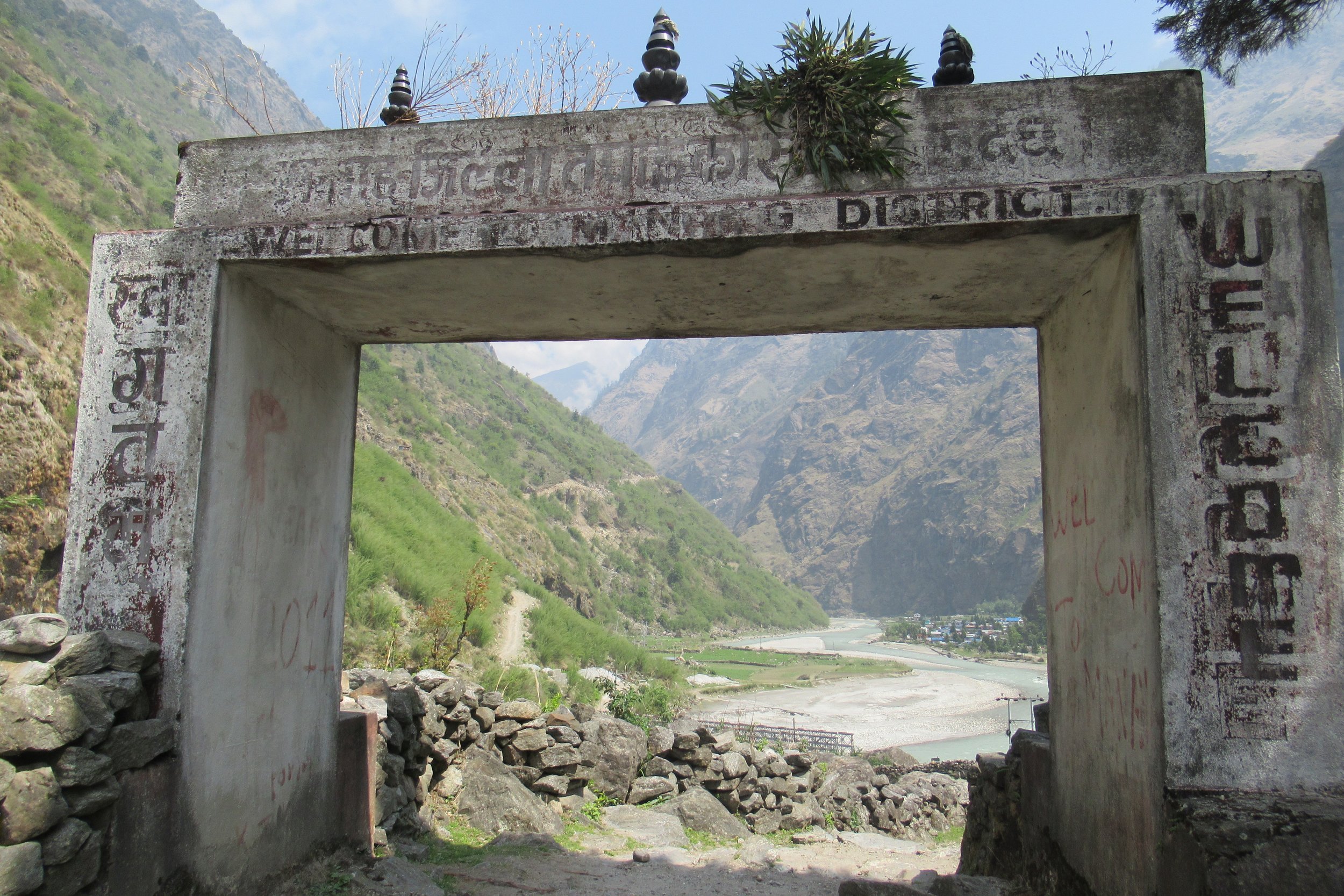
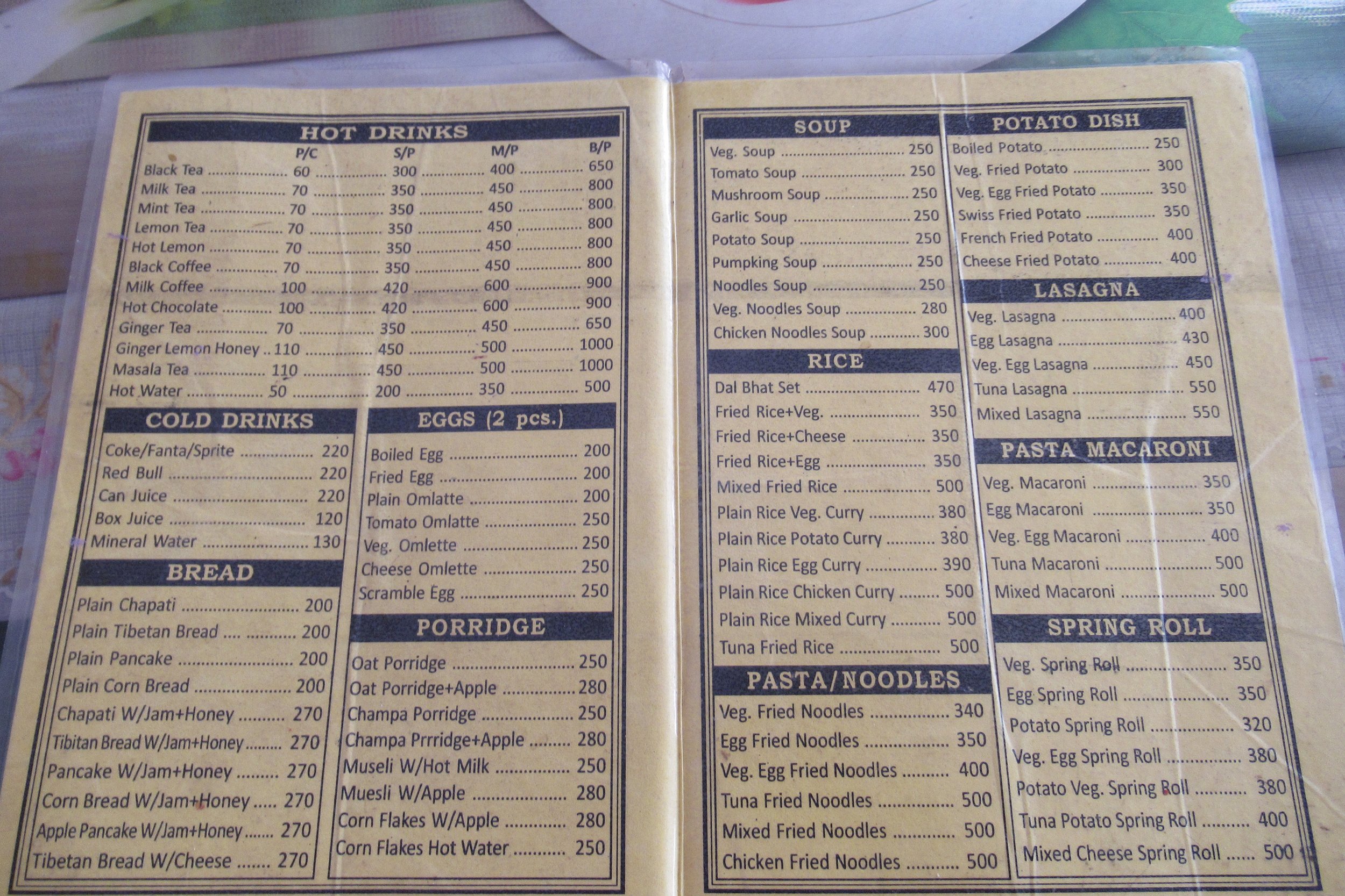
Photos Below: 1) Tibetan Bread - what I had for breakfast most mornings w/jam, honey, or cheese 2) Mountain village 3) On a suspension bridge 4) Goats on the trail 5) Welcome to Manang District-entrance to Tal 6) They tell distance by time not kilometers 7) Trail cut into the mountain 8) River walking 9) Old bridge, new bridge 10) Typical menu & prices
April 20: Danaqyu to Dhukur Pokhari - 3240m/10,629ft
The morning brought a nice time to hike and I didn't see anyone on the trail for the first few hours. However, I did get going down a path that I was uncertain was the trail but was relieved to see a marker and bridge 30 or so minutes later. The trail is marked by a white over red painted mark found on bridges, buildings, rocks, and more. Sometimes the markers are inconsistent and not visible at intersections, but for the majority of the hike it was easy to navigate. I should also note that the distance between towns were judged on time rather than kilometers. I never really knew how many miles to a town, instead I was told it would take and hour and a half, and so on. This way of judging distance was different for me since I'm used to gauging how long it will take me to hike based upon miles because my hiking speed is fairly consistent. I adjusted well and found that I didn't focus on time or distance as much as I usually do and was able to just enjoy the walk more. I would get there when I got there.
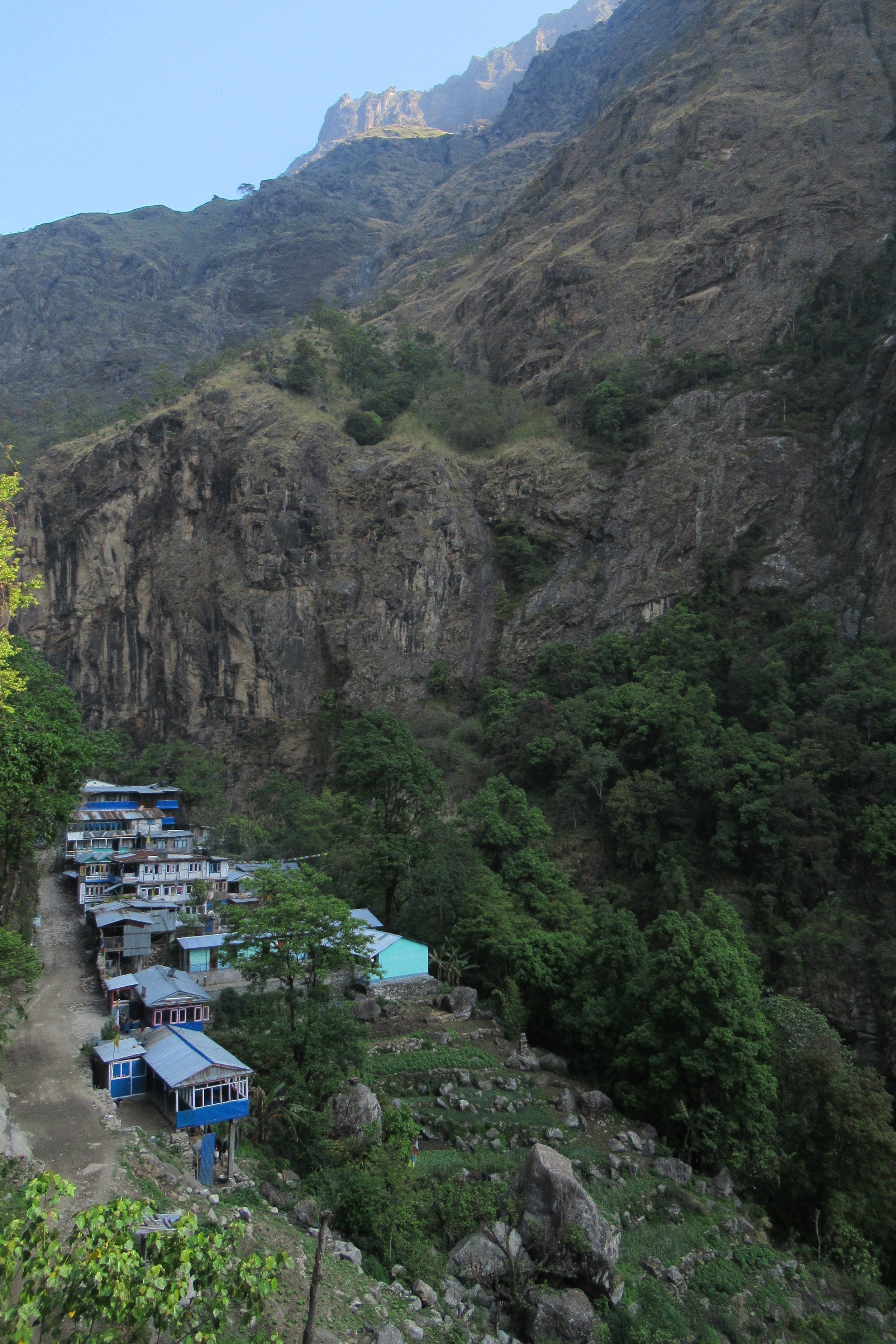
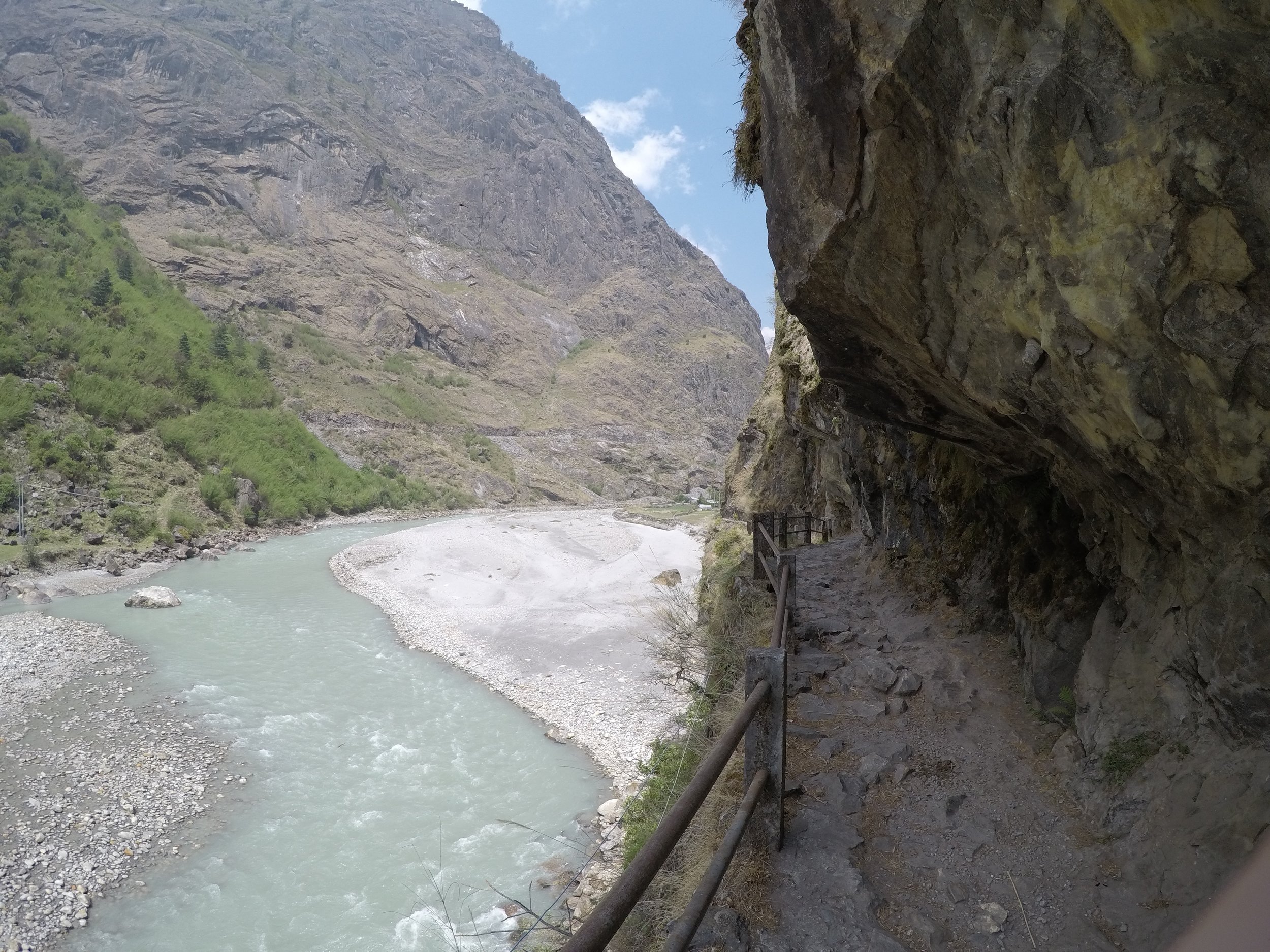
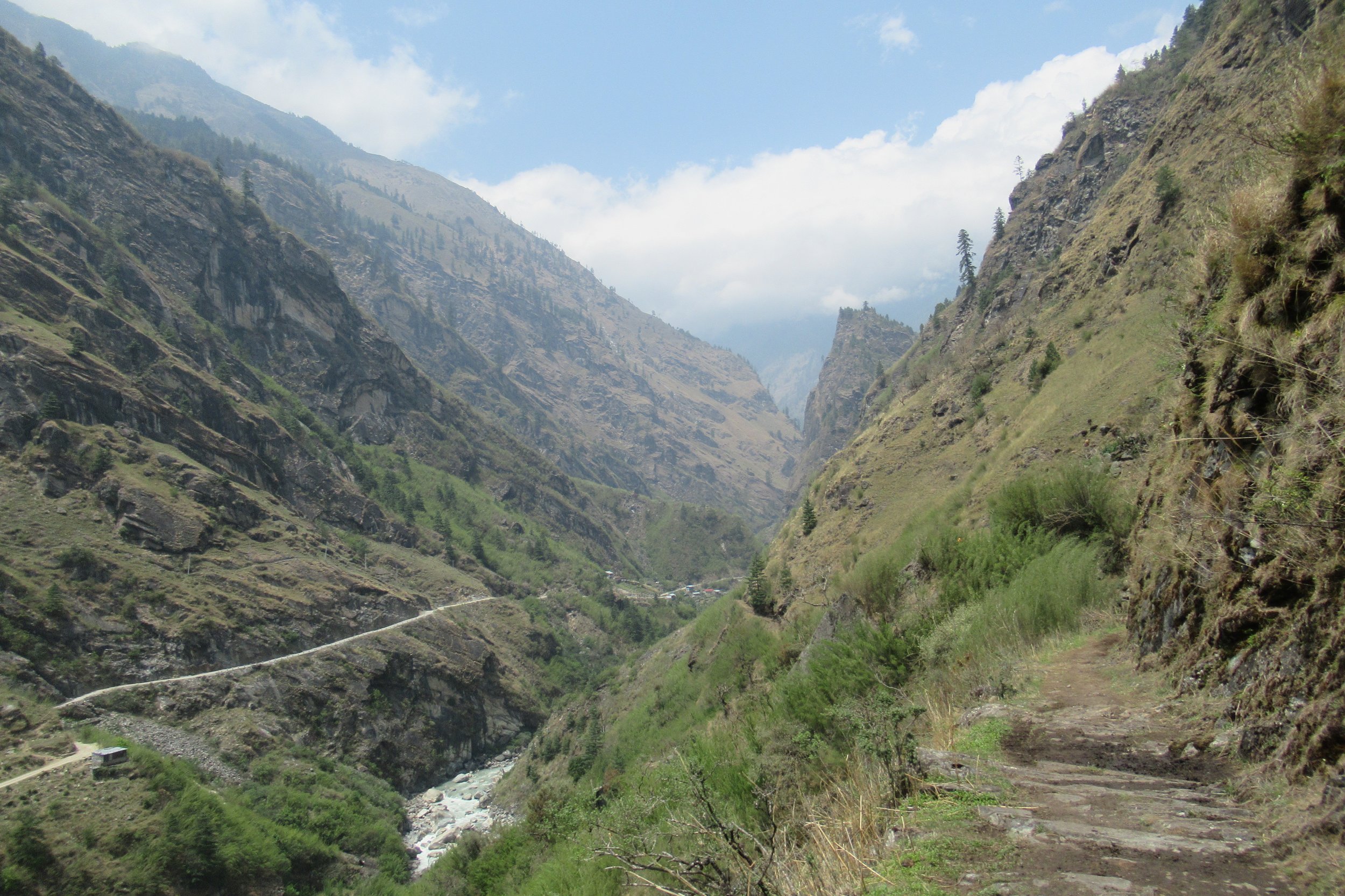
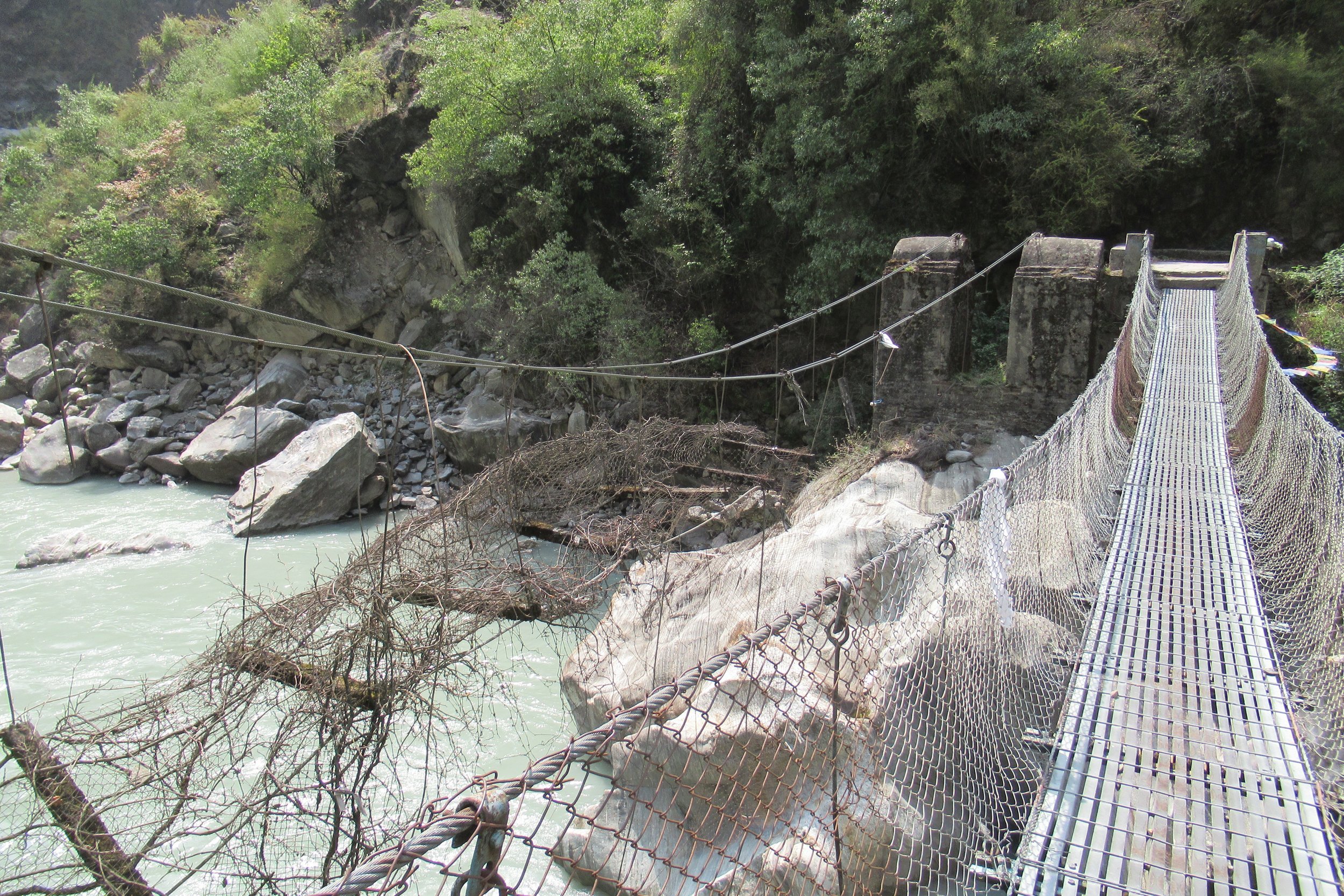
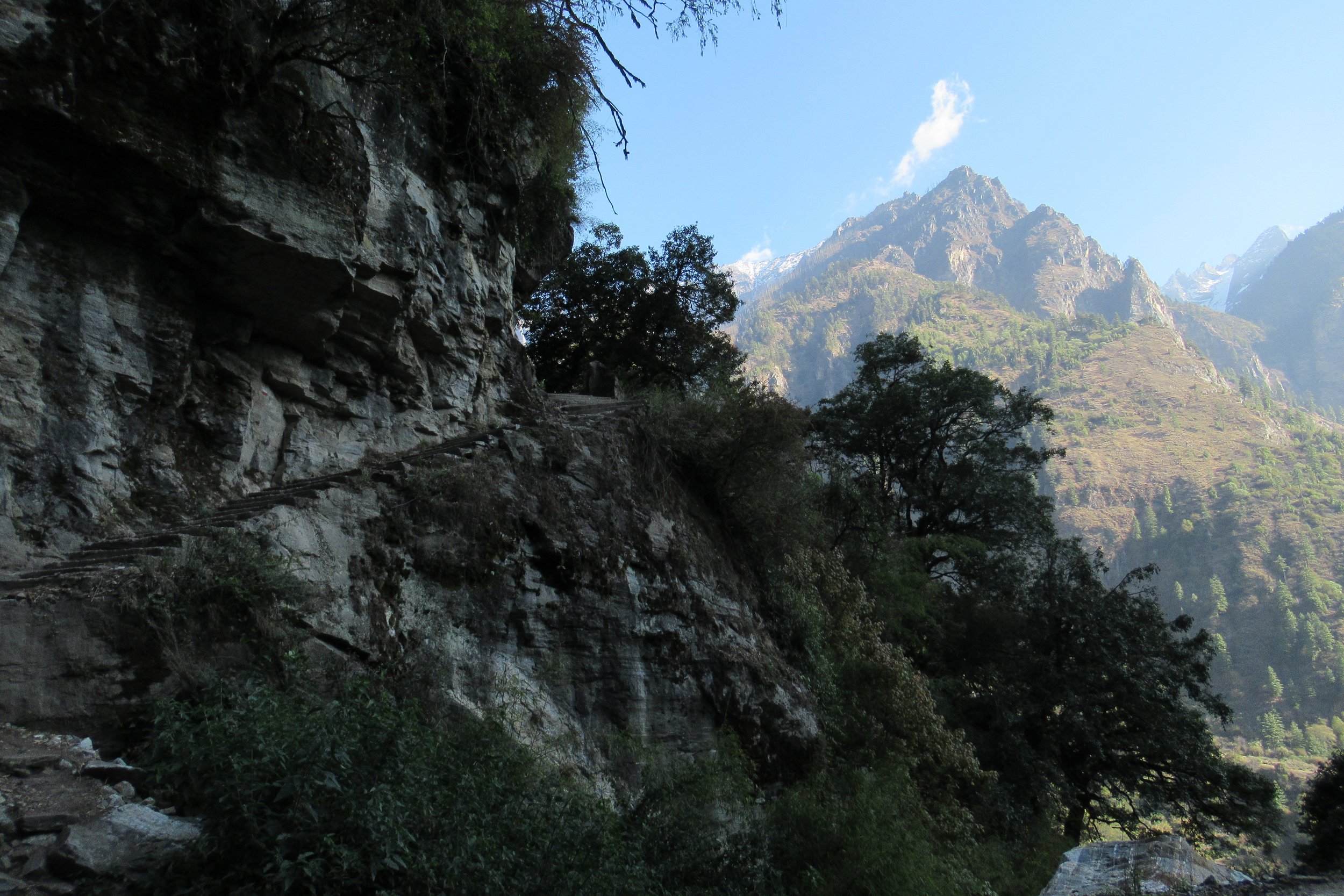
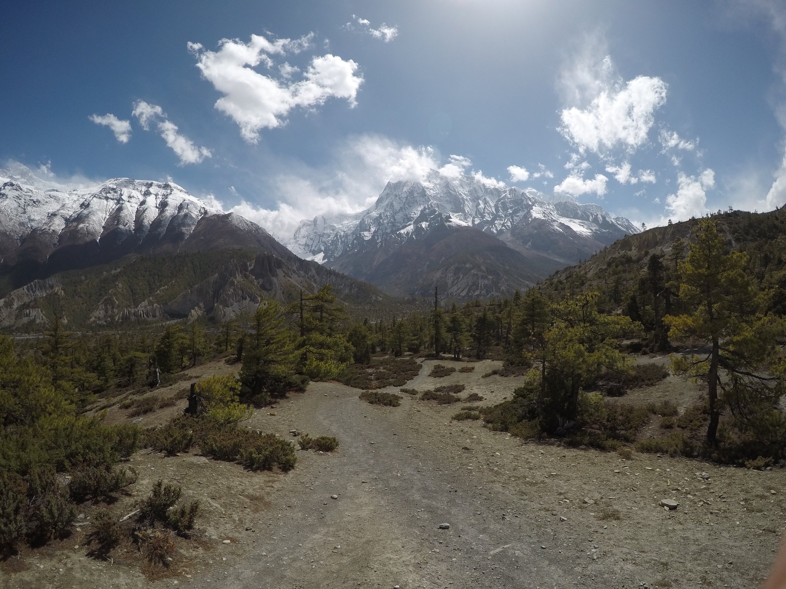
I passed through the town of Chame. I think most people stay there for the night but it was still early so I kept going. I ended up walking for the next few hours on a gravel road. Lots of road walking this day. I walked with some locals along the road for a little bit and we talked about English/Nepalese words. The sky darkened and it started raining lightly. I reached a part of the trail I had looked forward to seeing because I remembered how neat it looked on the youtube vlog. The trail cut into the mountain side high above the river below. It also provided a brief respite from the rain. More road walking while I passed men huddled up by campfires taking a break from working on the road while it rained. I crossed a suspension bridge while it was lightening, passed spooky, small abandoned buildings in the pine forest, and finally reached my destination right as it started pouring. I really liked my guesthouse room this night because the room was paneled with wood and smelled like a cabin.
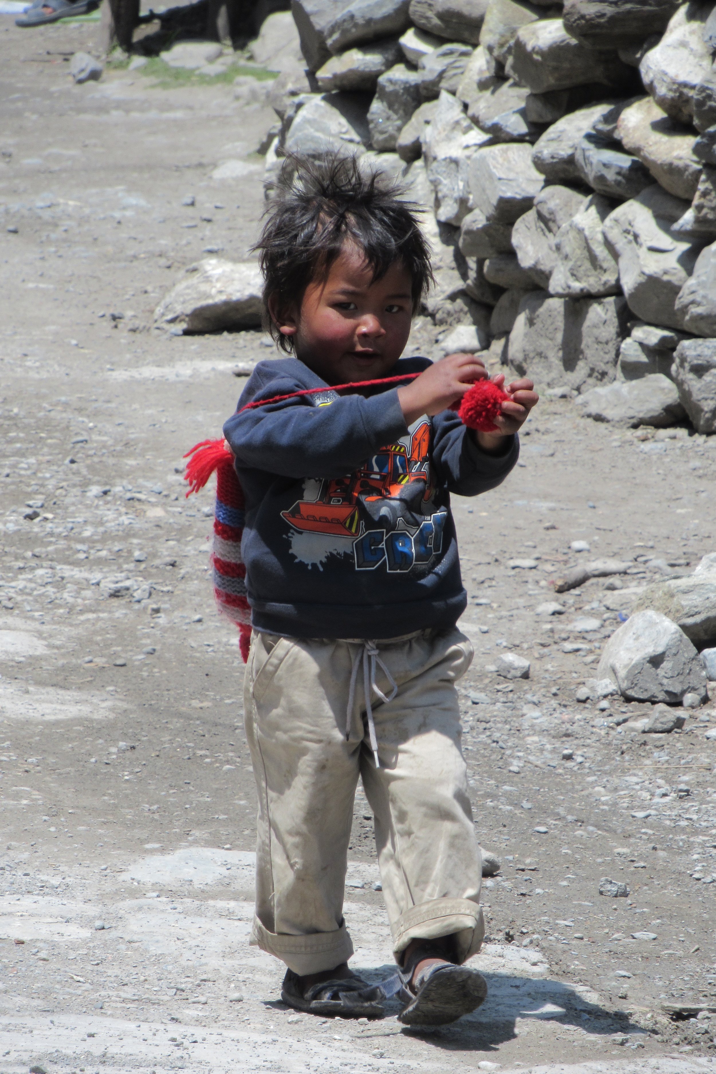
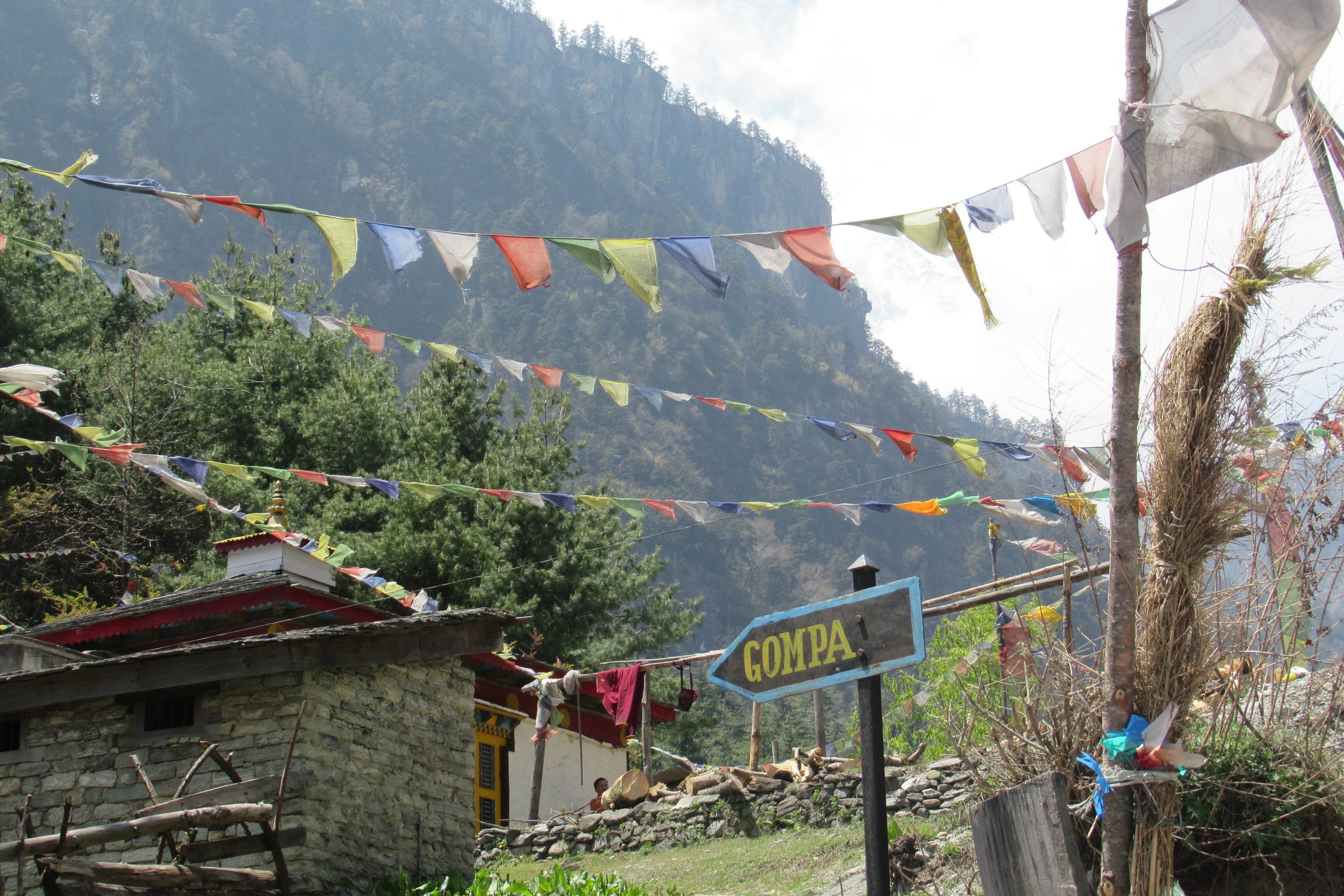
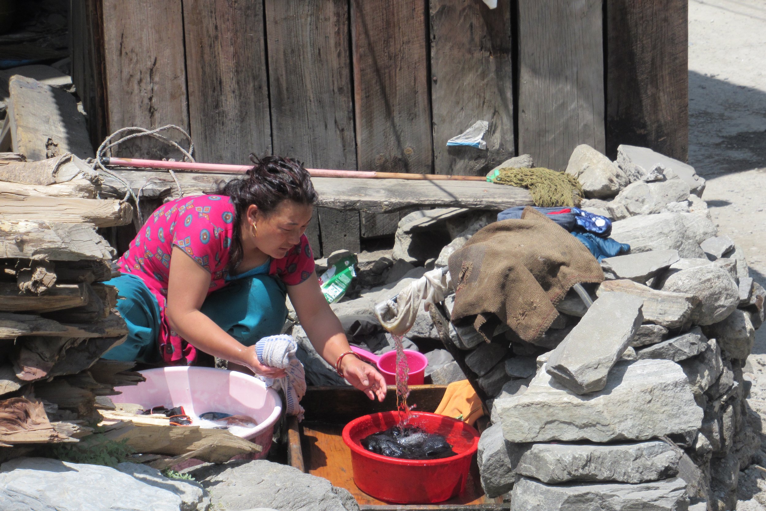
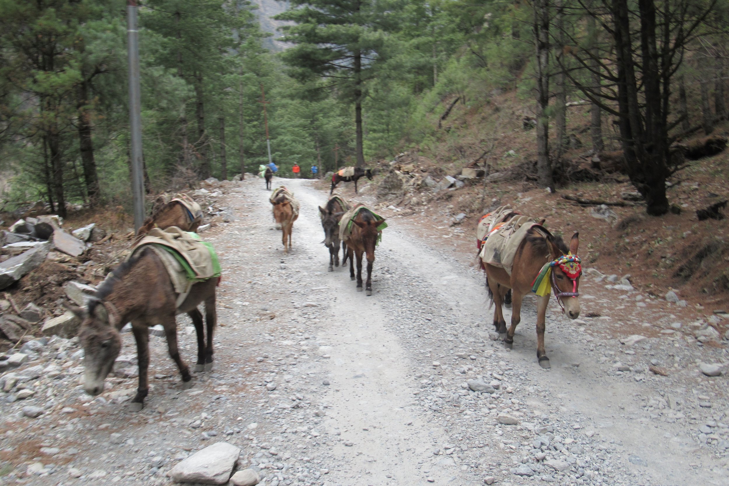
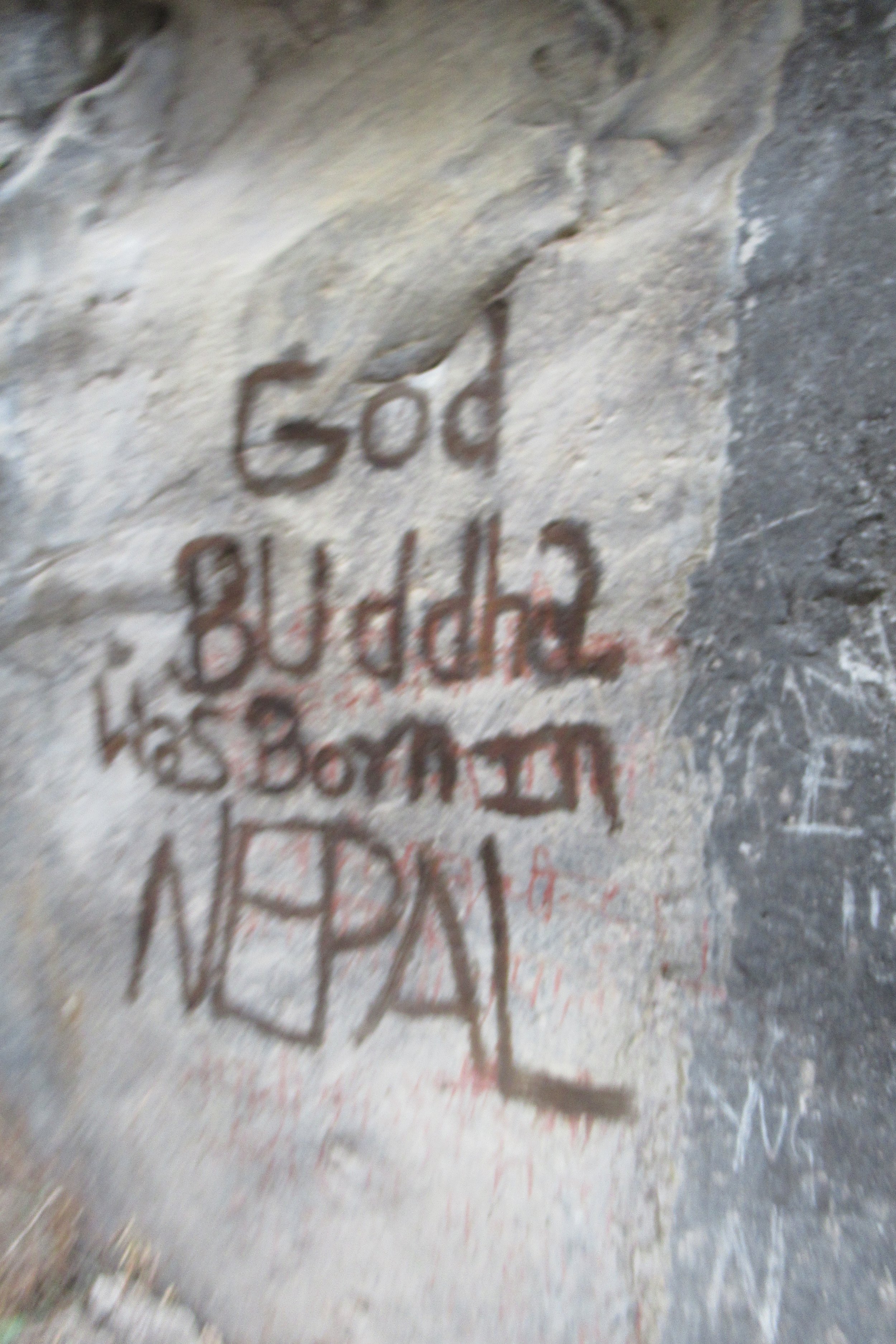
Photos Below: 1) Endless stairs 2) Just before town 3) Typical mountain lodge 4) Nepali boy 5) Gompa 6) Laundry time 7) Donkeys on the trail 8) Budhha was born in Lumbini, Nepal 9) Crossing a bridge in the rain 10) Kind of spooky area
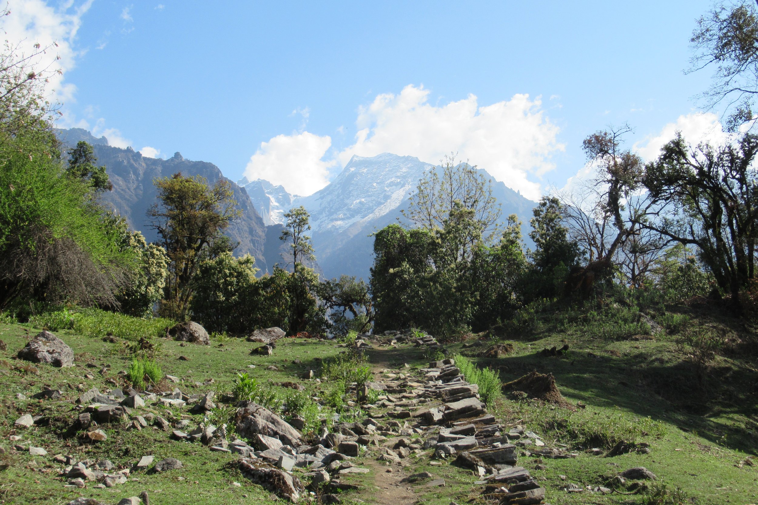
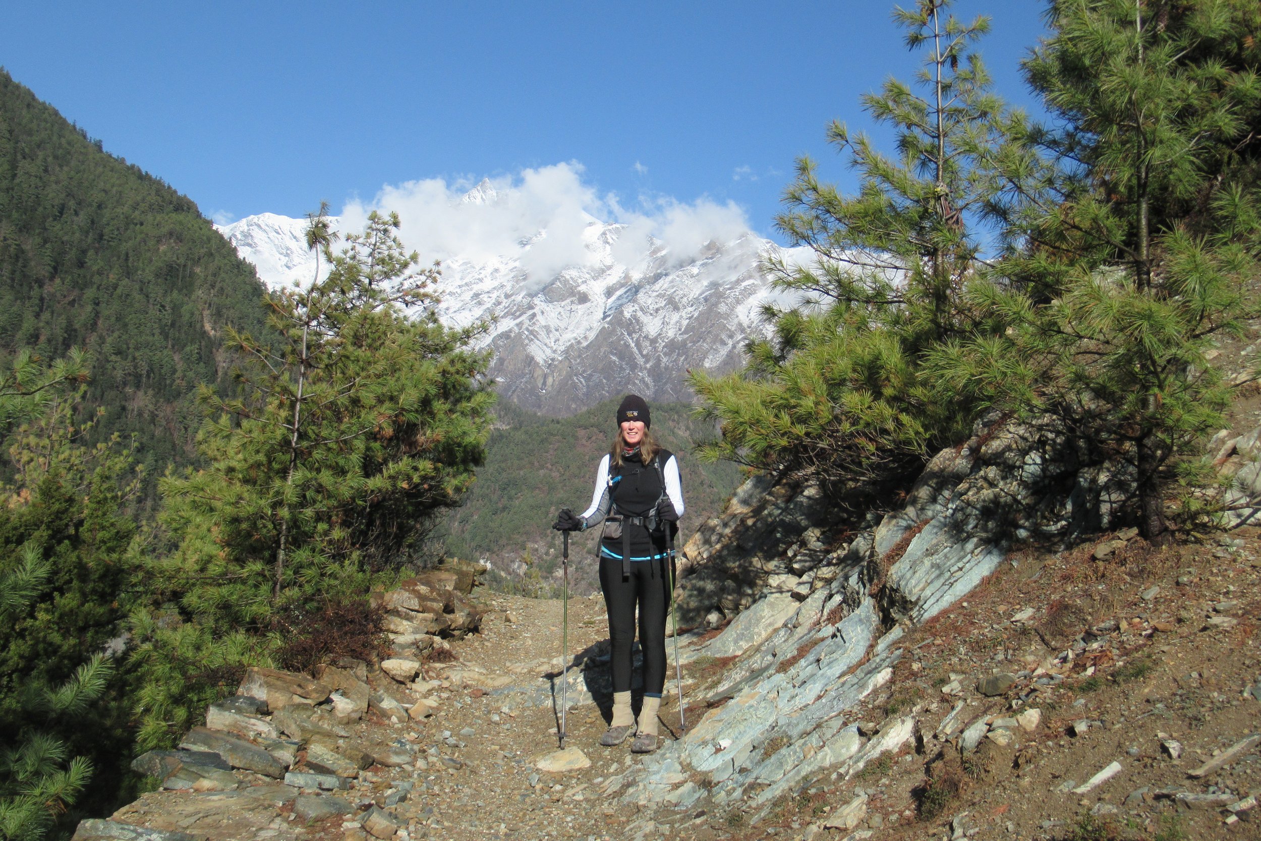
April 21: Dhukur Pokhari to Manang - 3540m/11,614ft
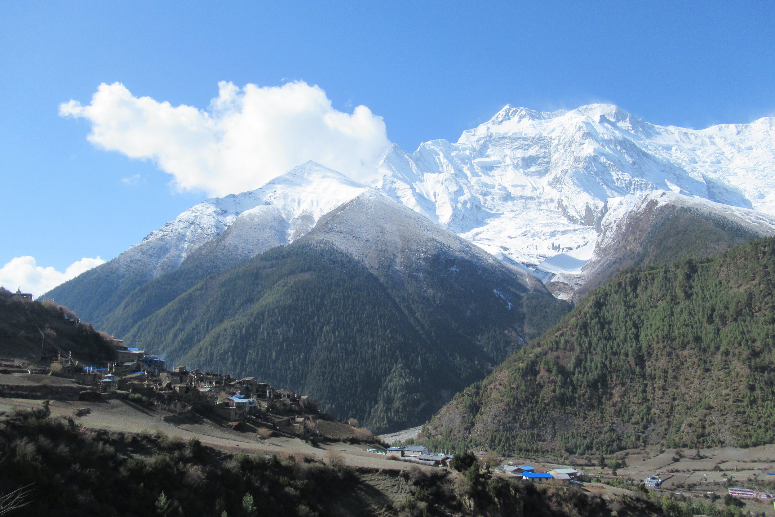
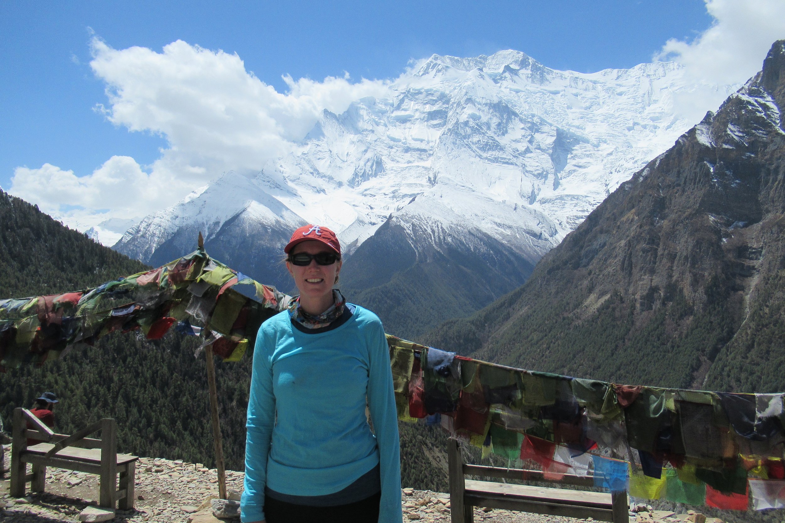
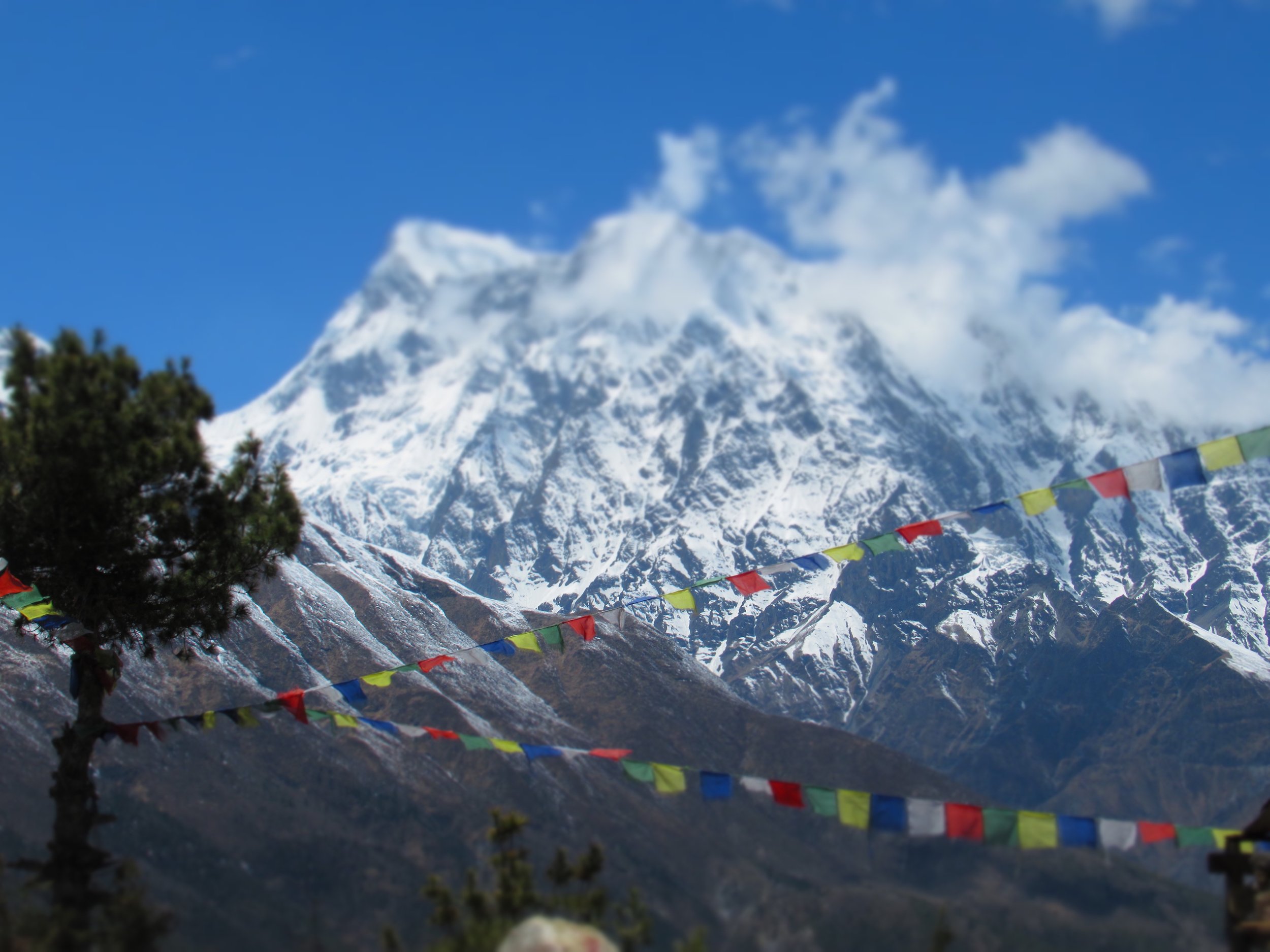
This was the first morning I needed to wear 3 layers, beanie, and gloves. I was also graced with gorgeous views of snow covered mountains surrounding me, which I didn't get to see the day before due to the low cloud cover. It was a magical morning as I chose the Upper Pisang route rather than taking the easier Lower Pisang route. After an hour climb of switchback after switchback I took a break by a gompa looking out at Annapurna II in all its glory. I'm glad the sky was so clear that I was able to see it. The weather at this time of year consists of daily light rain or it becomes cloudy in the afternoon. After descending back down off the plateau it was road walking the rest of the way to Manang. It was a long day and I was pretty spent by the time I reached town.
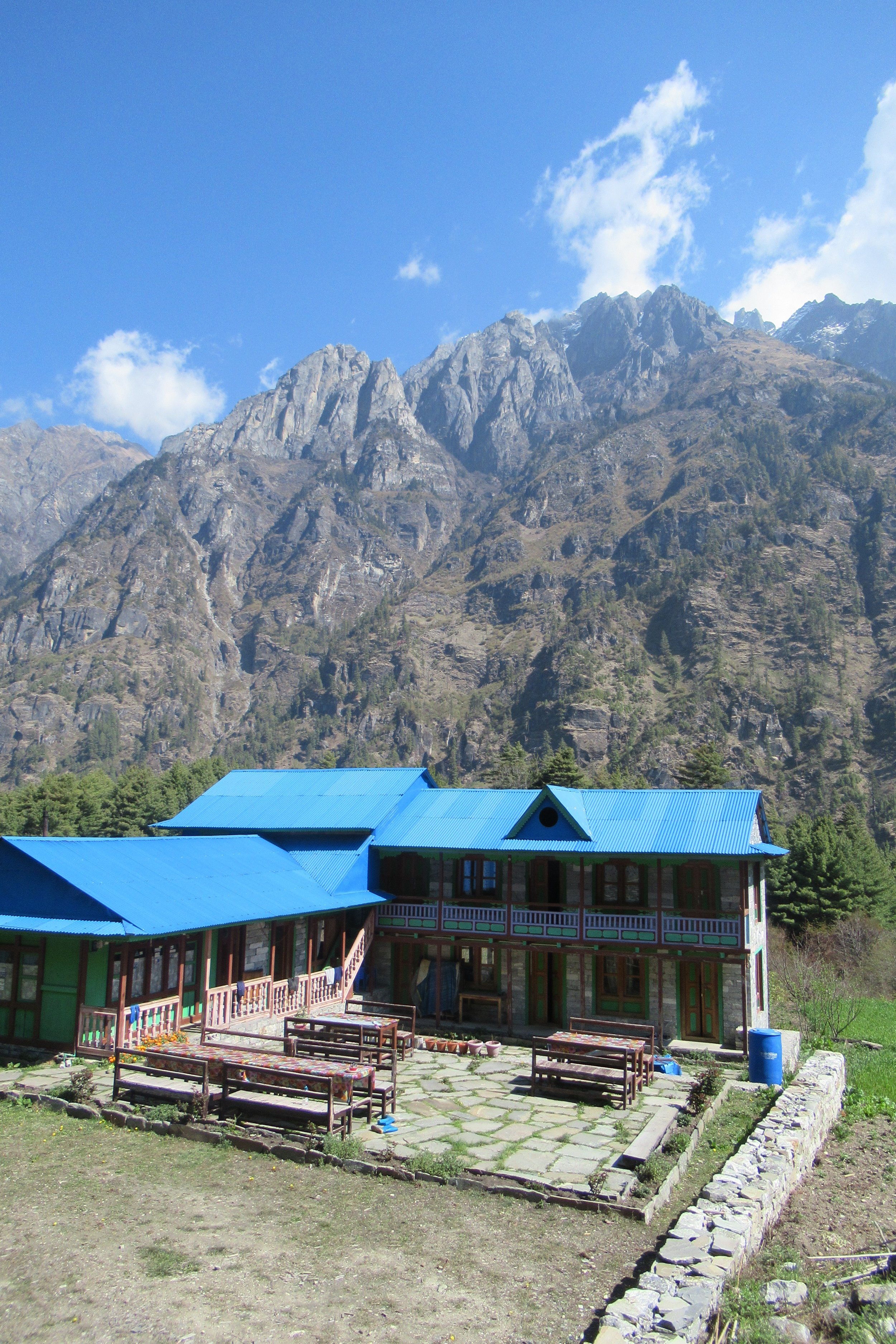
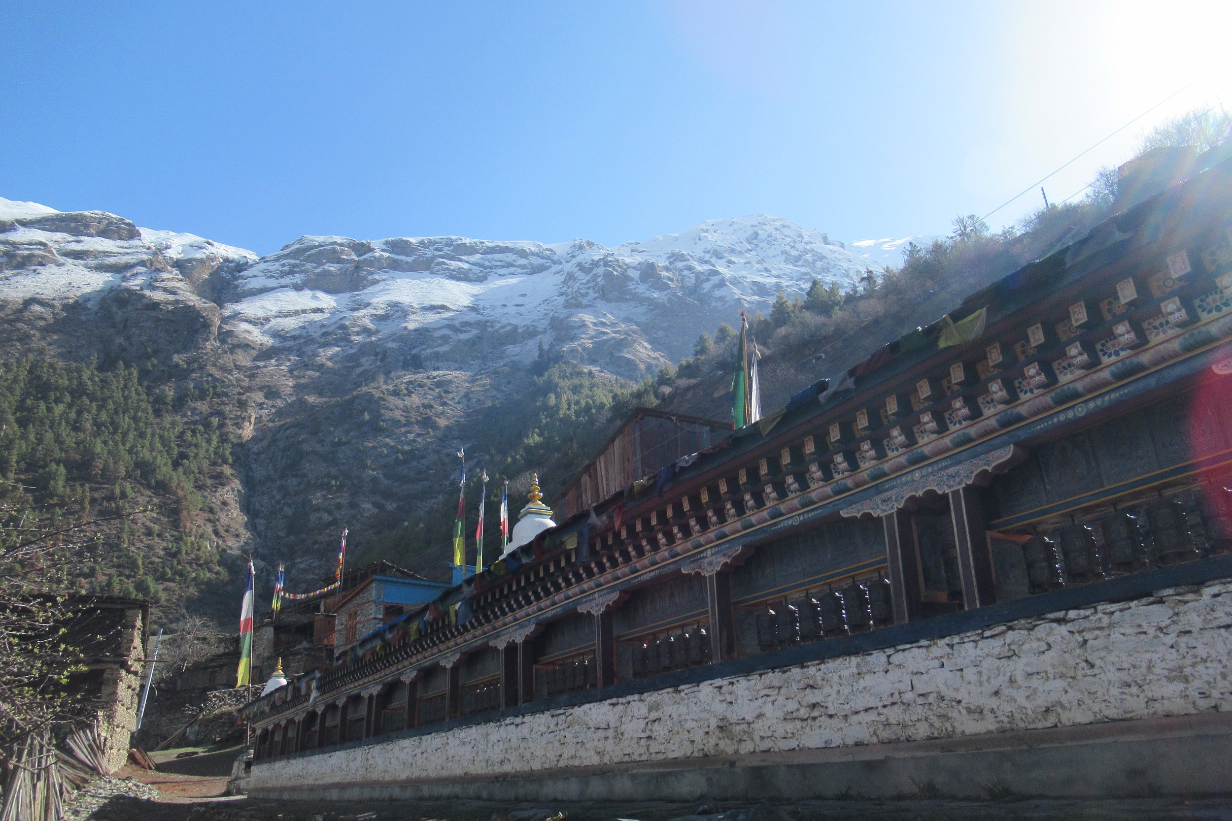
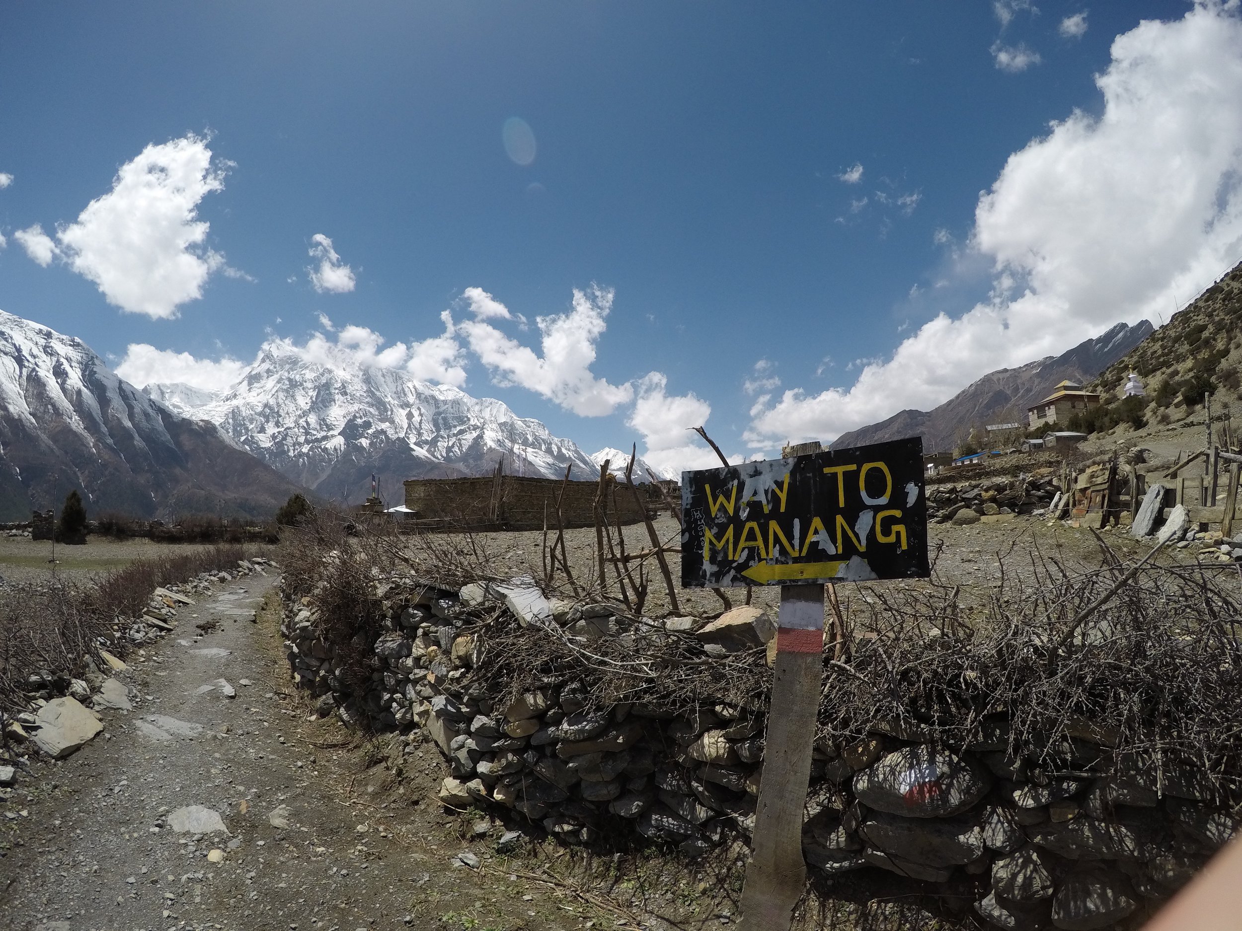
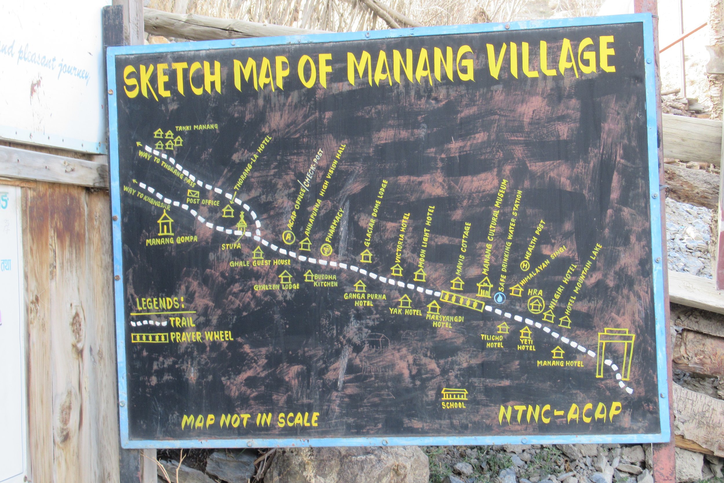
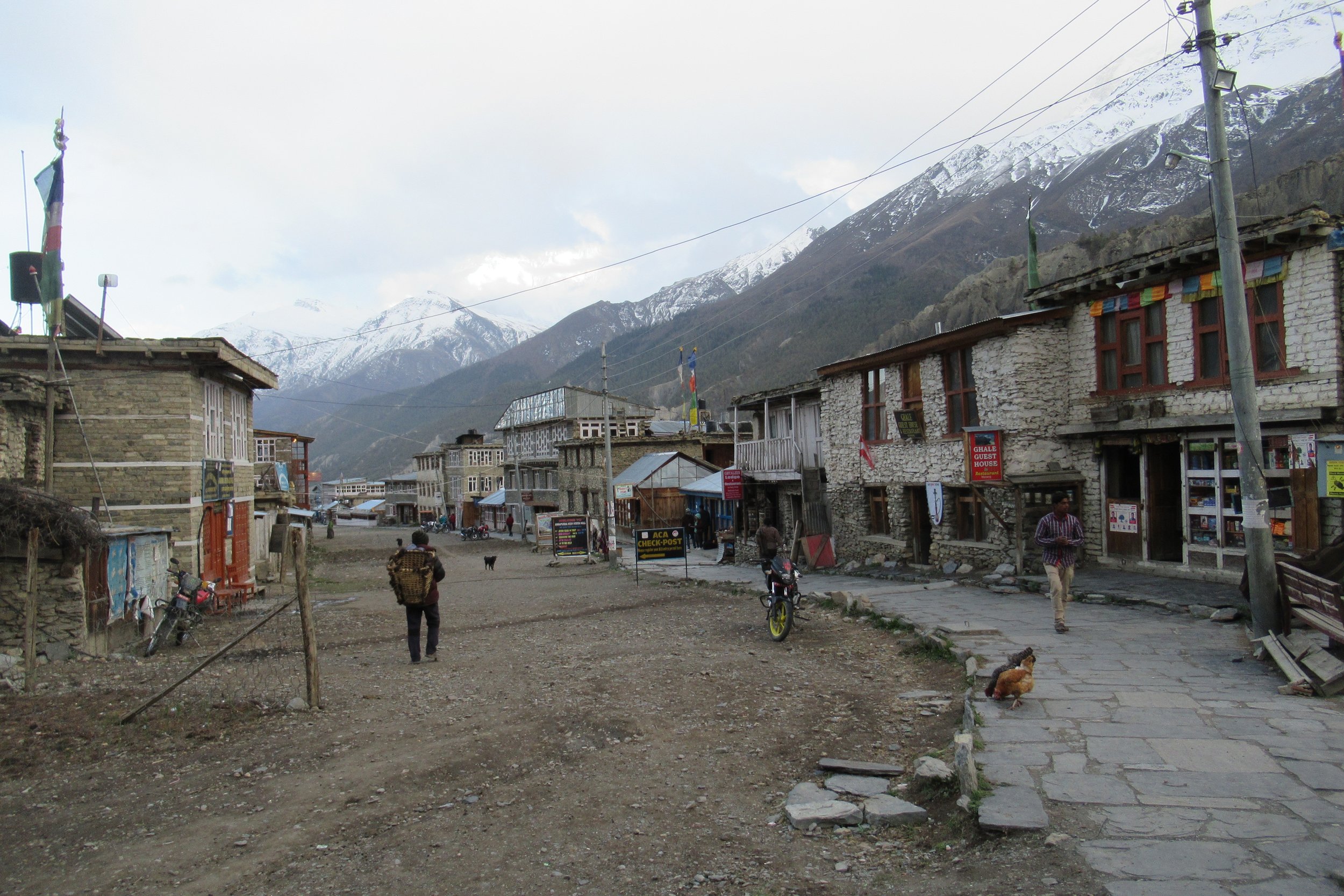
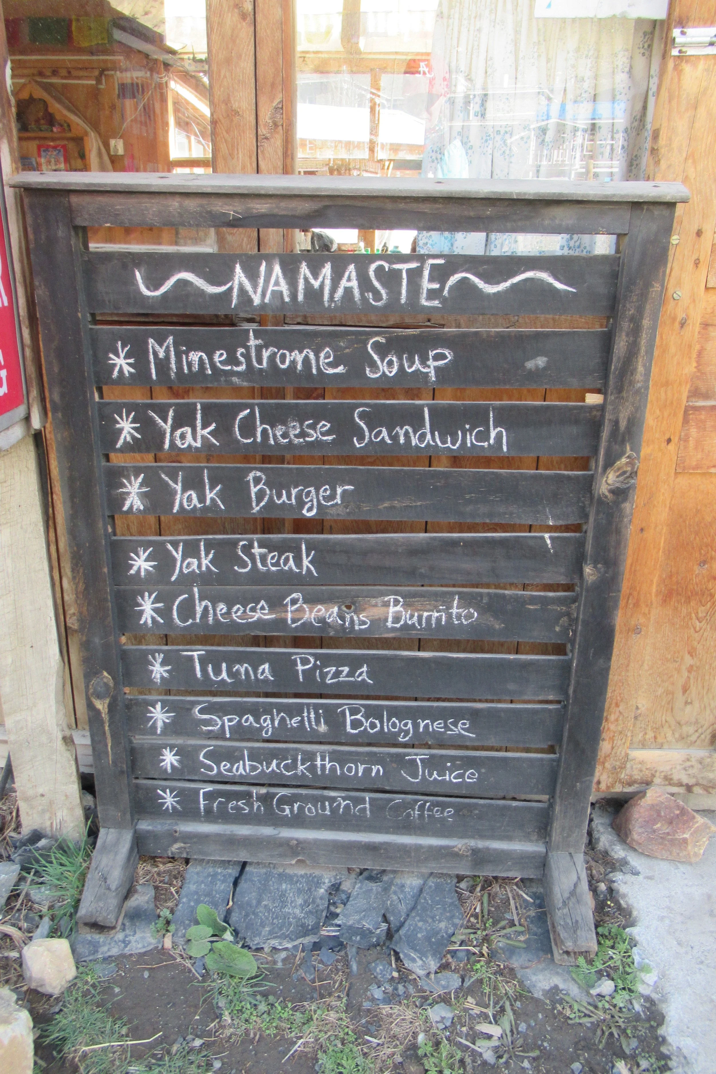
Manang was kind of a goal in of itself because all the markers from the beginning said "Manang" and pointed the direction. I think this was where the road pretty much ended (and by road I mean a small gravel path). The town was also bigger than most I've seen for the past few days so I walked through looking at guesthouse options before picking one that had a bakery attached. Most people take a rest day in Manang to help with their acclimatization. Altitude sickness is real and a very serious element of this hike to watch out for. Being incredibly fit doesn't matter as it doesn't help in one's ability to acclimate to altitude. All the information about altitude sickness recommends to ascend only 500m/1600ft a day. And the saying goes- hike high, sleep low. However, since I had been living and working in Colorado at 9000ft I felt that I was better set-up than most and ended up making the decision to not take a rest day. The weather forecast called for snow and I wanted to make sure I could go on the side trek to Tilicho Lake and get over the high pass before it got bad. SO before dinner I walked around town sightseeing. Manang is also known for their several movie halls where they play films for the hikers to watch on their rest day. Yaks frequent the mountain sides now so yak cheese and yak burgers fill the menus around here. For dinner I tried the local beer, xang. I went to bed not entirely sure what my plans were.
[I also want to say that I was constantly surprised to find each village with access to wifi. Hiking everyday through villages you just feel like you're in a super remote place, but then you get to your guesthouse and they have tv and wifi. Sometimes the power goes out and the wifi is usually slow but I was always impressed because I wasn't really expecting much.]
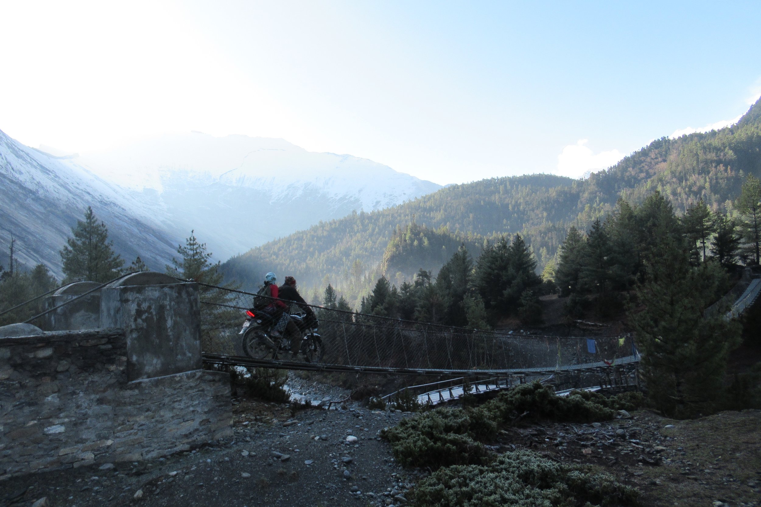
Photos Below: 1) Motorcycle crosses suspension bridge 2) Good morning on the trail 3) Massive prayer wheel stand 4) Village in the mountain's shadow 5) In front of Annapurna II 6) Stone buildings 7) Mountain blurred 8) Way to Manang 9) Wide open spaces 10) Manang map 11) Checkpost 12) Manang village 13) Manang menu 14) Locals spinning prayer wheels
Next--> Annapurna Circuit: Part 2
Vlog #1 - Kathmandu to Danaqyu
Vlog #2 - Danaqyu to Manang
Vlog #3 - A Walk through Manang